Good Evening!
Well we hope that all of you have been enjoying the relatively warm temperatures over the past few weeks, because it looks like things are about to change in a big way over the next few days across the entire east. Today was the last in the series of warmer days across the Northeast as an area of low pressure moved eastward across New York state. Southwesterly flow at the surface allowed warmer mid level temperatures to funnel in, as well as some leftover moisture from yesterdays severe weather outbreak over the Ohio Valley. This moisture was responsible for producing some clouds and showers over much of the Northeast, but much of the rain was on the light to moderate side of things. Despite these clouds and showers, temperatures were able to head into the middle to upper 60’s, with some locations in southern New Jersey actually reaching the 70 degree mark once again! The area of low pressure moving to the north of the New York Metro area has a rather strong cold front associated with it, and is currently moving over Pennsylvania and into portions of New Jersey. Winds have begun to shift to a more westerly/northwesterly component, which will mark the beginning of cooler temperatures and lower dew points leaking into the region.
Any leftover showers will quickly head east and dissipate over the next few hours, and this should give way to more clear conditions as we head into the night. An increasing pressure gradient from an area of high pressure building to our west will begin to create some gustier winds from the north, which should range in the 15-20 mph area. Overall, lows this evening will likely drop into the upper 30’s and lower 40’s across much of the area, with some middle 30’s possible in the interior locations of NJ, PA, and NY.

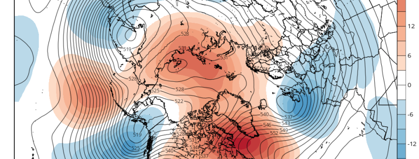
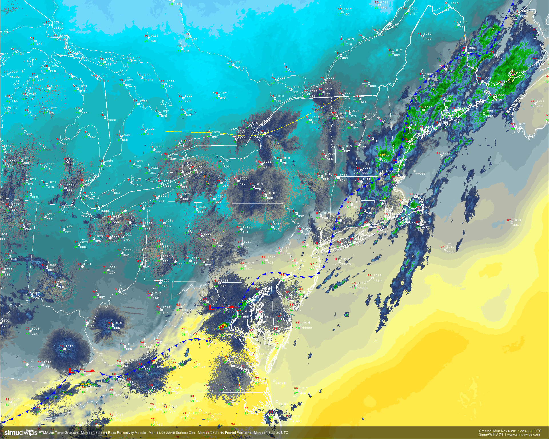
RTMA temperature analysis, surface observations, and regional radar mosaic showing the progression of relatively strong cold front moving through the area this evening (Simuawips)
Tuesday Into Wednesday
Tuesday morning should start off quite chilly, with some gusty winds still sticking around at least through the morning commute. The area of high pressure moving eastward will likley keep the majority of the day quite clear and calm, with highs generally in the lower 50’s across much of the New York metro area-though lower temperatures will likely be found to the north and west. The main story for tomorrow will be a weak wave of low pressure moving along the leftover cold front that will be located over portions of the southern Mid Atlantic states by tomorrow afternoon. As this system quickly slides along the front tomorrow, it should bring an area of light to moderate rain over portions of the Mid Atlantic states like Maryland, Delaware and Virginia by 5-7 pm. The northern fringes of this weak system will likely also impact the New York Metro area as well, but this setup will be especially interesting to watch for those located in NW New Jersey, NE Pennsylvania, southern New York, as well as the higher elevations of Connecticut as the wave of low pressure begins to head off the coast. As the system moves off the Delmarva late Tuesday and into the very early morning hours of Wednesday, the system will begin to strengthen just a bit, and this should help to cause a more uniform wind pattern at the surface, which could be capable of tapping the new/colder Canadian air just to the north.
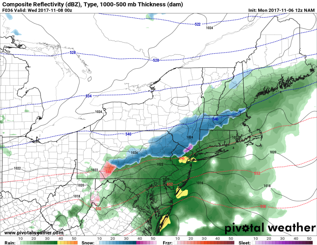
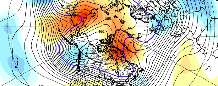
This evenings NAM model, a colder solution, showing snow mixing in on the NW fringes of the precipitation tomorrow evening
Some of the higher resolution models have just enough cold air filtering in at the lower levels of the atmosphere, that we will indeed have to watch for a mix to possible changeover to snow across portions of Northeastern Pennsylvania, Northwestern New Jersey, southern New York, and Connecticut around midnight. While the thermal profiles of today’s models do show a good chance at a mix of wet snow/rain, there also could be some graupel mixed in as well, making roads a bit slick for any persons traveling. Precipitation should be light enough in these locations that any wet snow that does fall will likely melt on impact with the ground, but if the cooler solutions of the other models verify, there could be some locations well to the north and west of the city that wake up with a trace of wet snow in the grass that melts away by the morning commute. Further south and east, this event looks to be mainly a “33 and rain” type of event, where there just isn’t enough low level cold to support anything but light rain with little fanfare. Lows tomorrow night will be rather cold, with temperatures ranging from the lower to upper 30’s-with warmer temperatures located near the coast.
This system will quickly move away by Wednesday morning, leaving some high clouds and light winds in its wake. A very weak area of high pressure will try to build over portions of Pennsylvania during the day, which should keep winds light, and skies clear for the rest of the day. Temperatures will be on the cool side for highs, with most of the Northeast likely staying in the upper 40’s to lower 50’s. Lows will be quite cool as well, as conditions set up for radiational cooling to take place, so expect temperatures to drop into the lower to middle 30’s-with warmer lows closer to the coast.
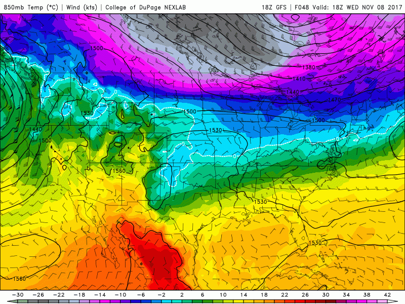
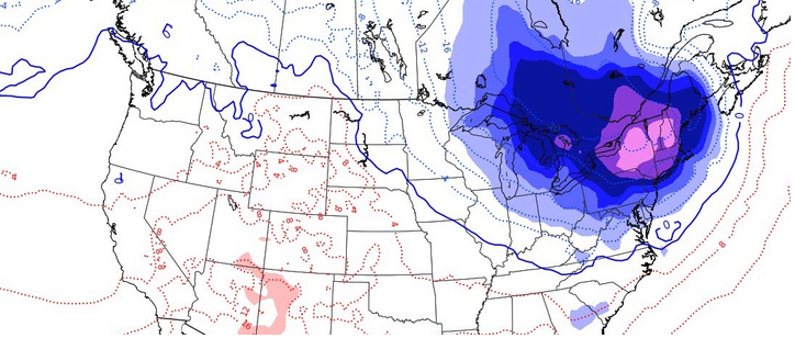
This afternoons GFS model showing a very impressive cold shot blasting through the Northeast on Friday and into Saturday morning
Thursday and Beyond
By Thursday, a strong upper level trough will be moving east over Canada, carrying very cold air with it from the northern regions of Canada. This cold and dense Canadian air will begin to sink south into the Northeast in the form of an Arctic front. This front should quickly move through the region late Thursday, bringing lows in the 20’s and 30’s, with a shot at some snow showers across the entire Northeast. This cold shot should last into Friday evening, where lows may drop well into the 20’s. Temperatures will moderate a bit by Sunday, but should stay somewhat below-normal.
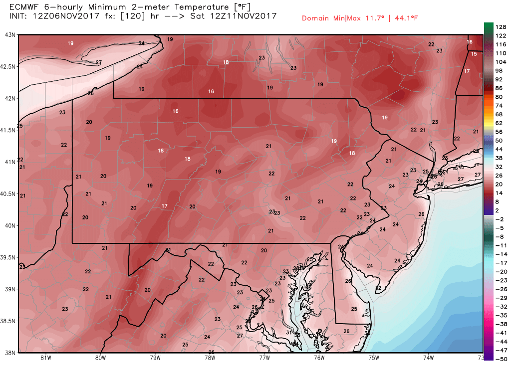
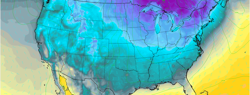
12z ECMWF overnight lows Friday PM/Saturday AM
For more information and posts like this one, make sure you sign up for Premium Forecasts — where multiple detailed articles, videos, and interactives are posted each day. Also, come interact with our staff and many other weather enthusiasts at 33andrain.com!
Have a great night!
Steve Copertino
-2")