Good Evening!
Today was another cold and breezy day across much of the Northeast, as the strong low pressure area that affected our region earlier this weekend continues to move off to the east and over the martime regions of Canada. The interaction between this low pressure system and a high pressure system to our south has created a steep pressure gradient which has been the source for these gusty conditions over the past day or so. Strong northwesterly flow in the mid levels of the atmosphere has also contributed to colder air aloft blowing over the Great Lakes, which has produced some lake effect snow showers that have mainly been focused across far northern New York state and Pennsylvania. However, some of these “lake-effect” snow showers moved over portions of the New York metro area, producing some of the first flakes of the year for most locations. While surface temperatures over the area were not at or below freezing, cold mid level temperatures allowed precipitation to remain mostly frozen, with ice pellets also being recorded in northern New Jersey. While these snow showers did catch some people by surprise, they weren’t anything more than “mood flakes”, or just some light flurries that do not stick to any surfaces-allowing travel to proceed as usual.
The rest of our Monday was rather chilly, with a mix of clouds and sun keeping our temperatures limited to the lower to middle 40’s across much of the area. Winds have really begun to weaken over the entire northeast as the pressure gradient between the two surface systems really diminishes with time as the systems grow further apart. As we head into tonight, the area of high pressure located over eastern Carolina will remain in control of our weather, bringing lighter winds out of the southwest and clearer skies. Lows tonight will likely have a range to them, with the far northwestern locations likely dropping below freezing and into the upper 20s, while locations near New York City willy likely get down into the lower to middle 30’s.
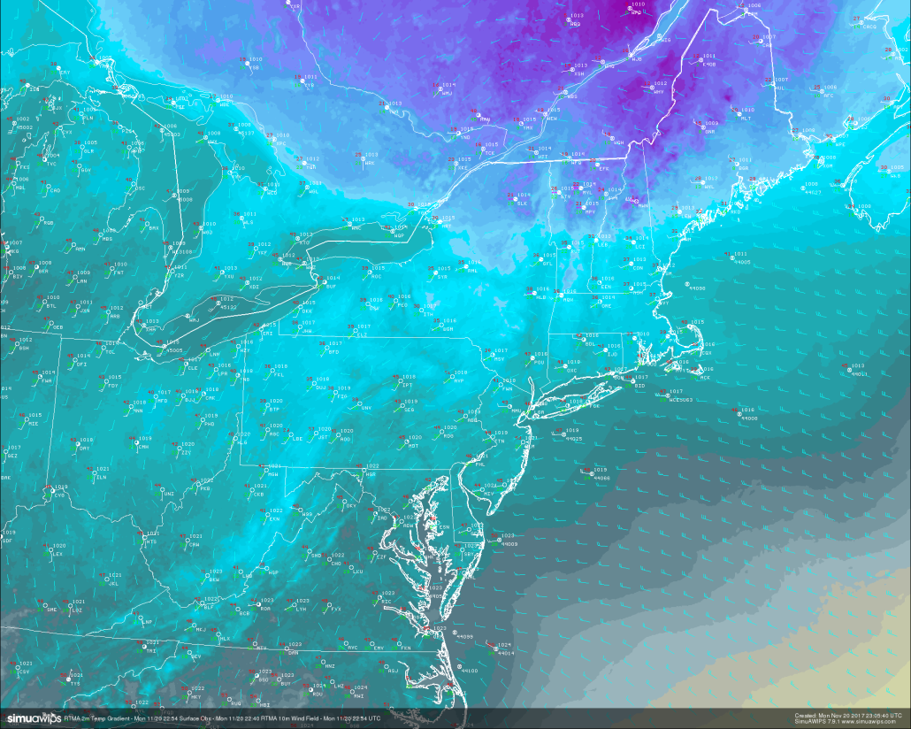
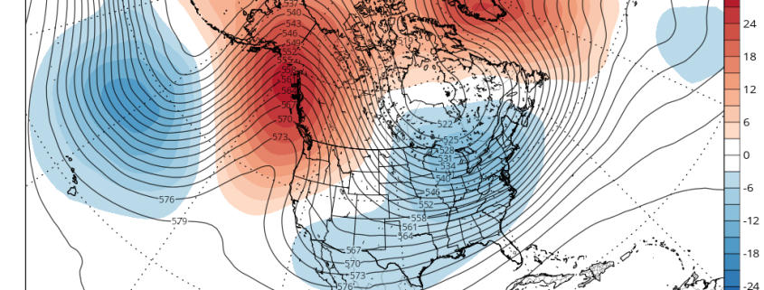
RTMA Analysis of the current temperatures over the Northeast, with surface observations finally showing a change from the gusty NW winds we have been seeing for the past day or so (Credit: Simuawips)
Tuesday morning will likely start off rather cool, but mostly sunny as the area of high pressure that we’ve been following moves offshore and into the western Atlantic by the morning commute. This will mean that as the day goes on, warmer mid level air from the southwest will move into the Northeast, allowing temperatures to moderate quite a bit when compared to today. Additionally, a vigorous area of mid level energy will be diving down from Canada by the afternoon hours of tomorrow, which will be accompanied by a moisture-starved area of low pressure at the surface. As this system heads east with time, it will increase the strength of the southwesterly flow, leading to an increase in winds across much of the Mid Atlantic and Northeast by the late afternoon hours. The relatively clear and conditions and warmer mid level temperatures from the south will allow highs to climb into the lower to middle 50’s tomorrow, with the warmest readings likely just inland from the coast.
As we progress into Tuesday evening, we should see moisture being to develop in the southern states as another messy batch of disorganized mid level energy moves in behind the first system in the Great Lakes. As this takes place, a cold front associated with the system in the Great Lakes region will continue to move east and into the Northeast by the end of the day. This front will remain relatively dry as it moves over the Northeast due to the system to the south and west of it stealing most of the moisture deep in the Gulf of Mexico.
Things may become a little more interesting during the very early morning hours on Wednesday when the upper level jet streak from the Great Lakes system begins to interact with the energy over the south and moisture begins to flow more northerly. The question with this time period is just how much will the precip expand and move west as the new low develops to the south? Today’s model guidance diverges a bit on the extent of the precipitation shield on Wednesday, but as of right now it looks like the immediate coasts of NJ and LI could see some steadier rain, with showers possible further North and West. Since these two systems will remain mostly independent from one another, this is very unlikely to be a big deal, but even slightly more interaction with these systems and a healthier upper level jet streak could promote the development of precipitation further inland, and this will have to be monitored. Otherwise, highs on Wednesday will likely remain in the lower to middle 50’s despite the incoming cold front. The front should clear the area by late Wednesday afternoon, with any residual shower activity quickly leaving the scene as well. Wednesday evening should be a cold one, with lows likely dropping into the middle to upper 20, with warmer readings near the coast.
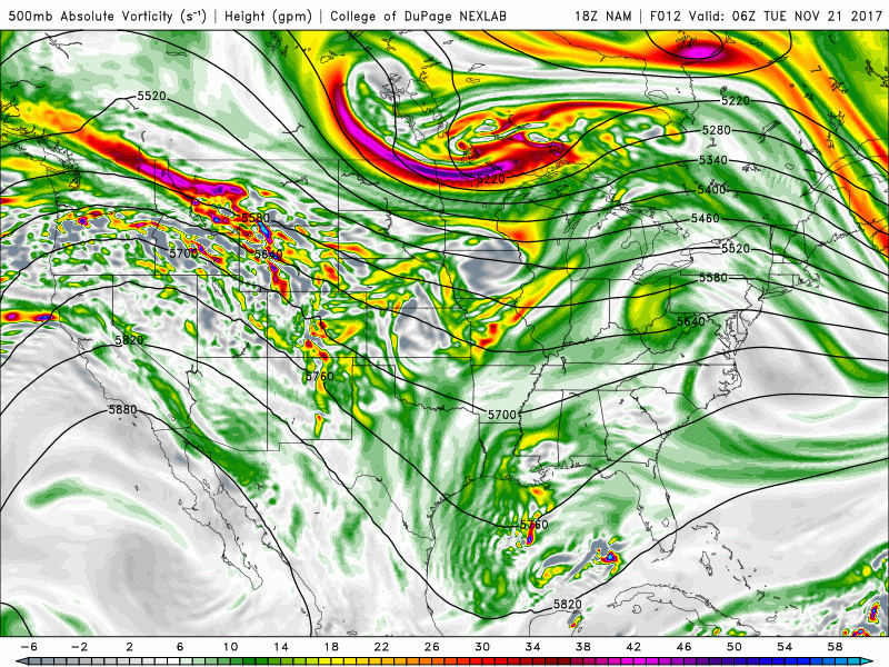
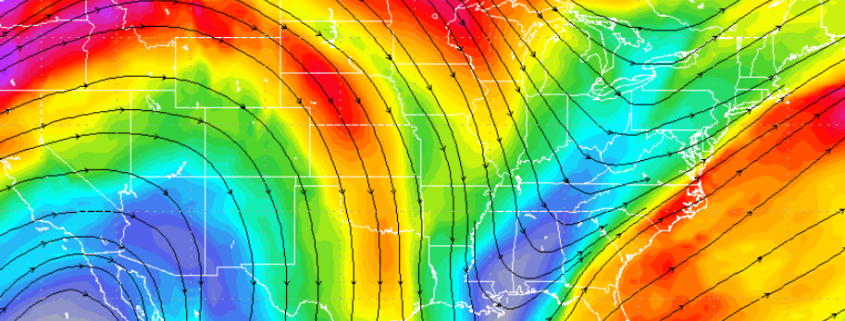
18z NAM 500mb loop showing the initial energy with Wednesdays cold front quickly moving east while more energy drops down into the Gulf of Mexico and becomes “stuck”
Thanksgiving Day and Beyond
A colder airmass from Canada will be in place over the Northeast behind Wednesdays cold front, which should cause the day to start off rather cold in the upper 20’s and lower 30’s. Left over dry air in the wake of the cold front should allow mostly sunny conditions to take over on Thanksgiving day. A colder airmass, clear skies, and calm winds should only allow temperatures to rise into the upper 30’s and lower 40’s across much of the New York metro area, with warmer readings located over portions of Long Island. From a historical standpoint, this Thanksgiving should be a rather cold one, as highs will likely come in 10-15 degrees below-normal! Conditions during the remainder of the day should be quite pleasant as a weak area of high pressure moves in from the west. This area of high pressure will cause winds to shift back to a more southeasterly component by the evening, which will signal the arrival of another warmer mid level airmass. Lows during the evening hours should drop into the middle to upper 20’s, with some warmer temperatures likely across locations closer to the coast.
Calm and cool conditions are expected through Saturday afternoon, before another strong area of low pressure over southern Canada drags a cold front through the region early on Sunday. As of right now, this cold front also looks to be moisture-starved, but the big deal with this system will be the temperatures, not the precipitation. With a large area of high pressure over the western Unites States, this cold front will have the potential to dump some impressive cold over the east, which could drop the area down into the lower 30’s and upper 20’s for highs. Though its just under a week out right now, this cold shot does look to be on the quick-hitting side, as the upper level trough associated with the cold air will quickly move out by the middle of next week.
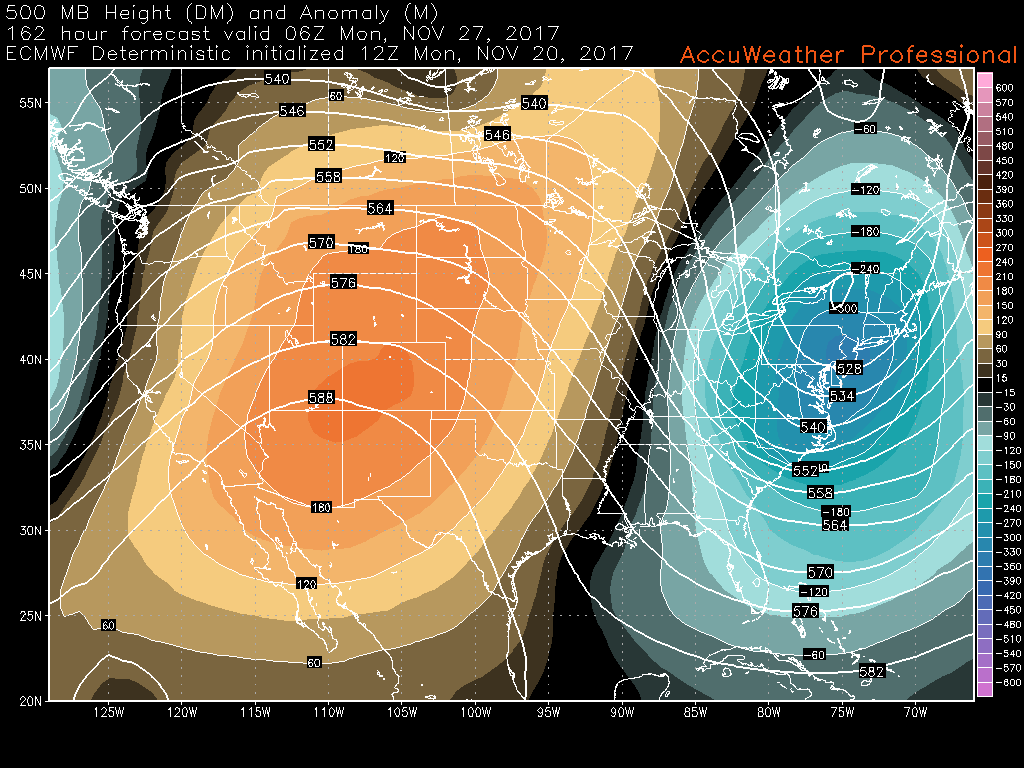
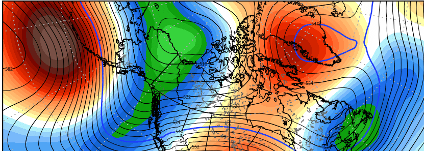
This afternoons ECMWF model showing the potential for a potent, but quick-hitting cold shot by the end of next weekend.
For more information and posts like this one, make sure you sign up for Premium Forecasts — where multiple detailed articles, videos, and interactives are posted each day. Also, come interact with our staff and many other weather enthusiasts at 33andrain.com!
Have a great night!
Steve Copertino
-2")