Good Evening!
We had quite the chilly start to the day today after the area experienced near ideal conditions for radiational cooling that allowed temperatures to drop well into the 30’s across much of the area. Some frost was reported in locations that saw lows drop into the low 30’s which lasted until just before the morning commute-a sign that we’re quickly approaching the start of the winter season. As the rest of the day went on, the area of high pressure that had been in control over the past three days finally began to lift out of the Northeast. This caused low level warm air to funnel in behind the high, which brought in not only numerous clouds over the area, but also some mid level moisture surging northward that helped to create some spotty showers over the western areas of the Northeast. The combination of thick cloud cover and increased shower activity allowed temperatures to stay relatively cool today, with most stations reporting mid day highs in the lower 50’s to middle 60’s. The large temperatures dependency over portions of southern New Jersey is due to an approaching surface warm front that will likely be working over the area later this evening and into tomorrow.
Given then increasing low level moisture and cool air trapped just below the warmer layer aloft, there may be some patchy areas of fog developing late tonight which could possibly last into the early morning hours. Some light showers may also be possible highly dependent on the exact timing of the warm front. If the front is quick to overspread the area, then showers may become more likely, but if the front crashes into the cooler/more dense air over Pennsylvania, then showers will become much less likely this evening and into the early morning hours. Regardless, expect mostly cloudy conditions continuing into sunset, with lows tonight topping off around the middle 50’s for most of the area. again, depending on the progression of the front, areas west of the city may see cooler temperatures if the front begins to slow down over Pennsylvania.
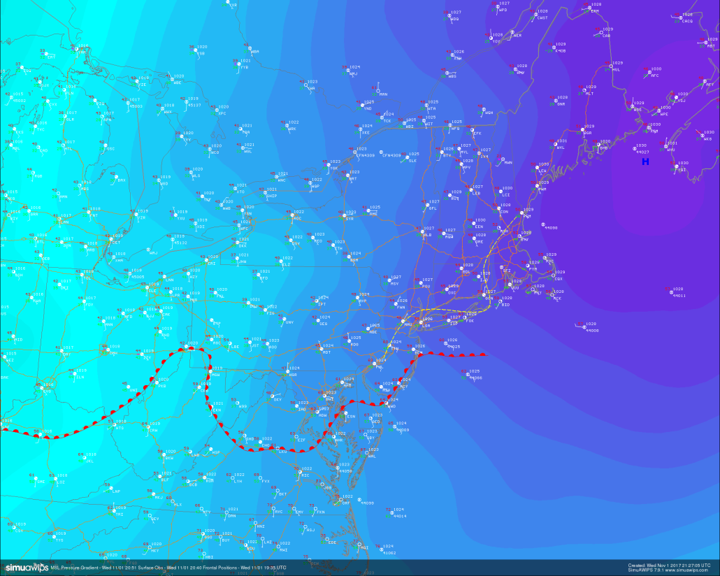
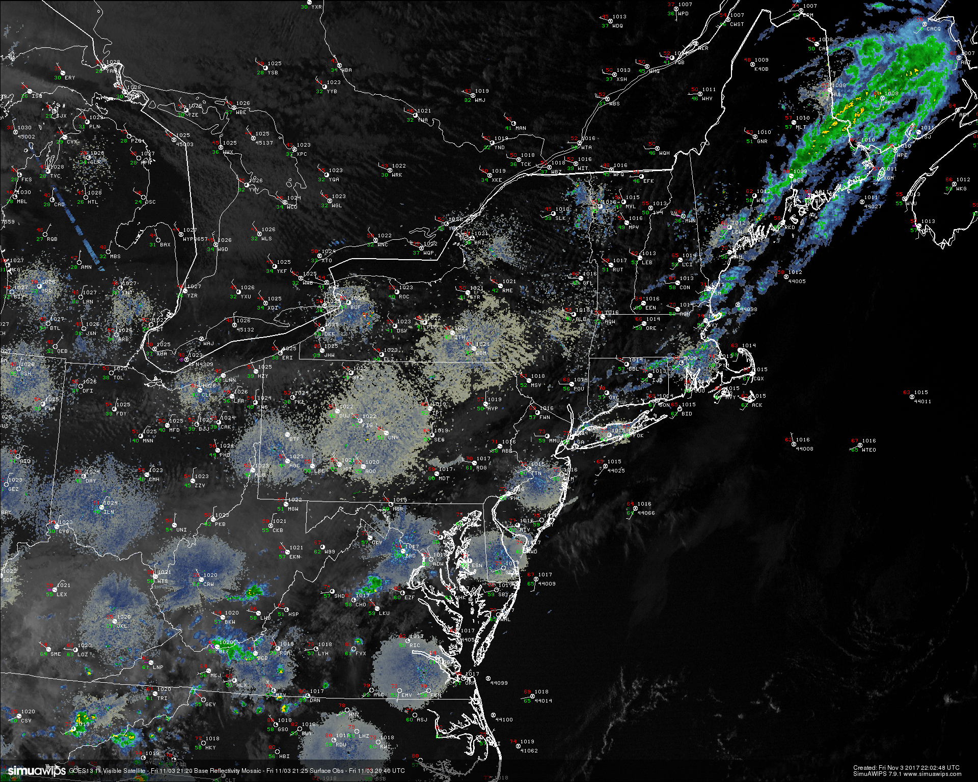
Surface pressures, surface observations, and surface fronts, showing a rather large temperature differential as the high pressure system in purple lifts out
Thursday Into the Weekend
Thursday morning will likely start off cool for most of the area, but with increased mid level riding beginning to develop overhead, any fog or leftover stratus clouds should quickly dissipate as more stable air gives way to clear skies by the mid morning hours. With clearing skies and warmer mid level temperatures, highs tomorrow will likely be a good deal warmer than they were today, with highs likely ranging in the upper 60’s to lower 70’s. Tomorrow should also remain free of precipitation throughout the entire day, so expect calm and mild conditions to last into the evening hours where lows should only be able to drop into the lower to middle 50’s across much of the area.
As we work our way to the end of the work week on Friday, relatively clear conditions are expected during the day, and with an enhanced southwesterly flow in the low level, we expect the day to get a head start on warmer temperatures than Thursday. Low level flow will likely be maximized ahead of another approaching cold front that should be located over western portions of Pennsylvania by Friday afternoon, so the day should have a nice and warm feel to it, with highs likely reaching into the 70’s across much of the area. Locations closer to the ocean like Long Island and coastal Connecticut may have to deal with some cooler offshore winds that may bring highs down a bit, but overall Friday will likely be the nicest day of the week for any outdoor activities. Later in the day, the cold front should begin to pass over the region, with a chance at some scattered/isolated showers with the front. Most of the energy associated with this front will be disjointed and weak, so widespread rainfall is not likely at this time. High pressure should begin to build back in during the night on Friday, so expect conditions to be cooler behind the front with lows dropping into the middle to upper 40’s.
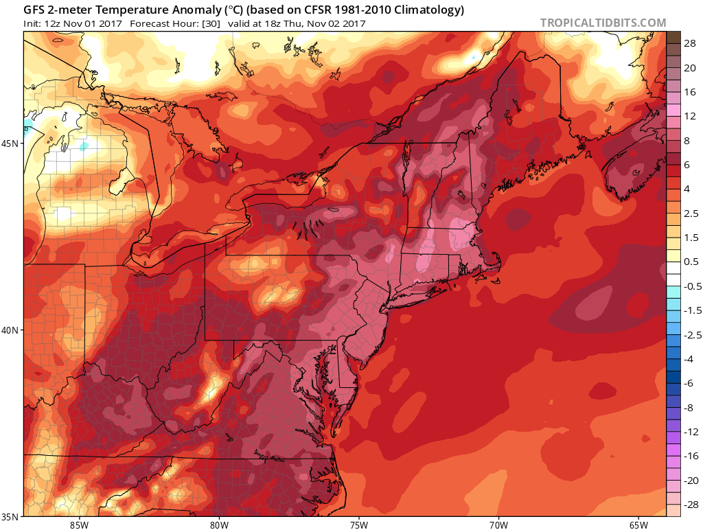
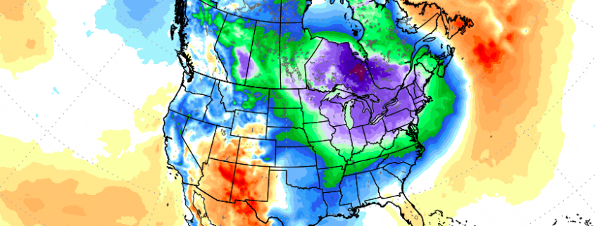
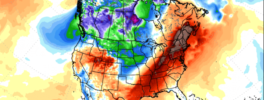
This afternoons GFS model showing above-average temperatures across the area over the next 48 hours
Saturday will likely start off rather calm and cool, with winds coming mainly from the cooler Atlantic. These cooler winds will likely run into some residual moisture from the weak cold front, so it will not be out of the realm of possibilities for some broken/scattered clouds to make an appearance during the day. Despite some cloudier conditions, Saturday will likely remain dry, with highs likely staying in the 50’s area-wide.
On Sunday, a warm front looks to march back over the region from the south, putting a cap on the short cool period. This front looks to come through during the very early morning hours, and could carry some lift with it, so we may have to watch for spotty showers to develop as the warm front takes over. Sunday may feature some partly cloudy conditions, but this will ultimately depend on just how strong the warm front is, in addition to how far inland it can advance. Overall, expect highs to rise into the lower to middle 60’s during the day, with only a slight chance of rain at this time.
An early look into next week shows that we may have to watch an area of low pressure and associated mid level trough for the next measurable rain potential across the east. Additionally, heights will likely rise considerably once again along the coast, which should elevate temperatures into the 70’s-with a shot at middle 70’s at some location early in the week.
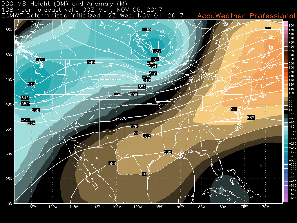
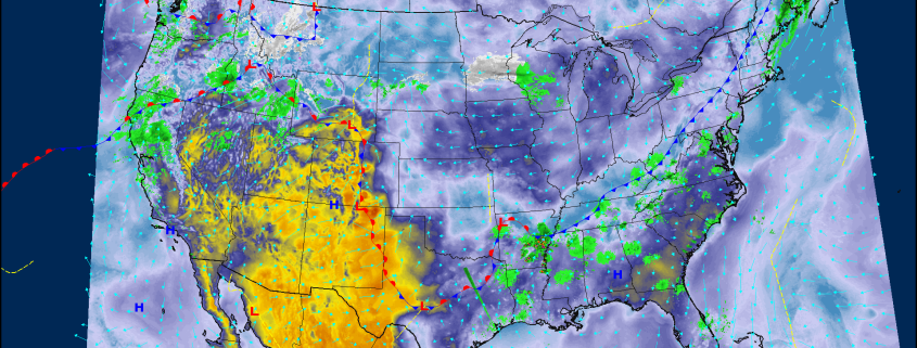
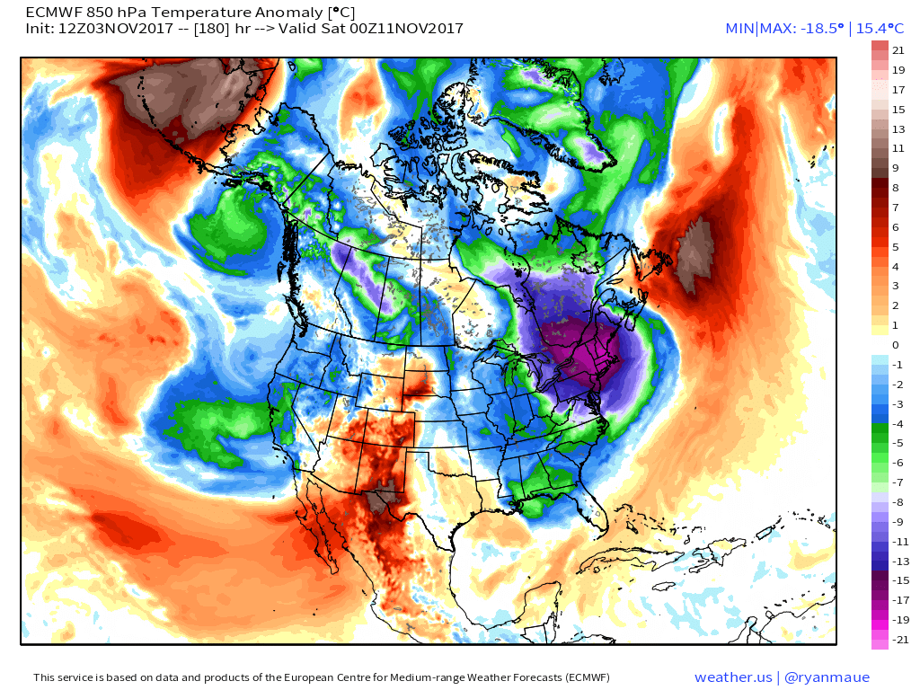
This afternoons ECMWF model showing the tail end of an area of ridging parked over the east for this weekend, with slightly above-normal conditions expected.
For more information and posts like this one, make sure you sign up for Premium Forecasts — where multiple detailed articles, videos, and interactives are posted each day. Also, come interact with our staff and many other weather enthusiasts at 33andrain.com!
Have a great night!
Steve Copertino
-2")