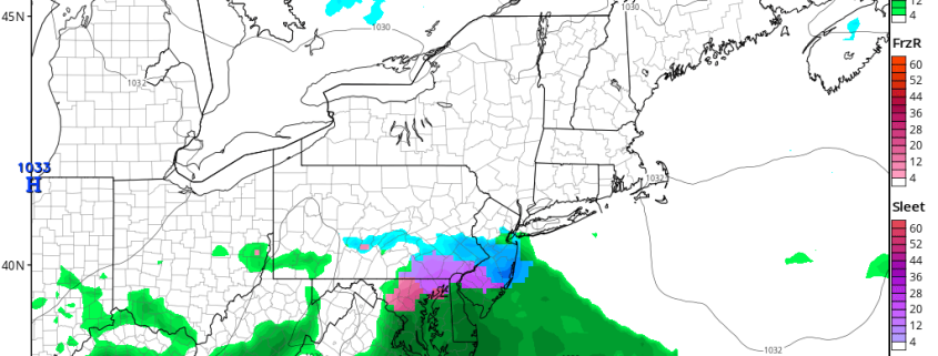
PM All Zones Update: Wintry precipitation slides south

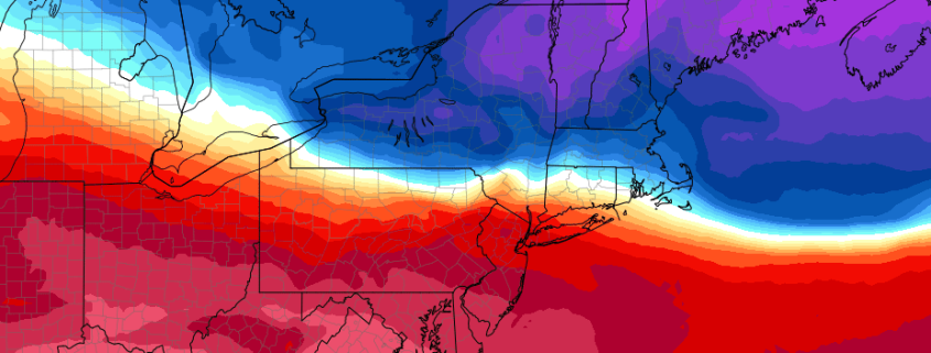
Fair and relatively mild weather remained in place this afternoon throughout the majority of the forecast area. Temperatures in the 40’s were fairly common and a mix of sun and clouds made for a pleasant day. A more complex situation will develop from later tonight into Saturday, however, as a temperature gradient to our southwest shifts towards the East Coast.

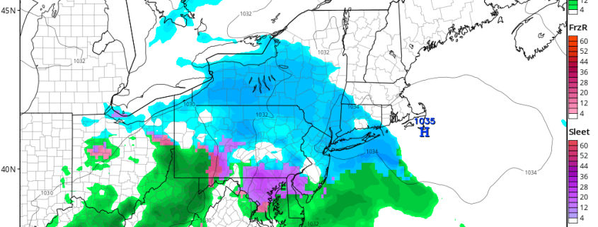
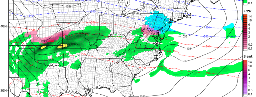
Colder air will move into the Northeast tonight and into Saturday morning with a very impressive surface high pressure area shifting over New England. Precipitation along the temperature gradient in the Mid Atlantic states will fall as a wintry mixture — with freezing rain, sleet, and rain all possible by Saturday afternoon.

Read more

1/13 All Zones AM Update: Colder This Weekend With Saturday Storm Farther South

An artic airmass over Southeast Canada that will begin filtering into all the zones gradually through this evening Temperatures have started falling into 40s over many of the zones this morning. Temperatures likely remain steady through in mainly in the 40s, through the midday hours. then slowly fall into 30s later this afternoon, from north to south across all the zones.

Later tonight, clouds will begin increasing from the southwest, as mid-level disturbance moves east from the Lower Ohio Valley. Temperatures will continue to fall down into lower to middle 20s over Interior zones to upper 20s to lower 30s over the coastal plain.

Read more

1/12/16 AM All Zones Update: Mild Temperatures Today, Wintry Weather Returns by Saturday

A warm front has lifted well north of the region. A mild southwesterly has help temperatures rise into the 50s. But cloud cover and some areas of drizzle continues to linger with some low-level moisture underneath inversion. Some more scattered showers are possible early this afternoon, as mid-level shortwave passing through region.

This afternoon, clouds may break for sunshine. If this occurs temperatures will rise into lower to middle 60s. Which will be near records at climo sites over the region. Partly to mostly cloudy remain tonight, as cold front passes through region. But more shower activity is expected to be more widely scattered with this front, with a lack of lift across the region. Temperatures will fall back into 40s, as this front passes through late tonight.


Read more

Saturday’s Winter Storm has Shifted South for now

We’re getting a nice break from winter for a few days, as a large Northeast Pacific ridge which had given us our Arctic cold has since retrograded, which shifts all the cold air well to our west and north. However, there is still some remnant influence of the North Pacific ridging, as most of Canada is still quite cold. This means that there can still be transient bursts of cold air in an otherwise warm pattern, and that’s what will be happening starting on Friday evening.

The Pacific Jet will be expanding towards the West Coast, but the flow will slow down a bit on the West Coast. This often causes a split flow where some energy digs into the Southwest US, yet due north you get a small ridge in NW Canada. This helps force some of that cold air in Canada further southeast, towards our area and leads to a lot of confluent flow, while the energy in the Southwest US amplifies a Southeast ridge. Thus, we get an extremely strong gradient where a lot of moisture can theoretically ride.

Read more