-2")
Public Analysis: Unsettled Conditions Continue, Keeping An Eye on Tropical Storm Cindy
Good Evening!
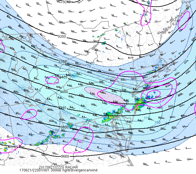
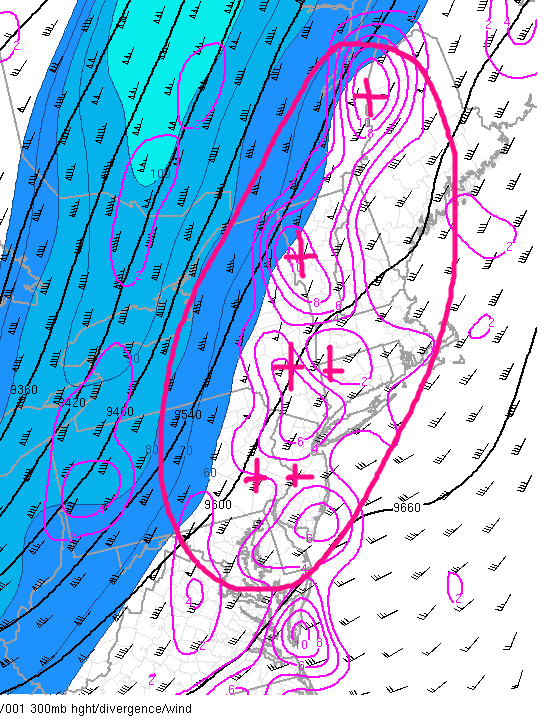
As discussed back on Monday, some residual moisture and weak instability worked its way into the area during the morning and afternoon hours, and when coupled with some forcing just to our northeast, we saw scattered showers and thunderstorms develop across much of the region. These showers and thunderstorms had some decent dynamics to work with, with wind shear being high, lapse rates being quite steep, and the upper level jet streak being located in a favorable position for divergence aloft. Since these conditions came together just at the right time, we actually saw some strong to locally severe thunderstorms develop over New Jersey, Pennsylvania, and portions of Connecticut. A segment developed in Pennsylvania and went on to track east, leaving numerous wind damage reports in its wake. Further north, isolated cells developed over southern New York and went on to track into Connecticut, which brought a few small hail reports and isolated wind damage reports.
As of right now, these storms have begun to weaken and are moving off the coast as the best dynamics and instability begin to fade away. Despite the storms and occasional cloudiness, temperatures were able to rise into the low to middle 80’s across much of the area. The cold front which acted as the lifting mechanism for today’s storms will begin to move through the region and bring a drier airmass in its wake later this evening. Clouds should begin to diminish by sunset, which should allow temperatures to fall back down into the 60’s tonight, with lows in the 50’s possible farther north and east of the city.
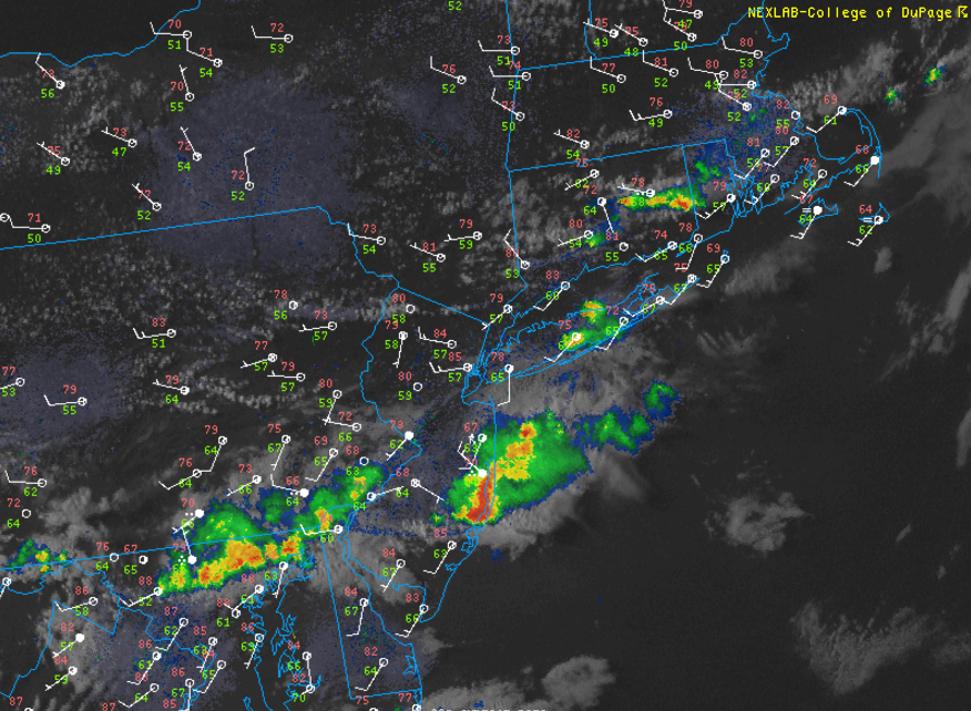
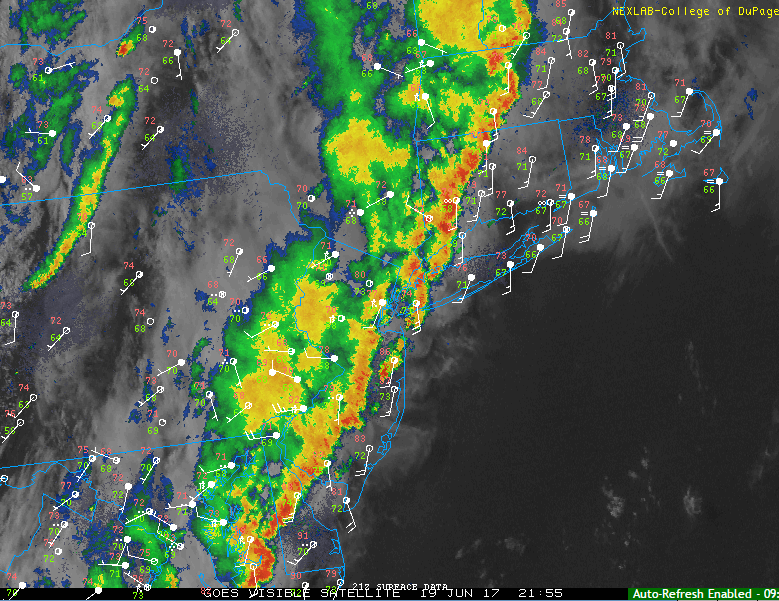
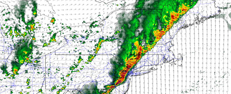
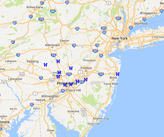
This evenings latest high resolution visible satellite imagery, regional radar mosaic, and surface station plots, showing the bulk of the shower and thunderstorm activity pushing to the east.
Thursday into Friday
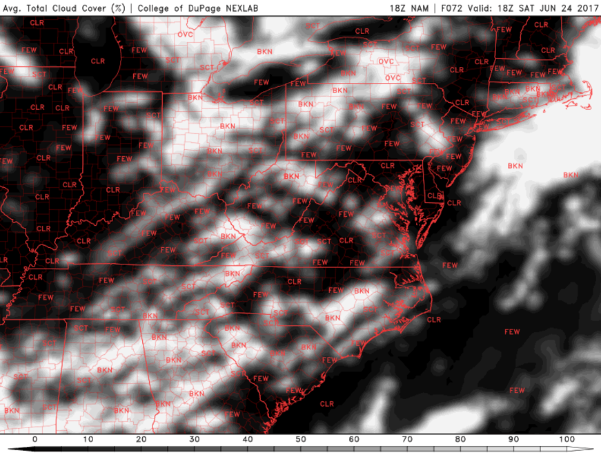
Thursday should start off as a rather beautiful day with low humidity, clear skies, and light winds from the west. Weak high pressure at the surface and aloft will allow the area to stay mostly-sunny during the day tomorrow, with just some upper level cirrus clouds likely approaching the area. Temperatures aloft will be rather mild thanks to the ridging overhead, so expect to see highs in the low to middle 80’s once again tomorrow, except this time it will feel more pleasant due to the lower dew points. Later in the evening tomorrow, low level moisture advection will begin to overspread the area due to a weak warm front aloft. This moisture will be quite rich in nature, as the majority of it is being fed from the deep south and portions of the Gulf of Mexico thanks to Tropical Storm Cindy. Some elevated showers and thunderstorms may try to develop late tomorrow evening as the moisture feed begins to overspread the region, but at the very least it seems likely that clouds will increase in earnest tomorrow night. The increased cloudy skies and rich moisture feed will lead to low temperatures not really being able to fall all that much, with temperatures in the low 70’s likely across most of the area.

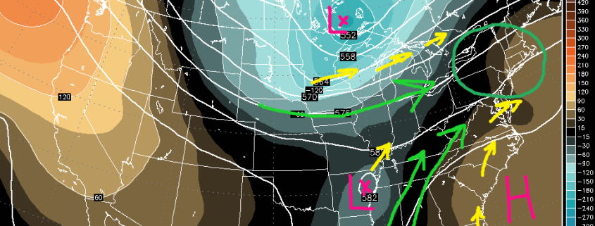
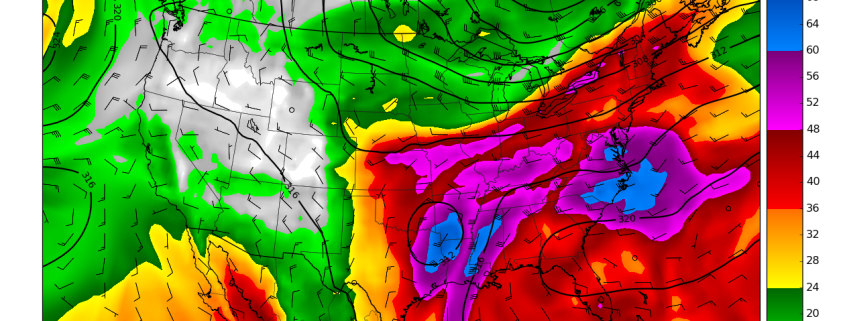
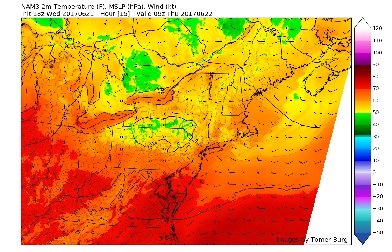
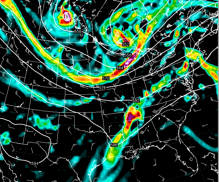
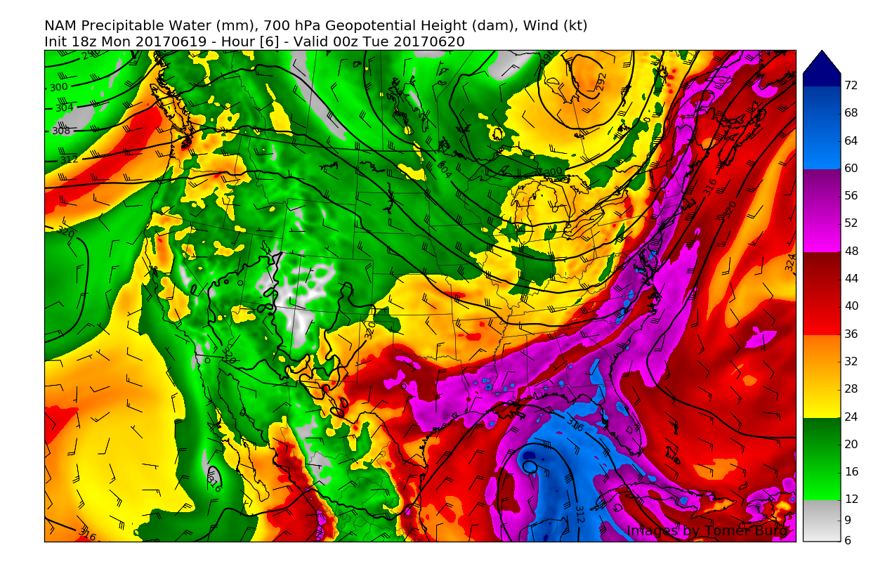
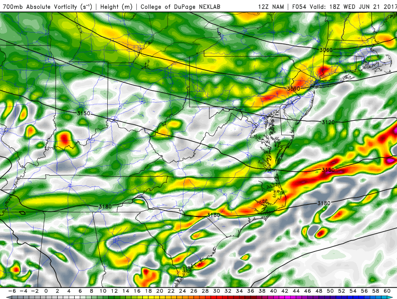
This afternoons Rapid Precision model, showing the potential for heavy rains associated with the remnants of Tropical Storm Cindy to affect the region on Friday and into Saturday (Credit: WSI)
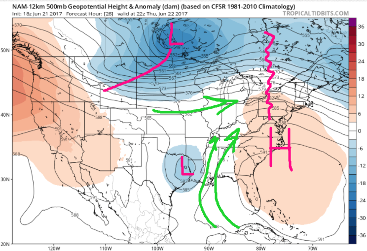
The forecast on Friday becomes quite complex as a strong northern stream disturbance begins to interact with the remnants of Tropical Storm Cindy, which will likely be situated over the Ozarks by Friday morning. The aforementioned warm front that we talked about for Thursday evening should be through the area by Friday afternoon, leaving most of the area with partly cloudy skies and warm temperatures once again.
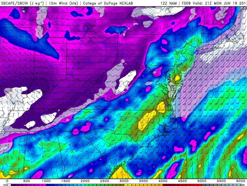
Highs will likely be able to climb into the middle 80’s with ease, but the increasing moisture from the south will also raise the dewpoints over the area, possibly making for a very muggy afternoon. With sunshine likely during the afternoon hours and an abundance of moisture also in place, instability will build over the area, and will be accompanied by some modest wind shear over the area. The pieces will be in place for heavy showers and thunderstorms to go up over the area during the afternoon hours, but the item in question will be whether or not we have a direct trigger to set off any storms. At this time, it appears likely that an adequate amount of mid level energy will be in place to set off the development of some isolated showers and thunderstorms capable of producing gusty winds and very heavy rainfall rates, possibly causing some localized flooding.
As we head into the late afternoon and evening, the threat for more showers and thunderstorms will increase markedly as the direct remnant moisture from Tropical Storm Cindy begin to crash into a cold front located to our west. Again, the main question that will be determining whether or not we see widespread heavy rainfall comes down the need for a “trigger” mechanism. One possible outcome is that Cindy deteriorates after making landfall to the point that the systems energy is dissipated, and all that is left is just some moisture. This outcome would lead to showers and thunderstorms being more scattered during the later portion of Friday, but still have the potential for heavy, tropical downpours.
The second option would be that Cindy does maintain itself as a coherent and trackable system in at least the mid levels of the atmosphere. This would allow the residual lift from the decaying tropical storm to spark numerous showers and thunderstorms during the afternoon hours of Friday, and would carry a much greater threat of torrential downpours and localized flooding concerns. At this time, it is looking likely that what will happen will be a healthy blend of both scenarios, with Cindy retaining some mid level energy that will set off heavy showers and storms just to the west of the NYC area, which will have the potential to track eastward and put down some impressive rainfall totals in a short period of time. This solution is baked up by this afternoons European model and the American model. Since Cindy has not yet made landfall, this solution may still change, so be sure to stay up to date and check back again over the coming days! Also, please keep an eye on the latest NWS products in the event that Flood Watches are issued down the line.
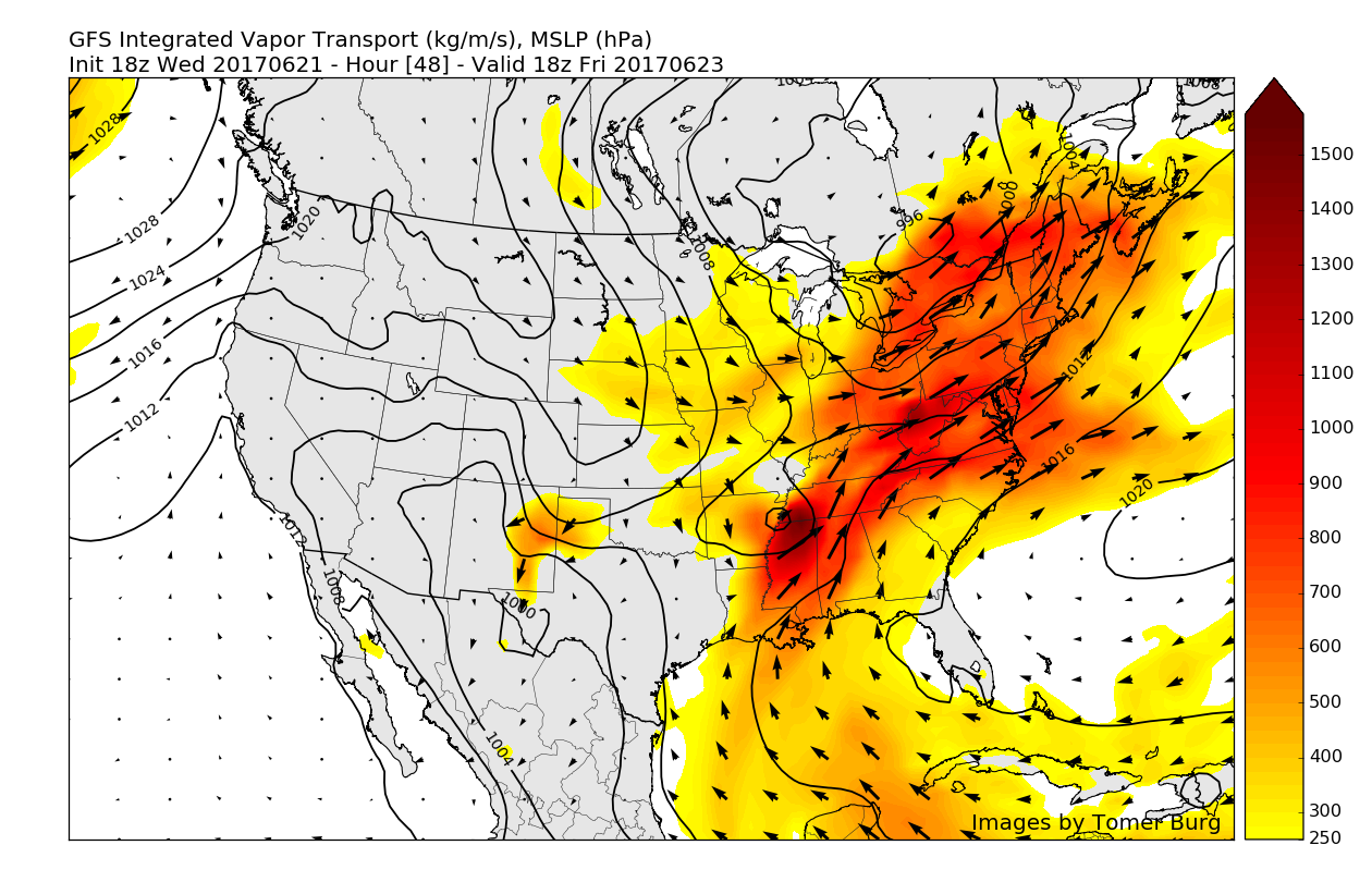
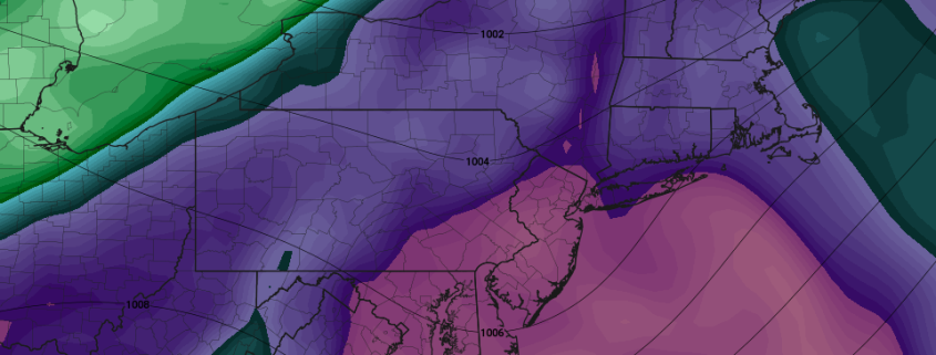
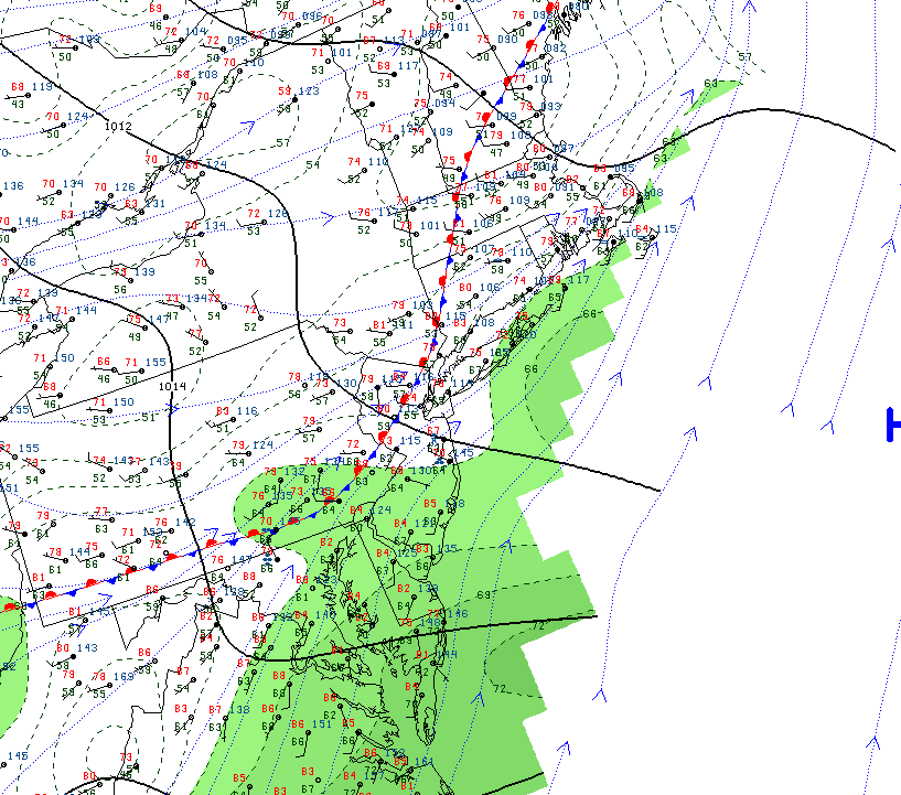
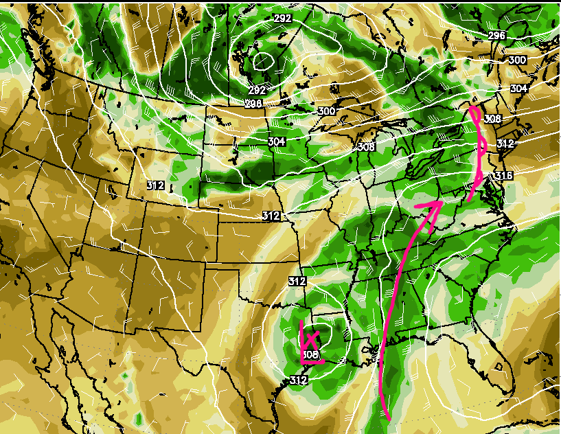
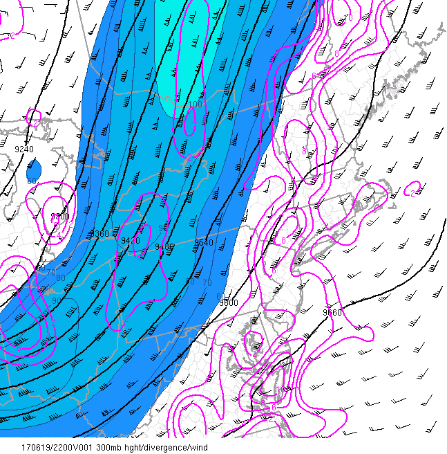
Image showing very impressive amounts of water vapor being advected north over our area, which will greatly increase the threat of heavy showers and thunderstorms.
Saturday and Beyond
Heavy showers and storms may continue into the early morning hours of Saturday and possibly even the afternoon as the cold front pushes through the area, dragging the rest of the deep tropical moisture with it. There are still some model difference on fast the cold front with tropical moisture moves offshore Saturday afternoon. If the front is slower, a more showers and thunderstorms could linger into Saturday afternoon. But latest model trends have been faster, so we are still leaning to more clearing skies by Saturday afternoon. More sunshine will help temperatures rise into middle 80s on Saturday afternoon.
The cold front and its associated moisture should then begin to shift well offshore, leaving an area of weak high pressure in its wake. Sunday should be quite pleasant, with clearing skies and highs in the lower 80’s, also accompanied by a much more comfortable airmass.
An active northern stream will keep conditions relatively unsettled for the foreseeable future, with a chance at a cool-down later in the week as well.
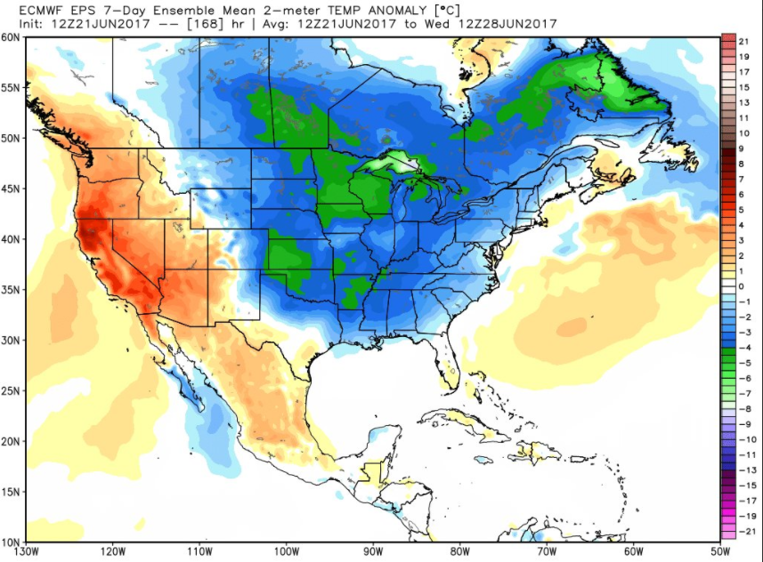
This afternoons European ensemble mean showing a shot at some cooler weather into the middle portion of next week (Courtesy of WeatherBell)
For more information and posts like this one, make sure you sign up for Premium Forecasts — where multiple detailed articles, videos, and interactives are posted each day. Also, come interact with our staff and many other weather enthusiasts at 33andrain.com!
Have a great evening!
Steve Copertino

