-2")
Wintry Mix Exits, Unsettled Pattern Sticks Around Through Next Week
Good Evening!
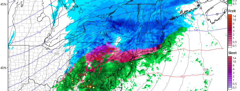
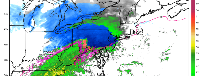
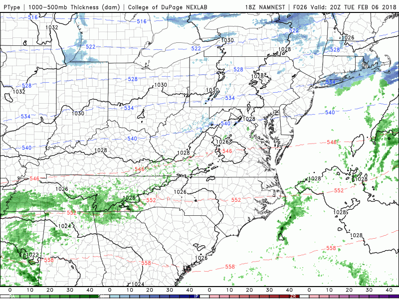
The area of low pressure that moved inland over much of the Northeast is finally beginning to wind down, with precipitation shutting down from west to east. The storm initially came up from the southwest early this morning, producing a wide area of snow and mixed precipitation over much of the Mid Atlantic and Northeast. The areas that did start off as snow around the New York metro area this morning gradually saw the snow change to sleet, and then light to moderate patches of freezing rain as warmer air in the mid levels began to push north. As mentioned on Monday, there was a chance that the low level cold would be under-modeled as it has many times in the past, and that is exactly what happened this morning/afternoon. Despite mid level temperatures above freezing a few thousand feet above the ground, surface temperatures remained at or below freezing just long enough to allow for quite a bit of freezing rain to fall across southern portions of New England as well as portions of the Mid Atlantic states. This freezing rain caused very hazardous travel conditions for the morning commute, with many folks getting caught off-guard by the unexpected slick conditions. As the area of low pressure continued to move to the north and east this afternoon, warm air began to surge in at all levels, and this caused most, in not all of the precipitation in the area to turn to plain rain. Some locations in southern New England are still dealing with light to moderate freezing rain, while locations well to the north are dealing with moderate to heavy snow.
Continued moderate rain will be likely over portions of the Mid Atlantic and southern portions of the Northeast through at least 8pm, with precip gradually ending from west to east. Colder air will be working its way east as well behind a frontal system, so there will be a slight chance that the precip could end as light snow or a light mix. Temperatures will once again drop below freezing this evening, with much of the area seeing lows drop back into the middle 20’s, with locations off to the north and west likely flirting with teens due to the snow cover. Regardless, conditions will remain hazardous for travel during the evening commute, so please use caution while driving on untreated roads!
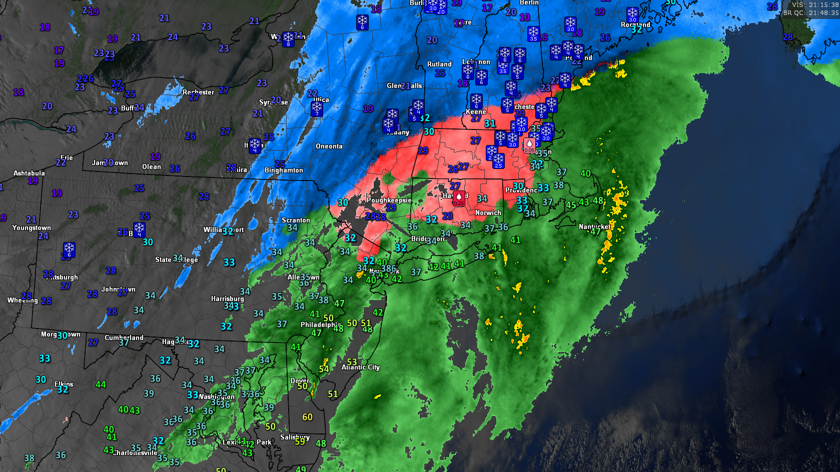
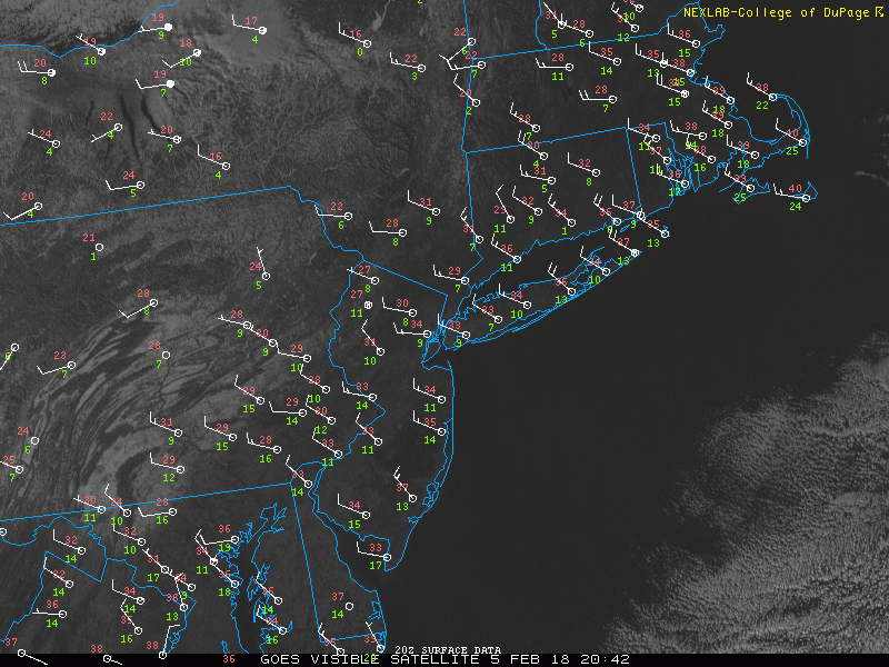
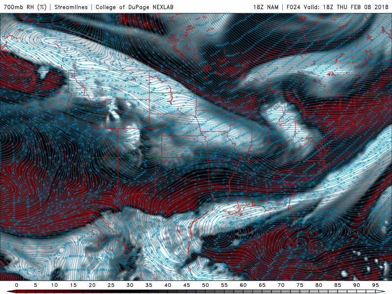
This evenings latest high resolution visible satellite imagery, regional radar mosaic, and surface temperatures over the Northeast showing a wide variety of weather conditions
Thursday Into Friday
Conditions will start off rather cold on Thursday morning as an area of high pressure builds off to our west over the Ohio Valley. Temperatures will have likely dropped quite a few degrees below freezing during the overnight hours, so expect any puddles or standing water to have frozen over, making for another potentially slippery commute. Black ice may be rather prevalent over the area tomorrow morning as well, so please use caution! Regardless, the rest of the day looks rather calm as the area of high pressure over the Ohio Valley continues to build, leaving most of the Northeast rather sunny. Colder and drier air will be working its way down in the mid levels of the atmosphere from Canada, so we expect highs to generally stay in the middle to upper 20’s. Conditions will remain calm and cold through the evening hours as the area of high pressure continues to move over the Mid Atlantic. As it does so, conditions will become rather favorable for radiational cooling to set up over the Northeast, allowing for lows to drop into the middle teens and 20’s across much of the area.
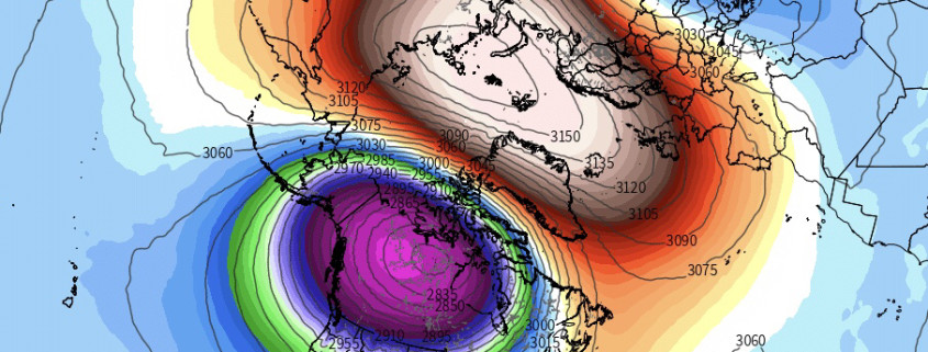
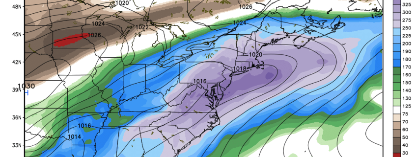
Friday looks to be rather similar to Thursday, just with a chance of more clouds and significantly less windy. The Pacific jet stream will begin to go zonal over the entire country (west to east), which will signal the start of a warmer period, but also an unstable one. This west to east pattern will allow for multiple impulses of energy to quickly move from one coast to the other rather quickly, but a lack of anything to slow them down along the way will keep each disturbance weak and disorganized. One such disturbance looks to be over the northern Plains on Friday afternoon, which could cause some very light rain or snow to break out over northern portions of the New York metro area later in the day before quickly moving to the east. Major changes will be underway by Friday night, as strong low level flow begins to establish itself from the southwest, ushering in warmer mid level temperatures. This will allow for lows on Friday to mainly stay in the middle to upper 20’s, with some locations staying in the 30’s.
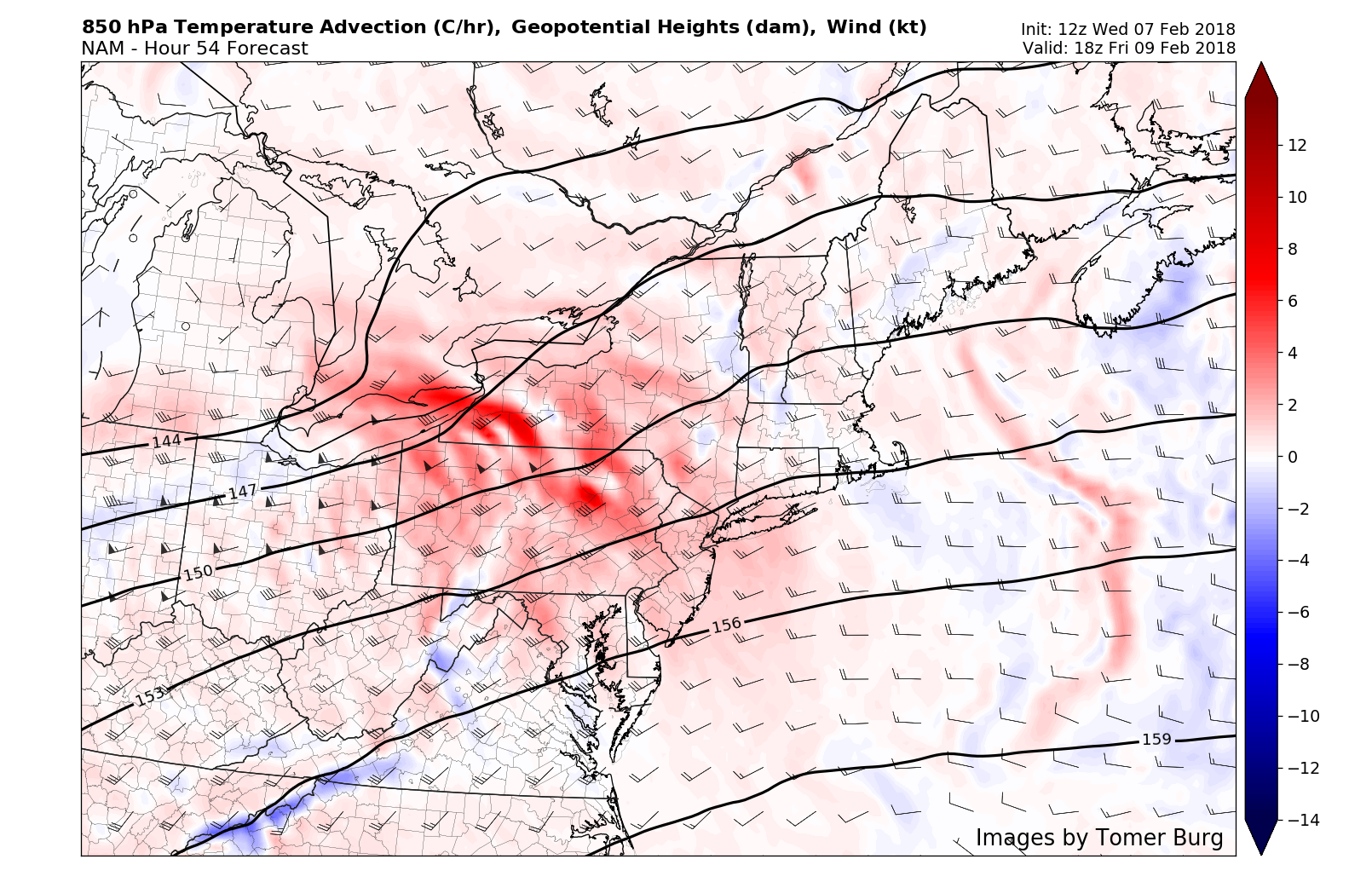
This afternoons NAM model showing significant warm air advection over the Northeast on Friday afternoon, leading to a change to warmer temperatures
Unsettled Conditions This Weekend
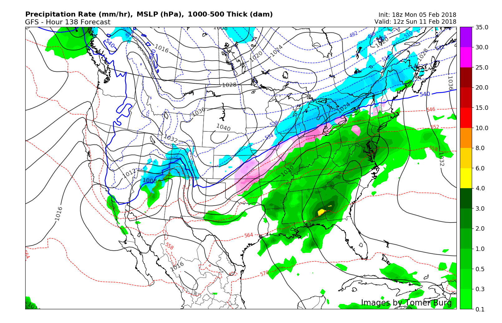
Starting on Friday, the subtropical jet stream will begin to expand over the Gulf of Mexico, creating abundant latent heat release which will eventually get caught up in the strong southwesterly flow over the eastern US. Our next system will begin to take shape over the southern Plains on Saturday morning as moisture-rich air runs into cooler mid level temperatures, sparking a large area of precipitation. The zonal jet streak will still be present over the northern tier of the country, and this will only work to enhance precipitation growth and intensity over the south. Snow will be possible over portions of the Mid West through the Ohio Valley where the colder air can hang on longer, as high pressure dives into the central Plains states. Mid level ridging over the western Atlantic will only help to enhance the northward transport of moisture into the Northeast on Sunday morning as light to moderate rain begins to break out. Rain looks to last pretty much all day on Sunday, likely making the day a washout. Due to the progressive nature of this system, flooding does not look all that likely in the Northeast, however there still may be some heavy downpours as precipitable water amounts will be quite high for this time of year. Temperatures this weekend will also be quite anomalous, with highs likely getting into the 40’s and lower 50’s across much of the Mid Atlantic and Northeast.
Another wave may develop along a stalled frontal boundary to our west on Monday, leaving us with another threat at some moderate rain to start the work week. At this time, it appears that the threat for substantial snowfall from either system is rather low, but we will continue to monitor these systems as they draw closer!
This afternoons NAM model showing an impressive moisture feed setting up directly from the Gulf of Mexico
Have a great evening!
Steve Copertino