It has been six weekends in a row now that the New York City area has recorded precipitation. Some of them have been worse than others. This weekend, luckily, appears to be on the better side of things, although it will likely add to the tally of the unfortunate statistic above.
Forecast models have trended further south (and weaker) with a storm system expected to impact the Northeast and Mid-Atlantic states on Saturday, taking the steadiest and heaviest rain into the Central Mid-Atlantic states and leaving much of New England void of steady precipitation. This will come as exciting news to most, especially since it once looked like a washout was on the table for the weekend ahead.
Showers and unsettled weather are still likely in areas south and west of NYC, such as Central and Southern PA, and Central NJ and southward as well. Further north into NYC and New England, just enough high pressure should keep things dry, perhaps even yielding some sunshine. Precipitation totals are expected to be quite low, with most mesoscale forecast models indicating less than .25″ in most locations, and 0.0″ in some locations as well. In the Mid-Atlantic states, nearer to Washington, DC and points south, precipitation amounts could be more impressive – aided by convection and embedded thunderstorms. We cannot rule out some rain expanding a bit northward into NJ and NYC on Saturday night into early Sunday morning, but precipitation coverage still should not be widespread. Areas that do get a few peeks of sunshine could approach 80 degrees on Saturday.
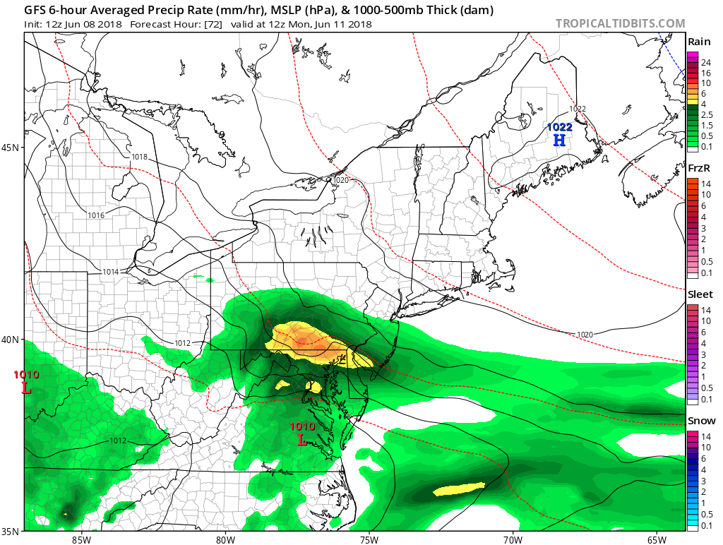
The latest GFS model shows a follow-up storm system passing to our south on Sunday night, but could bring some heavy rain to Southern NJ (Tropical Tidbits).
The weather improves even further on Sunday, as a cold front and storm system will have marched through, providing more high pressure and sunnier skies in its wake. Temperatures will end up a few degrees below normal behind this front, but enough sunshine should prevent it from being “cold”. The one caveat is that this new front will not be able to completely clear the area, and it may stall just to our south on Sunday. This could allow a new system to ride this front and increase clouds later on Sunday, and bring some heavy rain and thunderstorms for Southern NJ, Southern PA, and the Mid-Atlantic. As of now, this rain should miss the immediate NYC area, but we will be sure to keep an eye on it.
Overall, the forecast has improved just about as much as one could have hoped for. After several days of the hemispheric pattern, and forecast model guidance, suggesting a high likelihood of steady precipitation this weekend, it appears likely that most of the Northeast will escape the weekend with just partly sunny conditions and transient showers to the south on Saturday and Sunday.
I think I speak for us all when I say: We’ll take it.
-2")