Prolonged heat wave set to begin on Friday

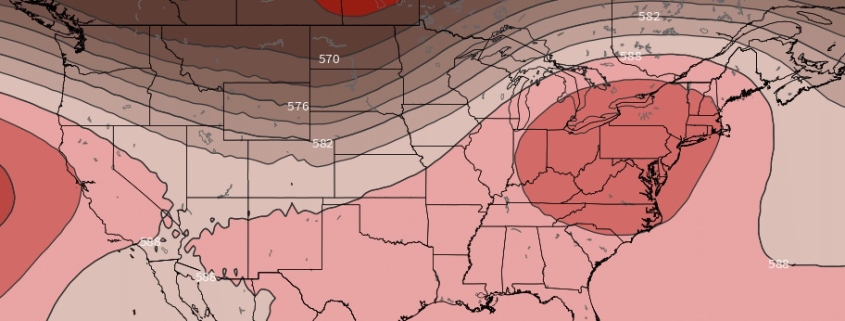
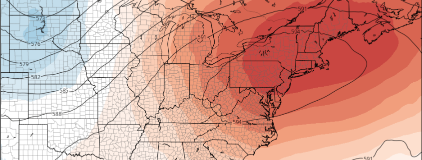
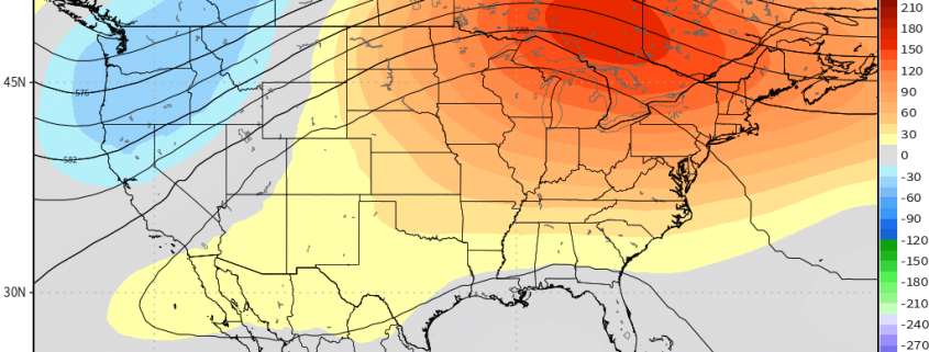
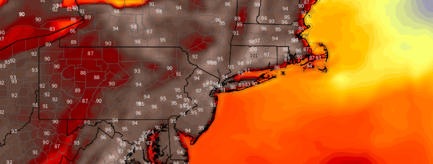
After several weeks of temperatures averaging largely below normal, the hemispheric weather pattern underwent a dramatic shift in early June. Since that time, much of the United States has observed temperatures above normal, with the lone exception being the Northeast states. That will change significantly beginning Friday, as a heat wave begins across a huge area of the Ohio Valley and Northeast – yes, including the urban corridor from Philadelphia to New York City and Boston.

The heat is expected to continue for quite a while. While a heat wave technically was observed in parts of New Jersey a few weeks ago, it will pale in comparison to the temperatures which are approaching starting this weekend – which may very well be the hottest of the year. The heat is expected to persist until the end of next week as a huge ridge builds across the Eastern and Central United States.

Read more

Behind the intricacies of the incoming heat wave

It is not often that we can confidently state “A heat wave is coming” so many days in advance, yet here we are.

A heat wave is coming.

Granted, it hasn’t been easy pinning down the details of this pattern. But forecast model guidance has largely pointed most meteorologists in the right direction when it comes to this upcoming bout of heat. A combination of tropical forcing signals and the wave pattern in the North Pacific Ocean helped tip the hand of the hemispheric evolution, one that signified the development of an anomalous ridge along the East Coast.

Read more

Weekly Planner: Cooler Start Then A Heat Wave Begins on Friday

Good morning, friends! Another gorgeous day is underway today , as high pressure from Canada (which provided excellent weather in the Northeast US on Monday) remains in place. Temperatures will remain quite comfortable and the weather very benign through midweek. A storm system approaches from the Ohio Valley and brings increasing rainfall chances to the Northeast states from late Wednesday Night into Thursday, followed by increasingly notable heat during the weekend.

Read more

Energy/AGwx Video Update: Tracking the Heat Ridge

Good afternoon! While the main story in the short term is the continued cool and wet AG Belt, we are quickly going to transition to a pattern that is much hotter across much of the Eastern US. A massive heat ridge will build in the Eastern US, giving a prolonged heat wave with multiple days approaching 100 degrees in many spots. This will also be a much drier pattern for the Heartland, although the ridge’s periphery will still be able to provide moisture for the Northern Plains.

The main story going forward will be tracking the heat ridge’s progression. While it is very likely that this ridge will retrogress, figuring the exact timing and orientation of its retrogression will be key regarding the continue warm risks going forward, as well as the potential transition to cooler and wetter. A look at AAM correlations gives us strong clues regarding what this ridge will ultimately do.

If this is a product you’d like to receive on a daily basis, inquire with us here and sign up! We’d be happy to work with you.