NYC Area Forecast: Some Unsettled Weather This Weekend

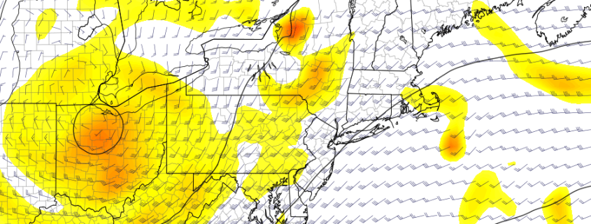
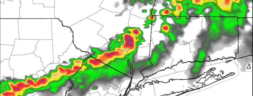
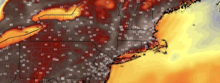
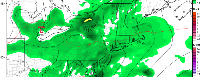
Good morning! A closed upper-level low over the Midwest will track through the Ohio River Valley and Great Lakes region through this weekend. This low will open up and weaken into a broader trough as it runs into additional confluence over the Northeast US. As a result, we aren’t expecting a washout with widespread or heavy rainfall for either day of the weekend. But this storm system will certainly cause some unsettled weather at times, especially for Saturday.

Read more

NYC Area Forecast: Improving Weather Today, More Unsettled for the Weekend

Good morning! A wave of low pressure that brought some rainfall to region overnight will move further offshore this morning. This will cause any lingering showers to end and skies to clear for sunshine as the morning goes on. This afternoon and early this evening, mostly sunny skies are expected as high pressure over Southeast Canada begins to build south into the region. High temperatures will be very warm with northerly downsloping winds this afternoon–in the mid-upper 80s.

Early tonight, a weak cold front from the north will pass through the region (mostly dry). However, winds will be turning more northeasterly behind this front. This may result in a marine layer with low clouds developing later tonight along some coastal areas. Otherwise, mostly clear skies are expected through tonight. Overnight low temperatures will range from the middle 50s over the Interior areas to middle 60s over NYC and urban areas.

Read more

Weekly Planner: Record heat to start the week

Good morning! What a wonderful weekend that was. After seven straight weekends with measurable rainfall, we finally broke the streak – and the heat built into the Northeast states on Sunday, with temperatures rising into the lower 90s. The heat will actually peak today, with temperatures expected to approach record highs for the day, in the middle 90s. 850mb temperatures (about 5000 feet above our heads) will actually be a bit cooler closer 19 to 20 C today, than what models had back last week. But the surface temperatures will warm as southwesterly winds increase.

In addition to the increasing surface temperature will come rising dew points, resulting in relative humidity values much higher than they were on Sunday. Heat Index values are expected to rise into the upper 90s and eventually near or over 100°F in many spots by this afternoon, especially over Northeast New Jersey and the Lower Hudson Valley.

Read more

Weekend Outlook: Heat Builds in the Northeast

For seven straight weekends now, we have discussed the possibility of showers, cooler than normal weather, and unsettled conditions. This weekend will finally buck the trend. Warmer, benign weather with plenty of sunshine is expected for the entire weekend in the Northeast states as high pressure settles in. As time goes on, temperatures will increase thanks to a building mid-level ridge.

On Saturday, temperatures will begin warming up with highs in the mid-upper 80s. By Sunday, high temperatures are expected to reach 90 degrees or higher, as southwest winds usher in increasingly warm and humid air. The heat will likely peak on Monday, as 850mb temperatures between 20°C to 22°C expand to encompass much of New England. There is potential for high temperatures in the mid to upper 90s and Heat Index values near or over 100°F in the urban corridor.

Read more