Multiple disturbances, unsettled weather likely this week

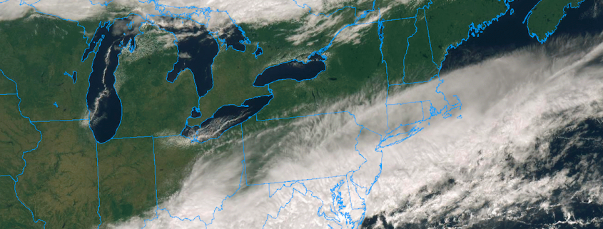
Welcome to Autumn! Although meteorological Autumn began on September 1st (which, if you ask us, is still a more accurate demarcation line for the season), Autumn officially began Saturday Night at 9:54pm. The weather cooperated quite a bit, as well, with a beautiful day on Saturday throughout much of the Northeast states. Behind a frontal boundary, skies partially cleared and drier, less humid air moved in.

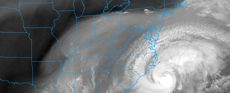
You may have noticed that the weather this morning is quite a bit different. The frontal boundary which moved through Friday barely sunk far enough southward into the Mid-Atlantic, and as a disturbance rode along it this morning it has moved further north once again. This has left many areas in the Mid-Atlantic, including parts of Southeast Pennsylvania and New Jersey, dealing with rain once again. Clouds have streamed into New England as well, with only Northern New England escaping and enjoying some sunshine.

Read more

NYC Area Forecast: Unsettled weather continues as Florence stays south

Good morning! Over the next few days, a large upper-level ridge will be building into the area from the Western Atlantic Ocean. Ridges like this would typically support the return of hot and humid conditions, but the area is sandwiched between high pressure to the north and Hurricane Florence off the Southeast US coast. As a result, an onshore flow has persisted and a frontal boundary has lingered over the region. This has lead to unsettled and muggy weather, which will continue into the weekend before high pressure takes over.

Read more

Florence may not make landfall in North Carolina. Does it matter?

More than seven days after meteorologists first started tracking what would become Hurricane Florence, the weather pattern we have been advertising as “extremely unusual” finally threw another curveball at us. Forecast models over the past 24 hours have come into better agreement on the idea that Hurricane Florence will put on the brakes as she approaches the Carolina coast, coming to nearly a complete halt and turning southwesterly along the coast.

In fact, some models suggest that the storm may not even make an official landfall in North Carolina at all – instead, it will float southwestward toward South Carolina before weakening and moving inland. This has left the public with a lot of questions. What is going on? What does this mean, and should we believe it? Does this matter in terms of overall impacts? Does this new change in the track of Florence really matter for those in its path? The answers aren’t simple, but they are there – and forecast models have been giving us clues all along.

Read more

Extremely dangerous Hurricane Florence heads towards Carolinas

Hurricane Florence weakened briefly this morning, but remains a powerful Category 4 hurricane with maximum sustained winds of 130 miles per hour. The weakening can mostly be attributed to an eyewall replacement cycle or “ERC”, which occurs when the inner eye-wall of a hurricane erodes in favor of a larger, more expansive one. The good news is the temporary weakening of the storm system. The bad news is the window for additional strengthening that occurs afterward.

To make matters worse, Florence is set to enter a nearly optimal environment for strengthening later today. Anomalously warm ocean temperatures, some of the warmest in the Atlantic Ocean, lie ahead of the storm. In addition, low mid level atmospheric shear will allow the storm to properly ventilate. After the eyewall replacement cycle is complete, Florence may additionally strengthen today, perhaps approaching Category 5 status.

Read more