
Quiet end to the week, watching a few weak systems next week
Good evening!
Today has been a somewhat unsettled day, but a large improvement overall compared to yesterday when much of the area was battling snow and ice.
-2")
Today has been a somewhat unsettled day, but a large improvement overall compared to yesterday when much of the area was battling snow and ice.
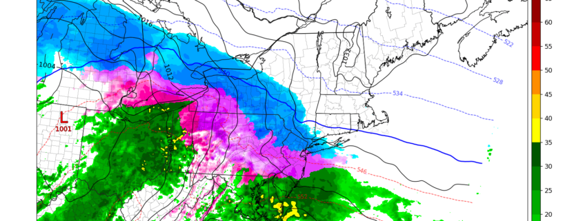
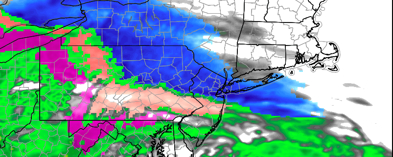
Today has been a rather dull and cold day across much of our area as an upper level disturbance off to our west continues to produce widespread overcast. Some light to moderate areas of snow have been reported over southern portions of New Jersey today. The main story for our area continues to be a more impactful period of moderate to heavy snow that will gradually work its way into the Mid-Atlantic and Northeast by early Tuesday morning.
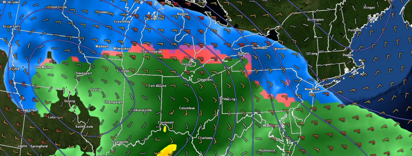
A prolonged period of benign weather, which has largely dominated the past few weeks, will come to a sudden end this week. Multiple rounds of wintry weather are expected, beginning Sunday Night and continuing through Tuesday Night. The most impactful weather will come on Tuesday morning.
The story begins with a weak disturbance, which is set to pass to the south of NYC on Sunday Night. Just enough lift in the atmosphere and cold temperatures suggest snow will break out across Southern and Eastern Pennsylvania. While the atmosphere remains dry to start, it will moisten up by Monday morning, and support snow. This snow will gradually shift eastward into Central and Southern New Jersey.
Conditions have improved substantially across much of the Northeast this Friday afternoon as a rather weak cold front cleared out any remaining cloudy & unsettled conditions.