-2")
AM Update: Warmth returns to east, but for how long?
Good morning and Happy Wednesday to you all. There is something oddly special about the first day of November in the meteorological community. It’s not a holiday, it’s not the start of any official season. But it has significance for many who forecast or follow the weather – it’s the beginning of “winter season” per se, where the forecasts for the weeks and months ahead start to have more significant implications on what we can expect during winter.
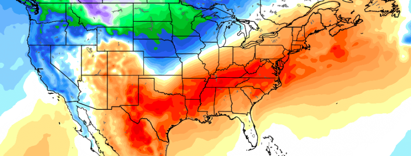
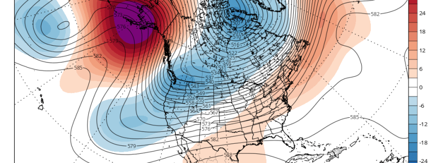
As we move into November this year, the weather pattern will be dominated by a large -EPO ridge, developing in the Pacific Ocean as we speak. We discussed yesterday in detail how these EPO ridges can impact the weather pattern throughout the hemisphere. In this case, the large ridge in the Northern Pacific Ocean will act to dislodge colder than normal air from the arctic regions into British Columbia, and eventually the Northwestern United States as well.