-2")
Severe T-Storms Possible for the Northeast Today, Irma Becomes a Category 5 Hurricane
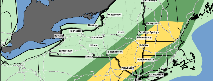
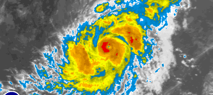
Good morning! Many eyes are on still Hurricane Irma. Which is now a Category 5 hurricane with 175 mph maximum sustained winds, as of latest reconnaissance reports and the 8am EDT advisory from the National Hurricane Center. It continues to move westward at 14mph and is major threat to the Northern Leeward Islands. Hurricane warnings are in effect for those islands, including for Puerto Rico and the Virgin Islands. Meanwhile, more unsettled weather with showers and thunderstorms, is likely over the next few days, with a strong cold front and upper-level trough moving through the Northeast and Mid-Atlantic regions. But there is potential for some severe weather later today, especially over the Interior locations.
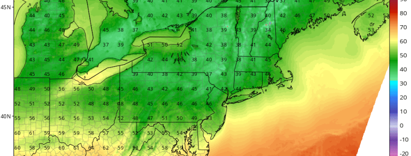
Before more thunderstorms, some high level clouds will likely filter with sunshine for much of today. 850mb temperatures between 15°C to 17°C and south-southwest winds will support temperatures to rise into the mid-upper 80s, this afternoon, especially away from the coast. A few spots may approach or reach 90 degrees, before clouds thicken or increase later this afternoon. These temperatures are actually slightly above normal for early September. Humidity will also be increasing this afternoon, with dewpoints rising into the middle to upper 60s. So it will feel like summer again briefly.