Record warm temperatures expected on Wednesday in NYC

High temperatures on Wednesday are expected to climb into the upper 80’s and lower 90’s in New York City, challenging daily and monthly records for October. Rising dew points will lead to heat index values into the mid 90’s during the afternoon.

The record high temperature on October 2nd in Central Park is 90 F, which will almost certainly be challenged. Records are similar at other reporting stations throughout the area. The all-time record high temperature for October in Central Park is 94 F, set in 1941.

One last summer-like ridge

A large ridge of high pressure sat over the Ohio Valley and Mid-Atlantic states for prolonged periods this summer, and it has continued to reappear this Autumn. September 2019 will end as one of the warmest Septembers in US history, with the majority of warmth emanating from those regions.
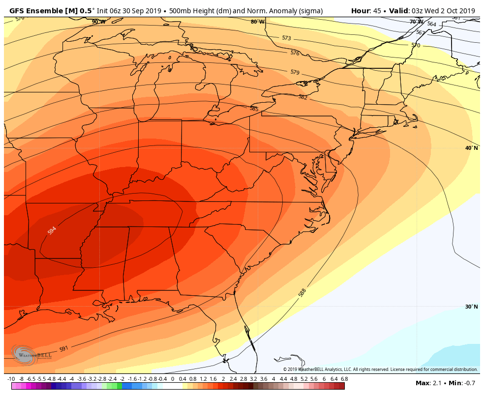
GFS Ensemble showing the large ridge that is causing heat and humidity this week.

A ridge of high pressure in this position helps to facilitate a warm, humid pattern across the Eastern United States. When these ridges amplify and slow down, they can lead to stretches of anomalous warmth and draw in humidity and moisture from multiple sources.

This ridge was no different. Thus far, the NYC Metro Area has been able to escape the worst of the heat, but the same cannot be said for our neighbors to the south (we’re looking at you, Washington).

Backdoor front will signal pattern change

The temperature forecast on Wednesday is very complicated. A frontal boundary will be sinking southward from New England, with a wind shift bringing cooler air southward from the Gulf of Maine. Parts of Connecticut and Southeast New York will see a 10-15 degree temperature drop during the afternoon hours.
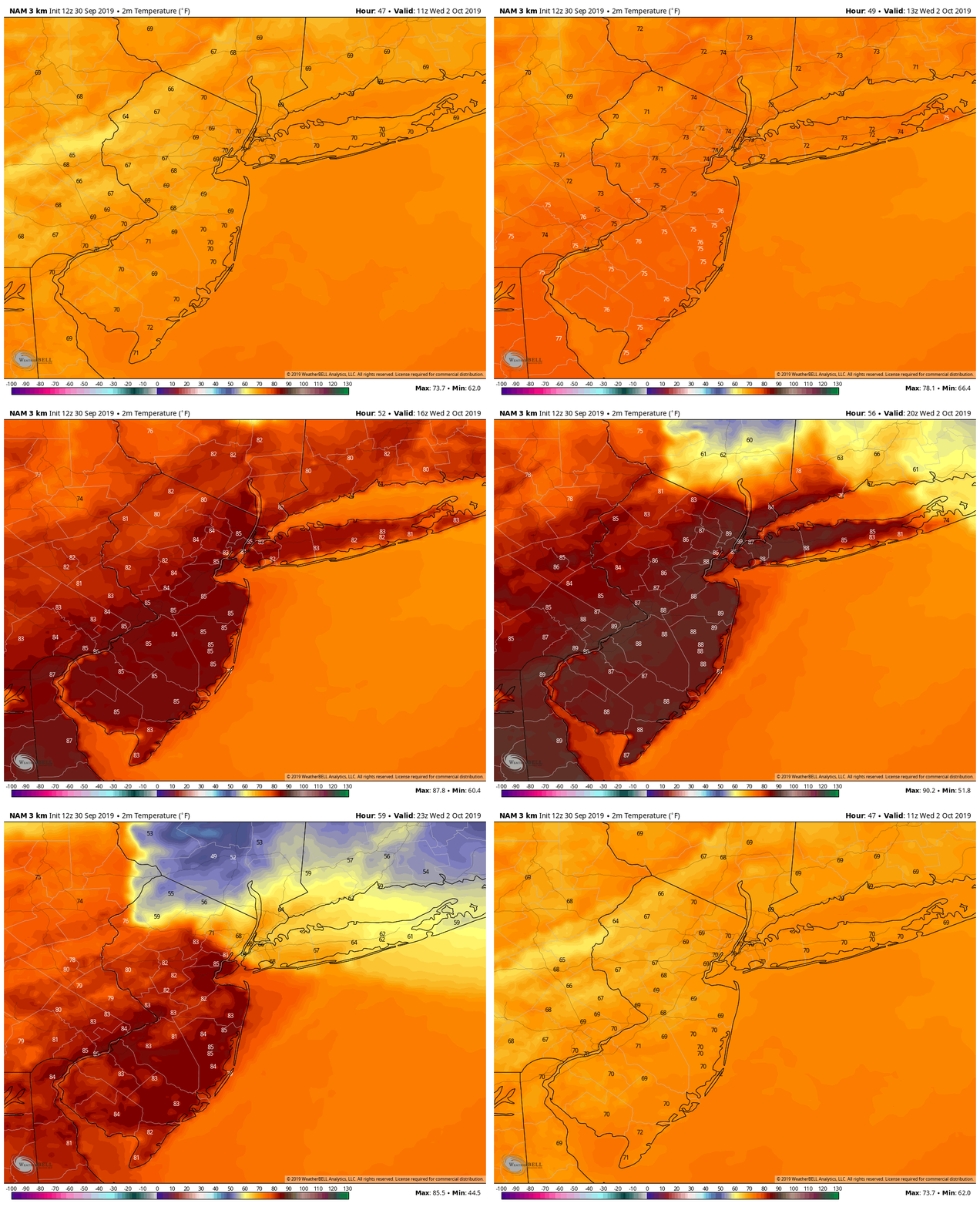
NAM model showing heat, followed by a front moving south from New England

Exactly where this front sets up during the afternoon will be key. Areas just south of the front will see enhanced warmth and humidity, and that could be just enough to push parts of New Jersey and the NYC Metro over 90 and near all time monthly record highs.

By the latter half of the week, temperatures will begin trending downward. Multiple disturbances will ride over the top of the ridge and begin de-amplifying it, allowing cooler air to move in and bringing an end to the warmth and humidity.

This pattern, with a more active flow and cooler temperatures, appears likely to settle in for at least a week or two as we move into the middle part of October.

Tropical Storm Jerry strengthens, recurve not a guarantee

Tropical Storm Jerry strengthened again today, with maximum sustained winds now at 60 miles per hour. The storm is moving steadily northwestward in the Tropical Atlantic Ocean. It is expected to move north of the Antilles later this week, while strengthening into a hurricane.

Latest IR Satellite imagery of Tropical Storm Jerry located over the Central Atlantic with sustained winds of 60 mph

The eventual track of the cyclone remains uncertain. Most forecast models and ensembles suggest the highest probability scenario is that the system will curve northward and into the open Atlantic. A nontrivial amount of ensemble members, however, suggest the storm could track further south – closer to the Caribbean Islands.

Uncertainty rooted in Jerry’s strength

Often times, a large spread in potential solutions or tracks can be overwhelming. For meteorologists and weather forecasters alike, it is important to try and understand the root of these differences. In other words, what is causing each ensemble member to act differently than the others?

In this situation, there are two clear camps in regards to the track of Jerry over the next 5 days. One group (a larger amount of ensembles) take the storm further north and eventually curve it out to sea. Another group (smaller amount of ensembles) take the storm further south, toward the Caribbean Islands.

12z ECMWF Ensemble members showing the potential tracks for Jerry over the next four days. Note the stronger members (darker colors) are further south.

The members which are further south with Jerry have one thing in common: They are stronger with the storm system over the next 48 hours. The stronger, more organized system responds differently to its surroundings and pushes further southward as a result. The northward members allow the system to drift northward and eventually recurve.

As you may imagine, it will be critical to monitor the storms organization over the next 48-72 hours. We’ll be watching both the organization of the storm and trends among the medium range weather models. Confidence in regards to the storms track should begin to increase steadily thereafter.

Stay tuned for updates over the next few days as the eventual fate of Tropical Storm Jerry becomes more clear.

NHC initiates advisories on PTC 9 in the Bahamas

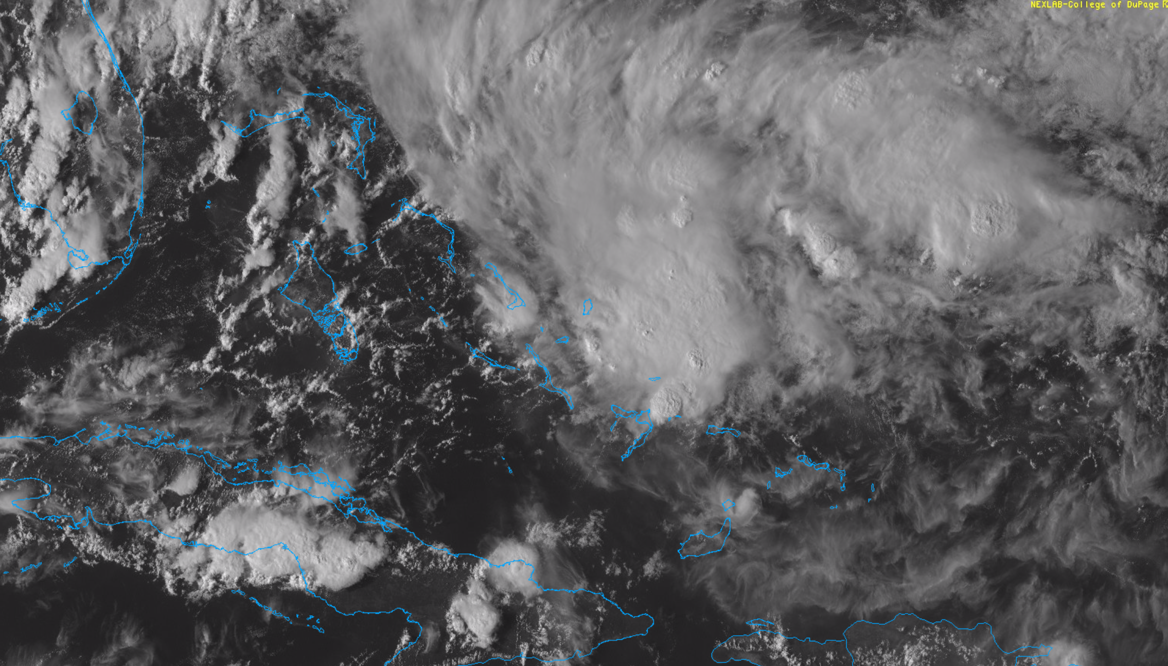
The National Hurricane Center has initiated advisories on Potential Tropical Cyclone (PTC) 9 this evening. The area of organizing thunderstorms is located in the Bahamas, and is expected to drift northwestward over the next day or so while continuing to organize.

Read more

Dorian passes offshore, improving weather this weekend in NYC

Hurricane Dorian is still a very dangerous hurricane this morning, making its approach to the Southeast United States. High winds, dangerous storm surge, flash flooding and tornadoes are all possible in the Carolinas today. See our latest updating blog post for local information there and live tracking of impactful weather from the hurricane.

Read more