Snowstorm increasingly likely in the Northeast this weekend

Good morning and Happy Friday! As many of us in the Northeast, and especially the Northern Mid Atlantic, make our way to work without a heavy jacket for the first time in what seems like months, the atmosphere is already undergoing a significant transition. Warm, humid air is entrenched in the region right now and a disturbance passed by overnight leading to heavy rain (and severe thunderstorms in parts of Pennsylvania, where it is believed a tornado touched down in Uniontown last night). A frontal boundary approaches and slides towards the coast later this evening.

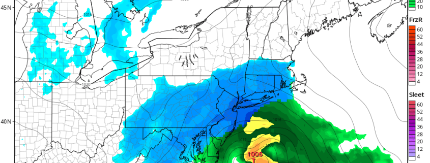
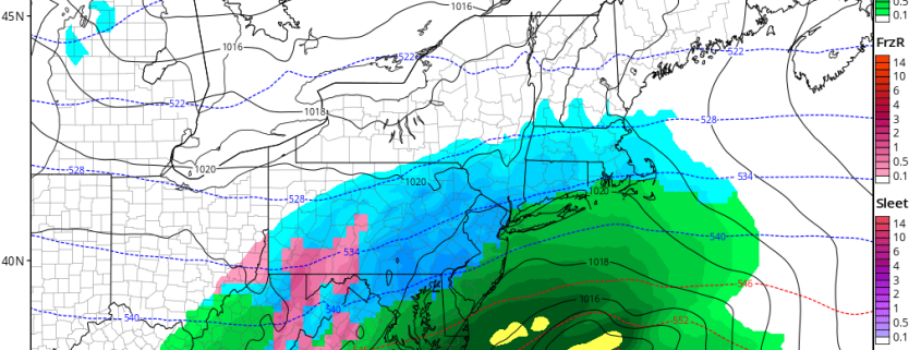
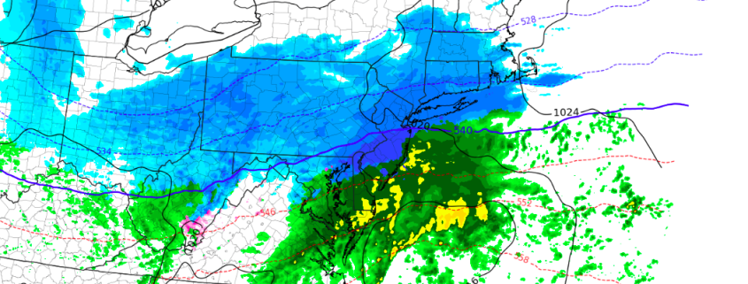
Lurking back to the west is another disturbance which will emanate from the Pacific and track across the United States, ending in the Ohio Valley and Northeast states late Saturday into Sunday. The frontal boundary will have sunk southward towards the Mid-Atlantic Coast, allowing cold air to filter back in. And when the disturbance approaches this front, the temperature gradient will promote the development of low pressure. Increasing lift will lead to the expansion of precipitation – likely in the form as snow for many areas.

The low pressure will develop off the coast late Saturday Night with snow spreading northward, from the Washington DC Area towards Philadelphia and then eventually New York City. There are several uncertainties that still remain:

Read more

Video Analysis: Saturday Night Snow Threat

Good evening! Despite a large sea of warmth expected in the next general 7-10 days, there is a quick shot of cold that will be arriving on Saturday, and a storm system may quickly follow. It may just so happen that this storm will arrive just in time to tap into this quick shot of cold air, and thus deliver an accumulating snow event on Saturday night, and perhaps significant.

Our latest video analyzes this snow threat, and talks about the features that support snow, and the features that do not support snow. In a broad sense, the pattern is very fast-moving and progressive, which typically prevents a large amount of amplification. When combined with a compressed flow from a strong Polar Vortex in Central Canada and a strong Southeast ridge, that may serve to keep the storm weak and sheared out to the south.

However, the initial energy entering the US looks very potent, and a strong temperature gradient with a surge of moisture from the Gulf does support a heavy axis of precipitation developing from the Tennessee Valley and into the Northeast. If everything comes together, a widespread area of 6-10″ of snow would be possible from DC to Boston. But this is a “thread the needle” situation, where it is easily conceivable that the fast-moving flow will shear out the storm system, but also the strong Southeast ridge and departing high pressure (remember, this is a quick cold shot!) will allow for a warmer scenario with more rain to unfold.


Wednesday Briefing: Warmer, Unsettled Thru Friday, Northeast Winter Storm Saturday Night

Good afternoon! A return southerly flow with high pressure sliding offshore, is helping temperatures rise into the upper 40s to around 50 this afternoon. Some clouds will be mixing with or filter sunshine. But overall it will be a pleasant afternoon for the middle of February.

Read more

Tuesday Briefing: Northeast Snow This Weekend Before Big Warmth Next Week?

Good afternoon! Overall the pattern will continue to be progressive until at least Friday. Canadian high pressure will provide mostly sunny skies for rest of today. Temperatures  are rising into the mid-upper 30s. Which is few degrees below normal. But the next few days will start see temperature moderate again, as southerly flow develops again. High temperatures on Wednesday will be in the mid-upper 40s. Then highs and Thursday and Friday will be the 50s or 60s, depending on amount of cloud cover.

Read more