-2")
Live Blog: Steady snow stays well south of NYC
1:45am Update: Steadier and heavier snow is beginning to develop near Philly and Northern Delaware. It is heading to South Jersey as we speak. Over the next couple of hours, any initial rain or mix in Burlington County and Ocean County and southward will quickly turn over to snow, and accmulate about 1″ per hour — perhaps even up to 2″ per hour in quick bursts. Due to the quickly accumulating snow and the fact that there is no solar insolation to warm the roads, roads will become slick pretty quickly.
Radar Imagery as of 1:33am EST. You may need to click to animate.
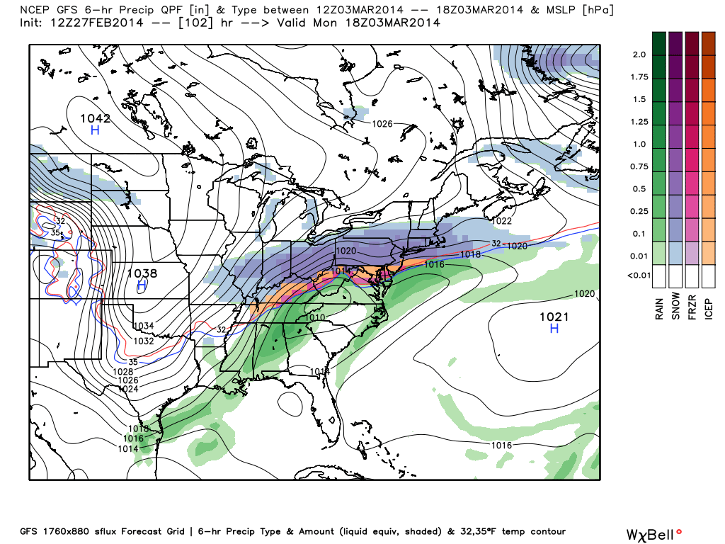
This heavy band of snow is falling as a result of a strong area of frontogenesis. In essence, frontogenesis is an area of a strengthening front, where the temperature gradient is increasing (cold areas are getting colder, and warm areas are getting warmer). This leads to enhanced lift in the atmosphere. Not surprisingly, the strongest frontogenesis is headed for Southern New Jersey.
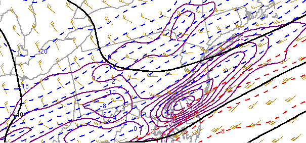
Latest 850mb frontogenesis is pretty strong in northern Delaware, and is heading for Southern New Jersey.
There are some weaker areas of frontogensis trying to streak northward towards NYC. Thus, even in areas north of Central NJ, light to at times moderate snowfall will be developing throughout the overnight. We still do not anticipate more than an inch of snow north of NYC, but an inch or so could still fall in the NYC area and Long Island — max potential is 2″. This includes western suburbs as well. So although not much snow is expected, enough could still fall to create some minor issues on the roadways.
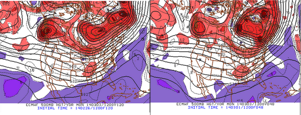
9:45pm Update: The south trend never stopped. As time has gone on, models have better picked up the true impacts of a strong Polar Vortex, which is to suppress precipitation to our south. For more on why this has occurred, check out our article from yesterday.
High resolution model trends, along with radar and surface observations are indicating that dry air and subsidence will be the rule for NYC and points north, where perhaps only a dusting of snow will fall. Perhaps an inch of snow or so for the south shore of Long Island, through Staten Island and Union County and points westward. Middlesex County looks to receive 1-3″, with the 3″ being on the southern end of the county. Snowfall totals exceeding 3″ will not be reached unless in southern Monmouth, and Mercer County, and points southward. Burlington and Ocean County could still receive 4-8″ of snow (closer to 4″ in northern sections, closer to 8″ in southern sections). Camden County and southward could still receive snowfall totals in excess of 8″, and perhaps even approach a foot, with heavy snowfall at times, so we will make sure to keep this blog updated for these residents.
Although the GFS shows totals a little higher for northern sections, we believe that its low resolution is not picking up on how sharp the cutoff in precipitation will be.
Here is the most recent HRRR Model’s precipitation output valid through 10:00am tomorrow, with steady snow still falling in Southern Jersey.
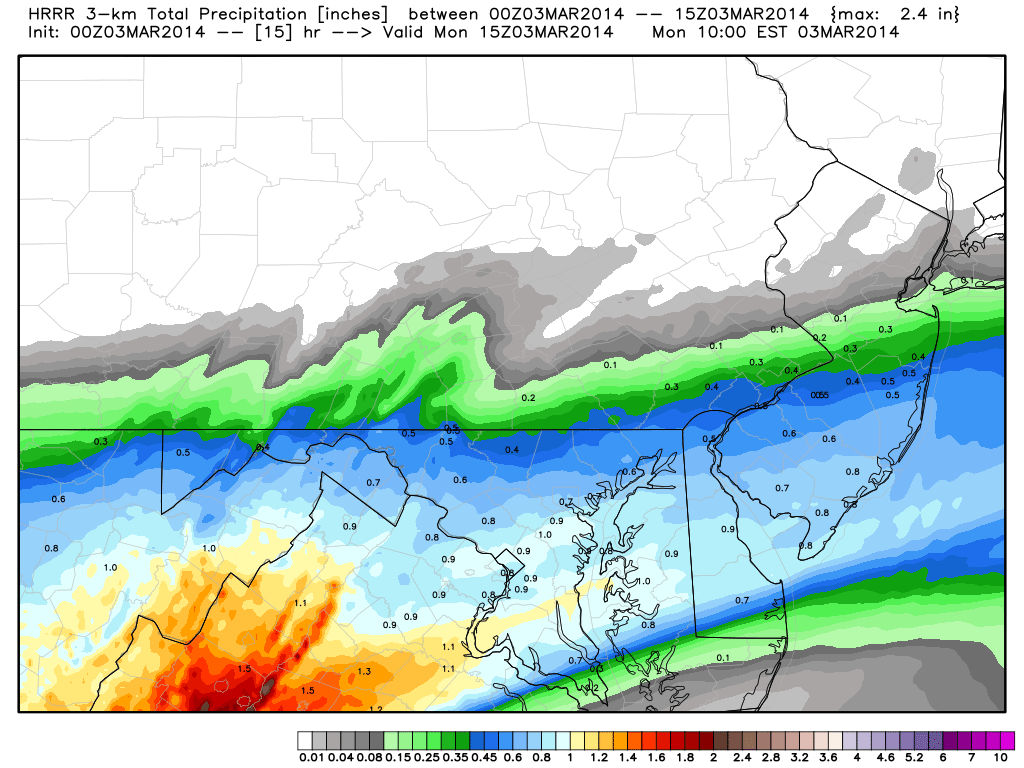
The most recent run of the HRRR (High Resolution Rapid Refresh model) shows heavy precipitation remaining to the south.
We believe ratios will be about 12:1 or so, so multiply these numbers by 12 to get an expected snowfall total. Heaviest snow in Central and Southern Jersey looks to from 3:00am through at least noon, with the heaviest centered between 7:00am and noon. Be sure to give yourself a lot of extra time for the morning commute if you are in these areas.