Many have longed to hear it: There is no snow in the short or medium range forecast. The historically cold and snowy pattern which had gripped the area over the past several weeks, dating back to the middle of January, will finally take a respite during the upcoming week. It wasn’t without a bit of dramatic flair that it will do so, still, with two small snow events simply nudging up the seasonal snowfall totals right before the warmup begins. We’ll have an article out within the next few days where we’ll talk numbers: Stats, information, and data regarding the past month or so — and just how staggering some of the snowfall numbers really are.
But for now, our attention will turn to a pattern change which is coming during this week and starting as early as today. If you haven’t felt it yet, warm sun has brought temperatures in the lower 40’s throughout the area behind the storm system which dropped a few inches of snow on the area this morning. The warmup will become even more noticeable as the week draws on, with a period of rain likely on Wednesday and then temperatures in the 40’s and 50’s from Thursday into Friday.
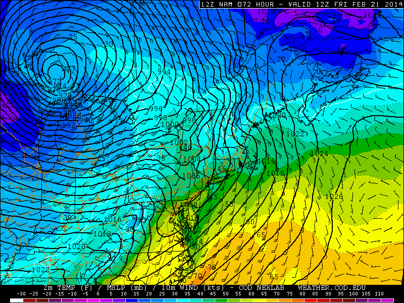
NAM model forecasting temperatures in the 50’s ahead of a cold front on Friday.
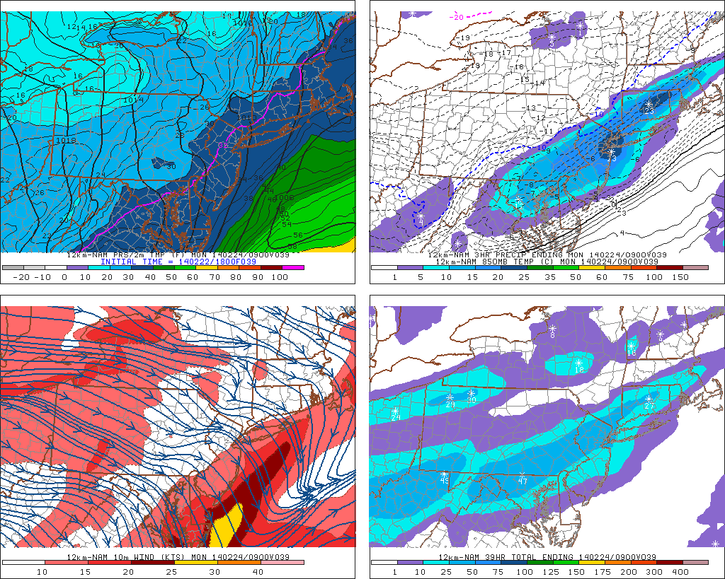
Interestingly, and probably not surprisingly to most, the rapid change in weather can and likely will cause problems which aren’t related to any precipitation. We begin with things like snowmelt, flooding and fog — and end on Friday with the potential for gusty winds in thunderstorms and heavy rain. Wednesday’s periods of rain will be the initial hit to the snowpack which is bordering on historic throughout much of the area, especially the interior where some still retain over 20″ of snow depth.
After periods of rain on Wednesday, the warmup and east/southeast winds on Thursday into Friday will allow for increasing fog throughout the area. Snowpack suffers greatly during thick or dense fog, so we should continue to see melting snow. If you have blocked drains, or areas that are susceptible to flooding from melting snow or rapidly increasing water levels, now would be a good time to deal with those areas in advance of the expected snow melt.
Much of this pattern change, however brief it may be (we’ll get to that in another post), is being driven by a significant low pressure system moving through the North-Central United States during the middle to latter part of this week. This low pressure system is being fueled by a significant trough in the mid and upper levels of the atmosphere, which will dig through the southwest states and then northward into the Great Lakes. As you could image, the result of all of this will be a fairly significant Southeast Ridge — and warmer than normal temperatures pumping northward toward our area.
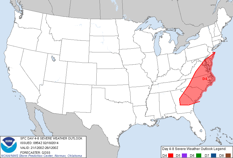
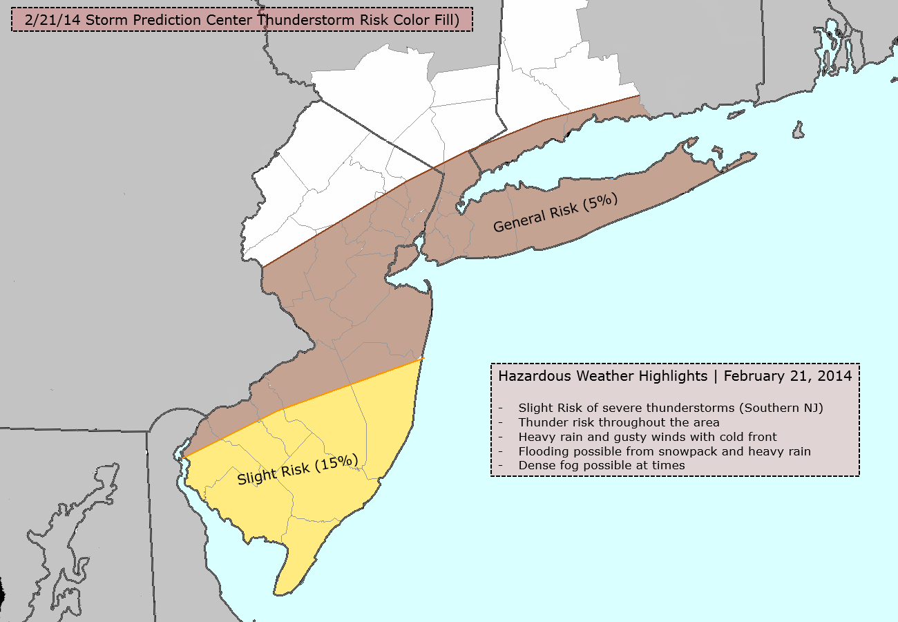
Storm Prediction Center extended outlook from 2/18/14, showing a risk extending into parts of NJ on Friday.
Ahead of the cold front on Friday, temperatures will rise into the 50’s despite meeting some significant resistance from the snow pack and trapped low level cold air. As the front moves through, showers and some embedded storms are expected, owing to lots of energy aloft and plenty of lift for heavy precipitation. The storms could border on strong levels given the impressive wind speeds aloft — and the Storm Prediction Center has noticed, placing parts of Southern NJ in a risk for severe thunderstorms on Friday.
After Friday, the warm air will be kicked out once again. And forecast models are hinting at ‘Ol Man Winter waking up from his quick nap, only to return more ferociously than before. Enjoy the warm weather..
-2")