Arctic plunge Sunday, potential storm near Thanksgiving?

Good afternoon! After a period of moderation in temperatures over the next couple of days and perhaps a few scattered showers on Friday and Saturday, an Arctic cold front will be crossing the area sometime on Saturday. This will lead to plunging temperatures on Saturday night and Sunday.

Today's 12z European Model valid for Sunday afternoon shows 850mb temperatures in between -15C and -18C. This supports temperatures not getting above freezing. Image credit goes to weatherbell.com

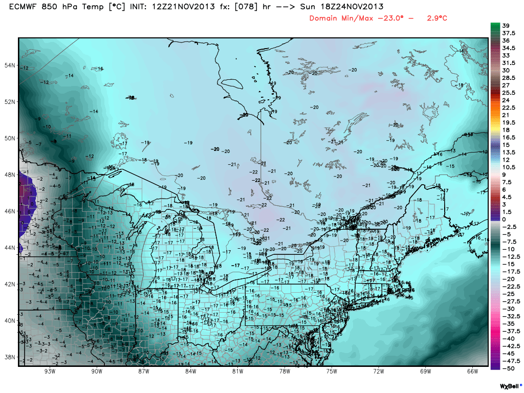
Today’s 12z European Model valid for Sunday afternoon shows 850mb temperatures in between -15C and -18C. This supports temperatures not getting above freezing. Image credit goes to weatherbell.com

850mb temperatures are expected to drop to between -15C and -18C. With full sunshine, you can normally add around 15C to that temperature to get what is expected at the surface; thus supporting highs in the upper 20s to low 30s on Sunday, as seen in the image below.

place-holder

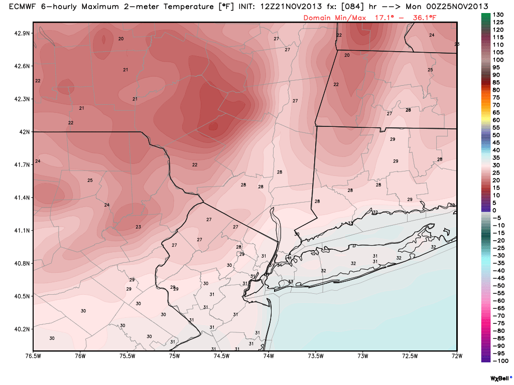
Today’s 12z European Model shows maximum temperatures not getting above freezing for most locations on Sunday afternoon. Image credit goes to weatherbell.com.

Today's 12z European Model valid for Sunday morning shows 1000-500mb thicknesses approaching 504dam. This supports temperatures not getting above freezing on Sunday. Image credit goes to weatherbell.com

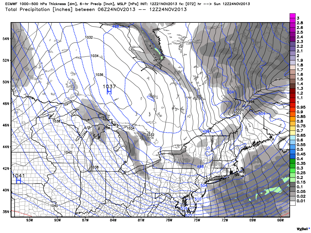
Today’s 12z European Model valid for Sunday morning shows 1000-500mb thicknesses approaching 504dam. Image credit goes to weatherbell.com.

Additionally, the 1000-500mb thicknesses will be quite low as well. This supports the theme of a very cold pocket of air aloft. This cold pocket of air aloft will yield an unstable atmosphere, capable of producing very strong winds. It is possible that winds could gust between 30-50 miles per hour on Sunday, leading to wind chills potentially staying in the teens throughout portions of the day. It’ll truly feel like winter. Sunday night will be cold, with widespread lows in the upper teens and lower 20s.

Read more

NYC Forecast: Moderating, big arctic surge looms

It was quite a cold start throughout the area this morning, likely made to feel more alarming due to the warmer weather which we experienced over this past weekend. But the progressive weather pattern which has become dominant throughout much of the United States over the past month continues to dominate, and colder air poured into the area on Monday and Tuesday. Today will be another cold one, with highs only in the 40’s to maybe near 50 in the warm spots. It will feel a hair warmer thanks to the lack of blustery winds, which took real-feel temperatures for a tumble on Tuesday afternoon.

Moderating temperatures are expected to continue on both Thursday and Friday, as highs will warm into the 50’s. The progressive nature of the pattern, despite continuing, seems to be becoming a bit more anomalous with time. And after the 60’s to near 70 this past weekend, an arctic plunge is forecast for the weekend ahead of us. Behind a cold front (which will move into the area on Saturday), the coldest air of the season thus far is forecast to move into the Northeast US. 850mb temperatures, for comparison, are near -3 degrees C today. By Sunday, forecast models show 850mb temperatures of -16 C or colder.

Surface temperature anomaly forecast for Sunday on the European model, showing well below normal temperatures.

Surface temperature anomaly forecast for Sunday on the European model, showing well below normal temperatures.

Read more

NYC Forecast: Chilly today, arctic air awaits this weekend

weatherrate
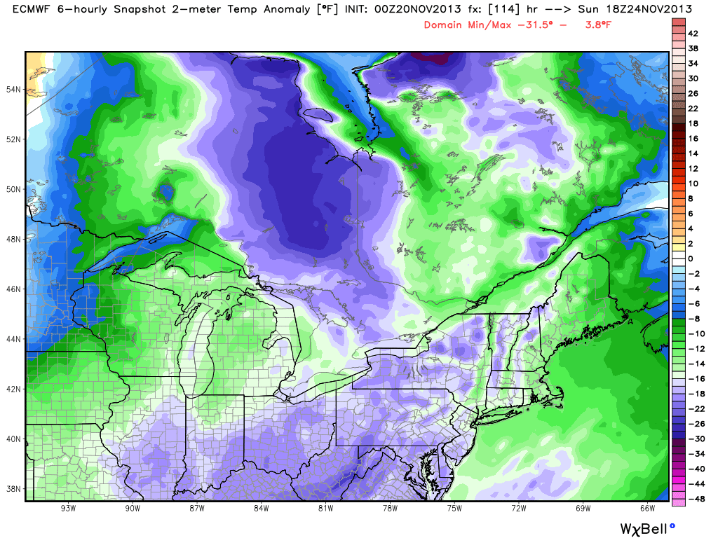
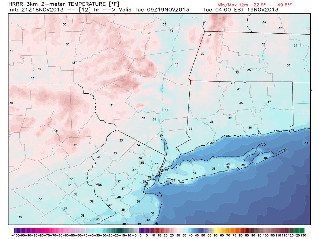
Much colder air filtered into the area late on Monday evening and continued to do so into early Tuesday morning. The change comes on the heels of a major cold front, which pushed through the early on Monday. Temperatures fell into the 30’s overnight — and the temperature drop at the 850mb level was equally as impressive, falling to near – 10 C in northern parts of the area on Tuesday morning. Highs on Tuesday will only scrape into the 40’s, with blustery winds especially early. The combination of the two will make it feel pretty cold, especially after Monday which featured highs in the middle 60’s with a very warm sun.

The forecast takes us through a bit of moderation as we look ahead to the middle of the week, as the cold airmass over the region currently will begin to lose its grip on the pattern. High temperatures look to warm a few degrees each day, from the mid to upper 40’s on Tuesday, into the mid to upper 50’s by Thursday. The moderation will come ahead of a potential arctic plunge, however, as another strong front and associated disturbance approach the area this weekend.

In the shorter term, winds calm by tonight and clear skies are expected through the overnight period with temperatures dropping into the 20’s inland and near 30 in the city/urban areas. Great viewing for the expected 730pm Minotaur rocket launch from Wallops Island in Virginia. You can catch a glimpse of the launch by simply looking southeast at that time — the rocket will appear in the skies 30 to 60 seconds after launch. More forecast details after the break.

Timing of first sighting above horizon by location, for tonight's 730pm planned rocket launch.

Timing of first sighting above horizon by location, for tonight’s 730pm planned rocket launch.

Read more

PM Update: Much cooler air filtering in

Behind a major cold front, which moved through very early this morning, westerly winds began on Monday. Winds picked up considerably on Monday afternoon, but the air remained relatively warm. Temperatures in the mid levels if the atmosphere remaining somewhat warm allowed for the highs to reach into the mid 60s — making for a pleasant, comfortable late-autumn afternoon. But the airmass is changing rapidly behind the aforementioned cold front.

The low pressure system which helped drag the cold front through the area deepened below 967 hPa in Southeast Canada on Monday, and much colder air will surge eastward to the south of it. Temperatures will plummet into the 20s and 30s overnight on Monday evening into Tuesday morning throughout the area — especially over the interior. Pleasant weather is expected to continue through mid-week with near seasonal temperatures.

Forecast low temperatures on Tuesday morning, from the HRRR model.

Forecast low temperatures on Tuesday morning, from the HRRR model.

Read more