Blizzard 2017 Storm Overview, Hazards, and Preparation

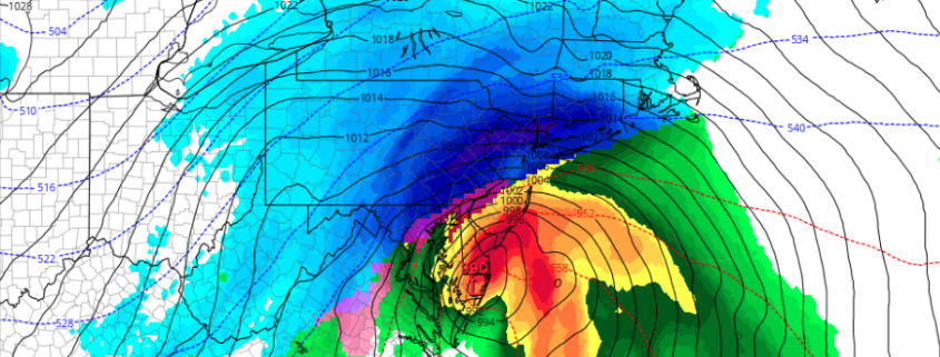
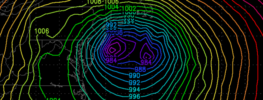
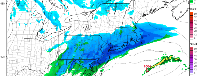
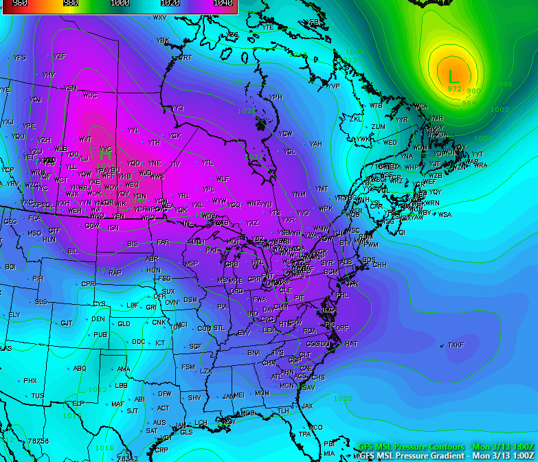
Good afternoon! It is becoming more clear by the hour that a major winter storm with blizzard conditions will be impacting the area late in the overnight and into Tuesday. Extreme snowfall rates — 2 to 5″ per hour — are possible on Tuesday morning, as well as wind gusts up to 50mph. This will dramatically reduce visibilities below 1/4th and even below 1/8th of a mile or lower at times. This may also lead to some power outages, so be sure to be prepared with flashlights, batteries, a full tank of gasoline, and charged phones.

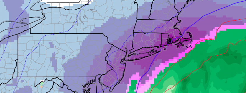
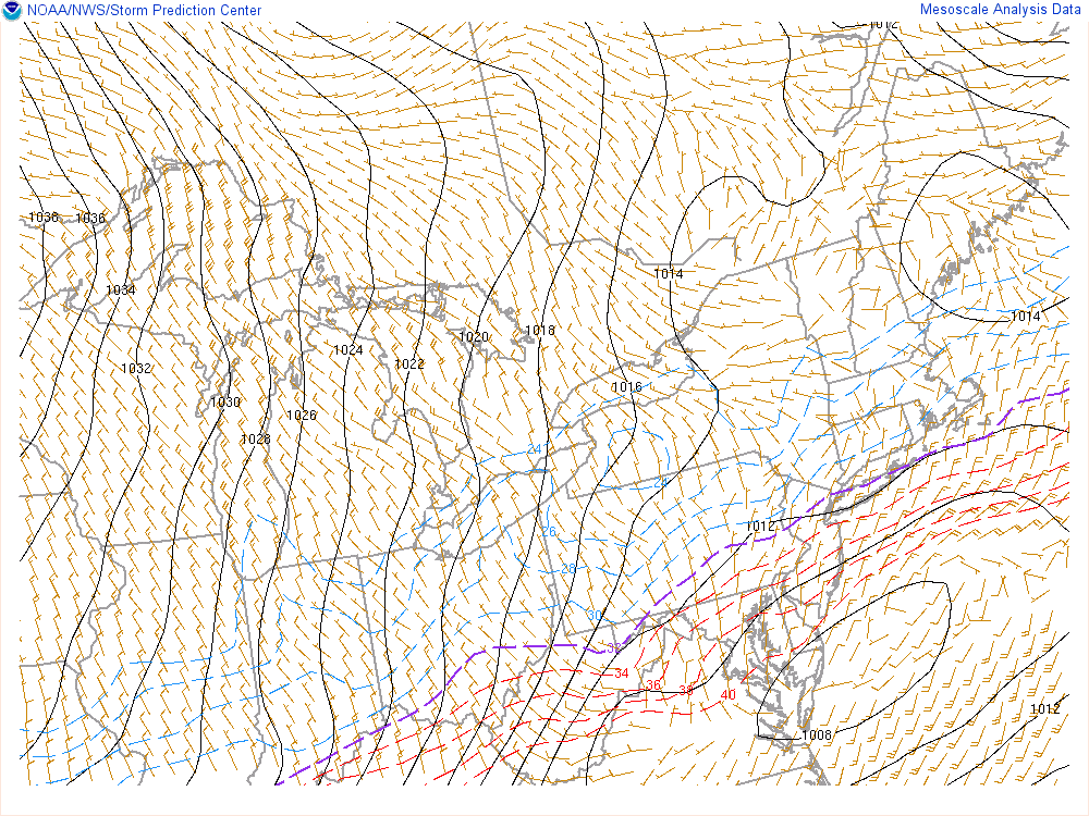
The storm has trended slightly warmer for coastal locations, with faster timing — but stronger dynamics away from the immediate coast has elevated the potential for extremely heavy snow and severe impacts. Even coastal areas will still see very heavy snow before a quicker changeover to sleet and rain — but less snow than inland areas. This video below has all of the details regarding the storm’s evolution, impacts, and meteorological explanation behind why the snow will be so heavy. Stay tuned for further updates!

3/12 PM All Zones Update: High-Impact Blizzard Likely Tuesday Into Wednesday

Today has been what some may call the “calm before the storm”, as the day has been characterized by mostly sunny conditions across the entire area with temperatures only in the upper 20’s to low 30’s, which is below normal for this time of year. We have also seen some gusty winds across the area thanks to isobaric packing between an Arctic high pressure system centered over the central Canadian prairies and a deep low pressure system off of the eastern Canadian maritime region. As this low pressure continues to the east, winds should gradually diminish this evening as the high pressure from Canada takes control. Tonight should be an excellent night for steep radiational cooling. Under mostly clear skies and light winds, temperatures will be able to fall into the upper single digits for inland locations and teens for the rest of the region, so another very cold night is expected.

Read more

PM Zone Update: Blizzard Watches issued ahead of significant storm

Confidence continues to increase on the development of a significant snowstorm early next week throughout all of our zones. As mentioned in detail over the past several days, two disturbances will drive southward into the Central United States late this weekend and early next week, in response to the development of a blocking ridge in the higher latitudes. These disturbances will interact and phase over the Mississippi River Valley and parts of the Eastern US early next week.

As the two disturbances interact, a strong low pressure system will develop across the Southeast US coast, shifting northwards up the Eastern Seaboard. The exact track of the system is still yet to be determined, and will greatly impact the ultimate impacts that the storm brings our area. However, the envelope of possible solutions continues to tighten — with most solutions impacting all of our zones at least moderate to significantly.

Read more

3/10 Early AM All Zones Update: Light to Moderate Snowfall Today

A wave of low pressure moving east from the Delmarva region, will bring a light to moderate snowfall to much of the region. Over the higher elevations over Northwest NJ and parts of Lower Hudson Valley snow has been falling over past few hours and surface temperatures have dropped to near freezing. So some accumulation is likely occurring on colder surfaces.

Closer to the coast, boundary layer temperatures may initially support some rain or wintry mix at the start, But it should quickly change over to snow, as lower dewpoints and wet-bulb temperatures, will support more cooling down to surface. Surface temperatures should fall down into low to mid 30s everywhere over by 9am.

Read more