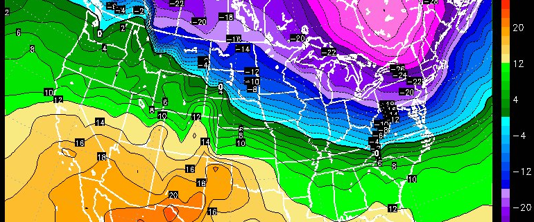
-2")
Public Analysis: Snow Likely Friday, A Larger Threat Looms
A cold front moved through the region early this morning and introduced some slightly cooler temperatures just ahead of another more potent front that should provide a good shot of colder air, followed by the potential for light to moderate snows on Friday. This weekend should remain quite cold and dry, but is this just the calm before the storm? We answer this with all of the meteorological details in our article below:
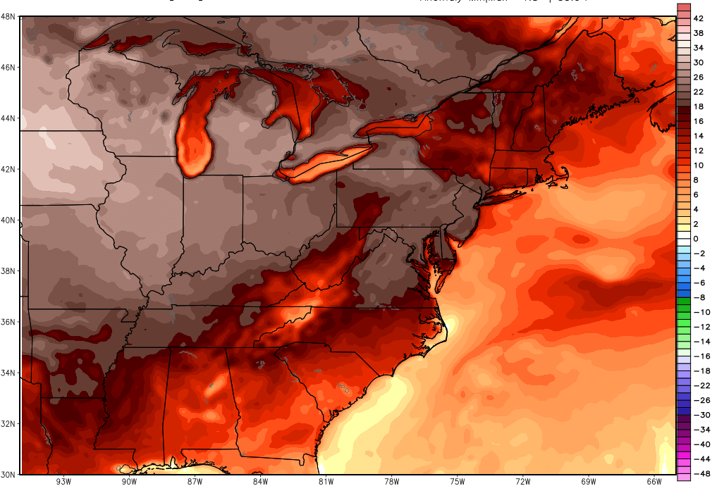
The region saw a cold front pass through the area earlier this morning with some showers passing through the area. Even though we did have this cold front passage, temperatures will remain relatively mild today and into tomorrow, due to downsloping westerly winds. With relatively clear skies this afternoon, temperatures should had no problem reaching well into the 50’s and even 60’s for southern locations. As the cold front that impacted our region continues to move off of the coast, a tight pressure gradient will set itself up over the region due to a large and intense area of low pressure over Hudson Bay in Canada, that continues to move very slowly to the east. This pressure gradient will create gusty winds of up to 35 to 45 mph this afternoon, but should gradually diminish as we head into the late afternoon hours and evening. Temperatures will be able to drop quite efficiently underneath clear skies with most of the area staying in the 30’s.
The beginnings of an Arctic airmass will start to bleed into the region by tomorrow afternoon as another front moves through, limiting temperatures to the 40’s and low 50’s. Despite colder mid-levels from this airmass, temperatures will remain only slightly above-normal due a more south-west component to the winds and direct sun. The Arctic airmass dropping through our area will set up a nice temperature gradient, which will set the stage for our next chance at snow.
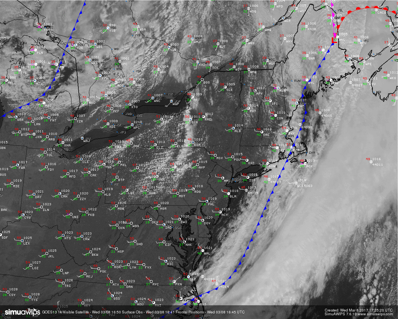
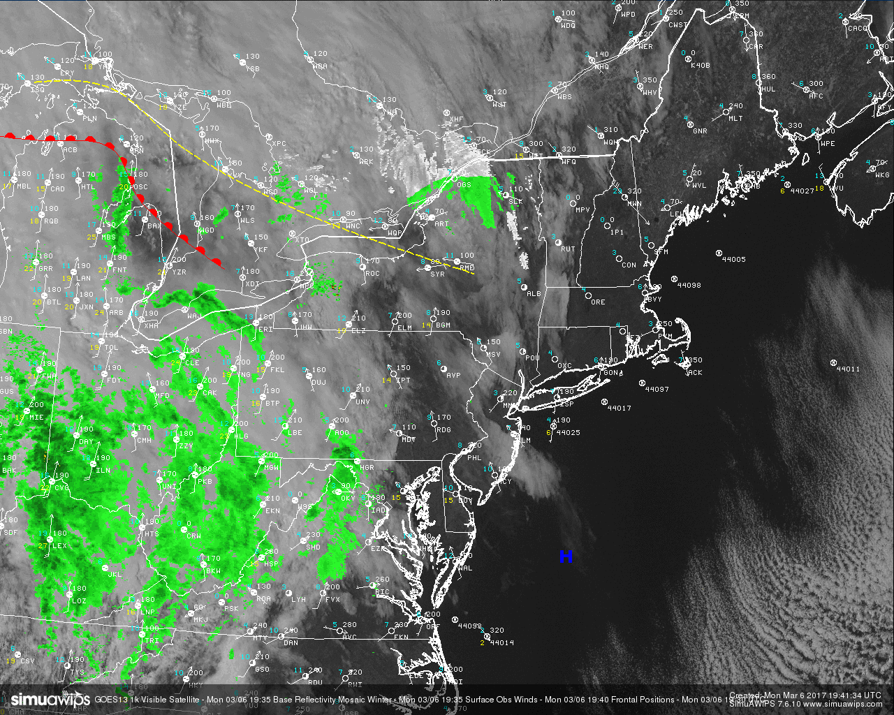
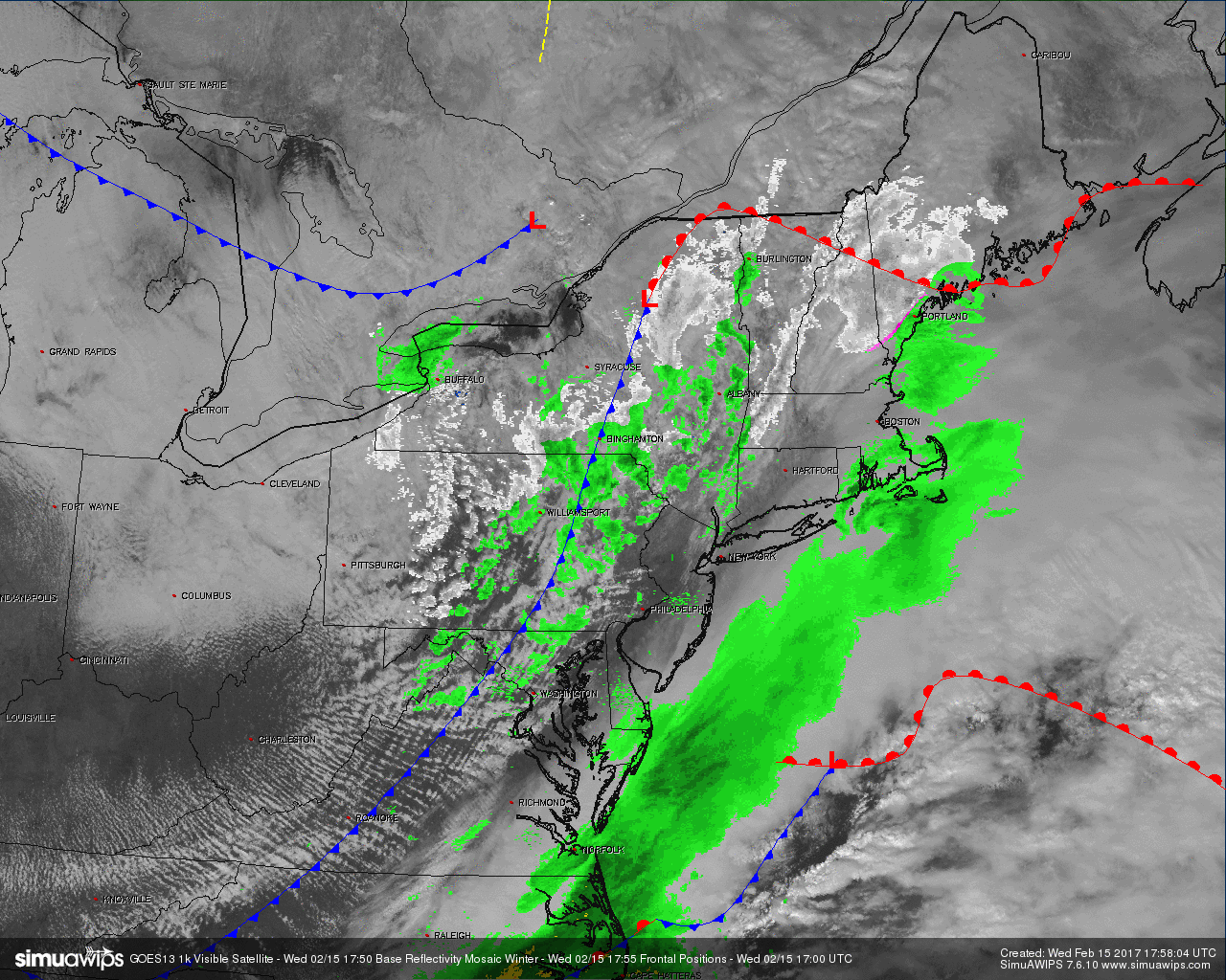
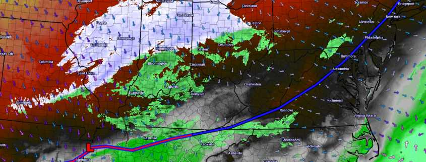
Visible satellite imagery and current surface observations over the Northeast this afternoon (Courtesy of Simuawips.com)
As a potent piece of energy begins to dive southeast out of Canada on Thursday evening, the Arctic front that will be draped over our area will be the focus for low pressure development along that front. Due to the strength of this upper level system, there will be a healthy amount of lift at the surface which will help to develop precipitation just to the north of the low pressure system as it begins to take shape over the Ohio Valley. This band of precipitation should initially be on the lighter side during Thursday evening and may be in the form of a rain/snow mix to the south and along coastal sections.
As we go into Friday morning, the low pressure area should pass to the south of the metro area and be located just offshore with precipitation affecting the vast majority of the region. As this low moves offshore, upper level dynamics due to a strong jet streak located at roughly 13,000 feet will provide an enhancement to the precipitation over much of the area just as colder air to the north begins to rush in, which should promote a change to more wintry precipitation for most locations.
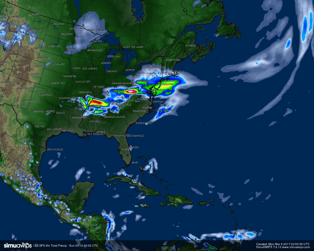
The snow should increase in intensity during the late morning and early afternoon hours thanks to the aforementioned dynamics at play. Snowfall accumulations across the region, will depend largely on where heavier banding develops and boundary-layer and surface temperatures for much of the event. If this low tracks further north, some areas south of the systems track will draw in warmer and drier air initially, which could reduce snowfall totals. We will try to pinpoint these snowfall totals in future updates, with a threat map likely by this evening.
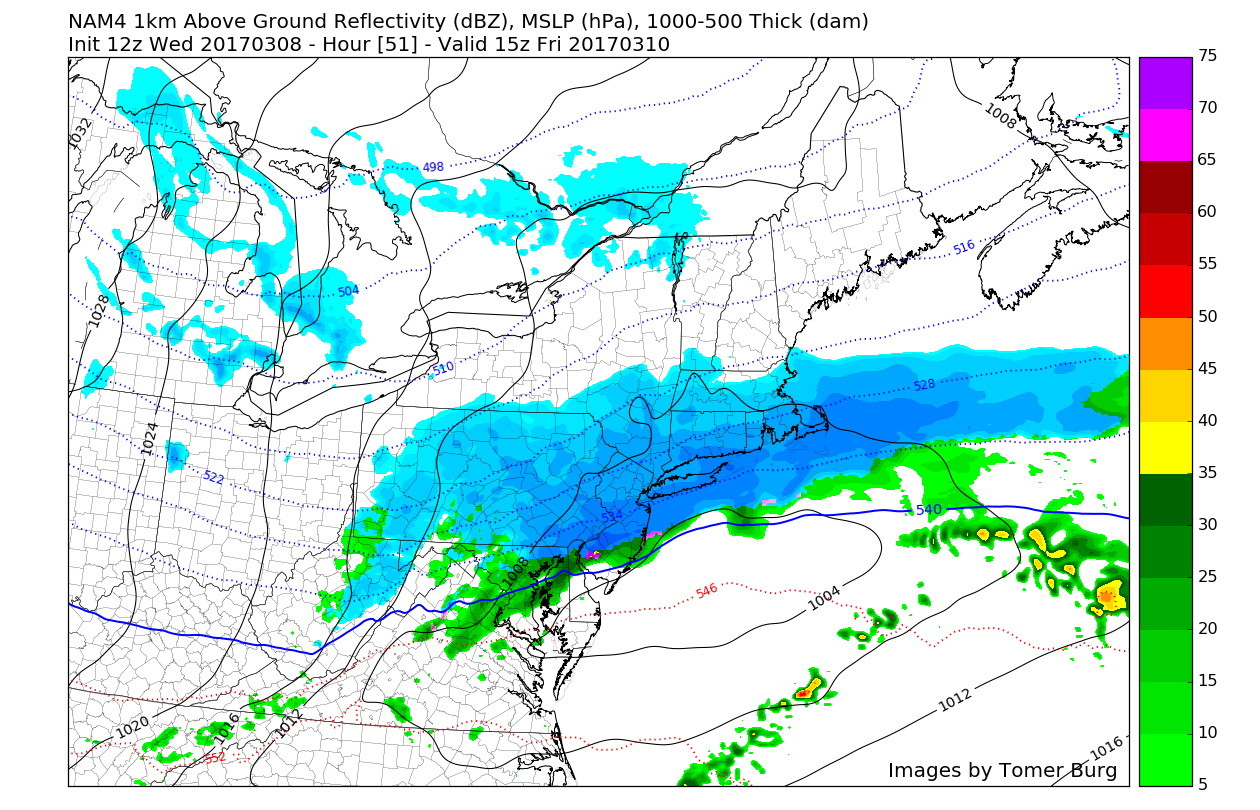
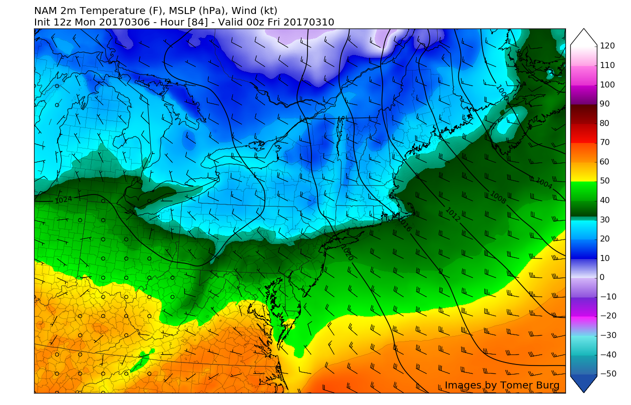
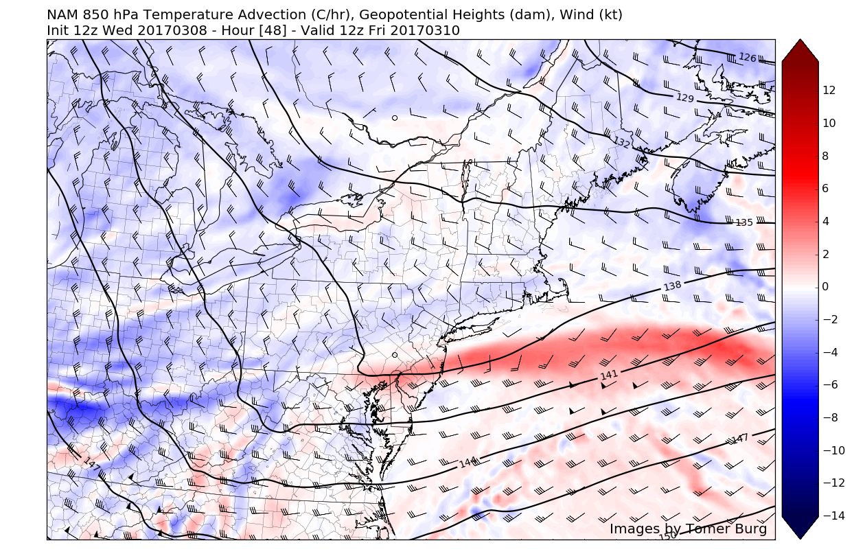
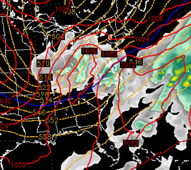
Afternoon NAM model showing the potential light to moderate snow event on Friday afternoon (Courtesy of http://www.atmos.albany.edu/student/tburg)
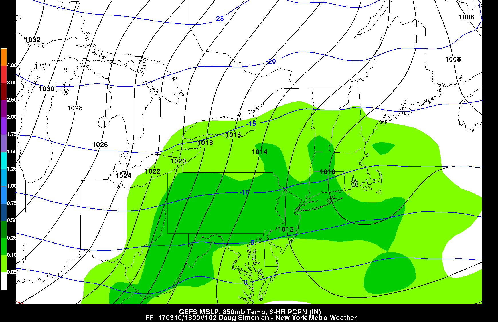
The Next Snow Threat: If you have been keeping up with our forecasts over the past couple of weeks, you already know that we have been very attainment on the prospects of high-latitude blocking developing for the time period that we are now entering. Earlier this week we also mentioned that we had three potential waves all with chances of affecting the New York Metro area over the next week or so, with the first wave being the storm talked about above. Now over the past few days, the models have really backed off the second wave, which was originally forecast by the computers models to pass to our south and provide a shot at some snow this weekend. However, it was highlighted that this threat was highly dependent on whether or not an upper level low near the eastern Canadian maritime region, would act to press down on this system as it moved east and shove the low south with time.
This is exactly what has happened since our last update as all of the computer models now agree on this second wave being pushed too far south for any significant impacts to the metro area as it quickly moves east through the Southeastern states this weekend. Some may think that we’re getting off easy now that this wave is no longer a threat, but this is quite the opposite actually. This wave’s failure to organize will set the stage for possibly the single most impressive snow threat we have seen so far this winter to take shape.
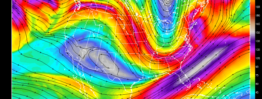
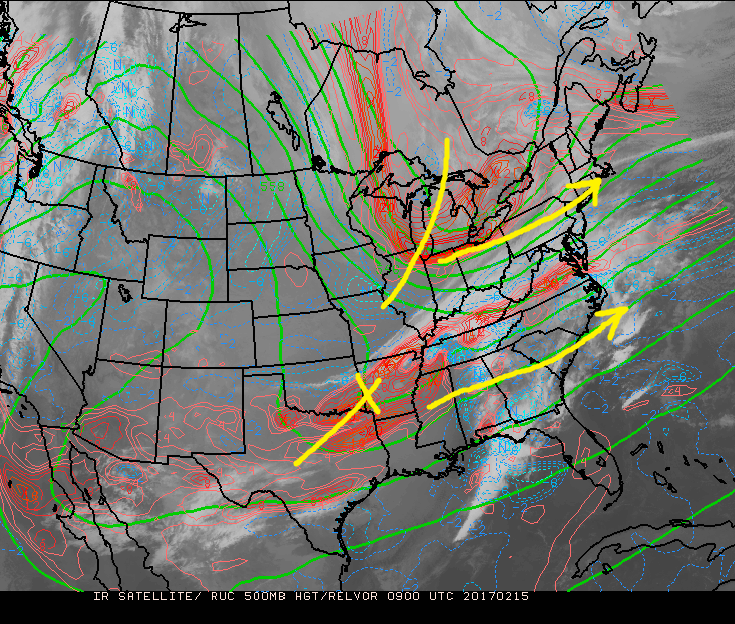
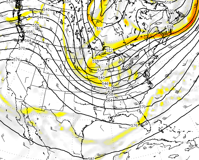
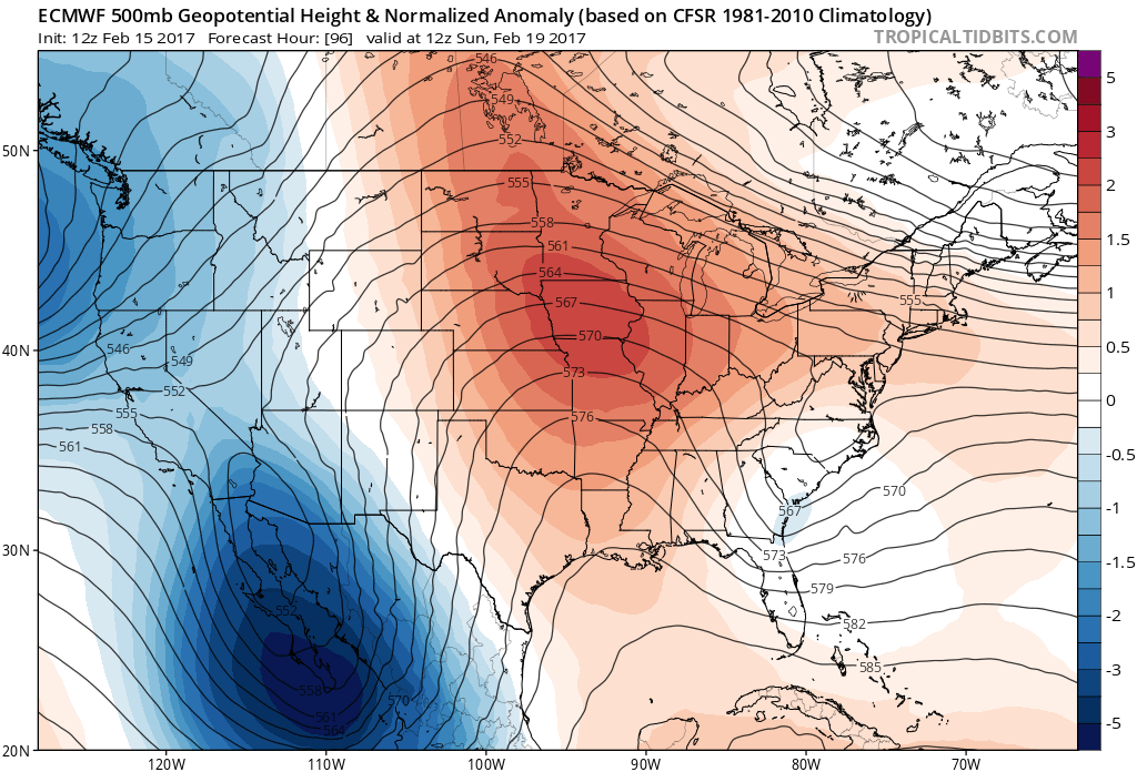
This afternoon’s computer models have begun to come closer together in their solutions as high latitude blocking — in conjunction with a sharper ridge out west — really slows down the progressive/quick pattern we have been plagued by during the entire winter. As this pattern really begins to slow down, it’s looking more likely that an upper level disturbance originating from deep in the Canadian prairies will dive down into the central part of the country, which allow a deep trough to form by Monday evening. Blocking over Greenland and ridging over the Northwest US could allow for this trough to continue to deepen/amplify as it swings eastward through the Ohio Valley on Tuesday, which may lead to the development of an area of low pressure. There is even evidence of the ridge in the Northwest US connecting with the blocking over Greenland, which amplifies the blocking and forces a very strong Upper Level Low to develop and get pushed to our south, thus interacting with multiple pieces of energy and gathering plenty of moisture before it makes its way towards our latitude.
This low pressure would have to be monitored very closely as an area of Arctic high-pressure to the north and west may force it to redevelop off the Mid-Atlantic coast as we have seen many times in the past. These types of systems that redevelop off of the coast are called Miller-B systems, and tend to produce rather significant precipitation for the Northeast as they slowly move off to the east and intensify, and have heavy precipitation blossom in a short period of time, bringing numerous prolonged impacts.
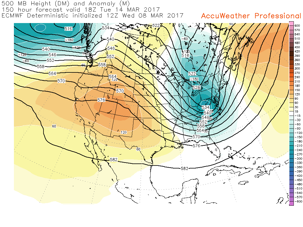
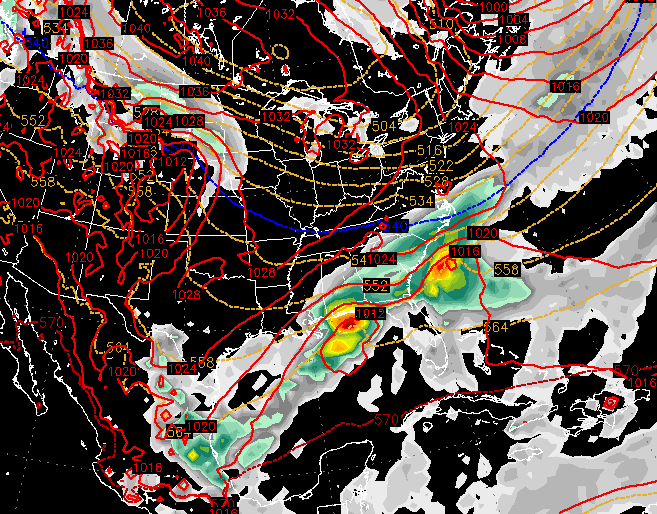
500mb heights from this afternoons European model showing a very deep trough over the US (blue) and blocking out to the west and east (Courtesy of Accuweather Pro)
While it is obviously much too early to nail down any specifics at this point in time, the clusters of models (ensembles), evidence of ridging over Greenland, and ridging over the Northwestern states all point to the possibility of at least an area of low pressure developing along the coast towards the Tuesday/Wednesday time period. Of course this can change very quickly as we have seen with the aforementioned second wave, which is why all of us at New York Metro Weather will be monitoring this potential system very closely over the next few days and will provide updates on the situation as we get closer.
For more information and posts like this one, make sure you sign up for Zone Forecasts — where multiple detailed articles, videos, and interactives are posted each day. Also, come interact with our staff and many other weather enthusiasts at 33andrain.com!
Have a great evening!
Steve Copertino