How the North Pacific Ocean offers winter clues in November

With Autumn very obviously and officially underway (have you been outside this morning?), questions have begun to surface regarding the upcoming winter — and if the Autumn pattern will foreshadow it. Unfortunately, it isn’t quite as simple as “A cold October means a cold winter” or ” A warm November means a warm winter”. If that were the case, we’d have long range forecasting figured out by now, and there would be much less urgency to winter outlooks. Instead, meteorologists use “drivers”, analogs, teleconnections, and ensemble guidance to help with seasonal forecasts. When used together and properly weighted, these tools provide a higher probability of success in medium to long range forecasting. These methods are far from perfect, but can help offer us clues as to how the coming season will play out.

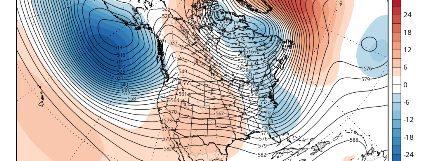
One major piece of the Winter’s puzzle can be found in the form of “clues” in the North Pacific Ocean. Meteorologists use different oscillations to measure the pattern in the North Pacific over time. The pattern in the Eastern Pacific Ocean is represented by the aptly named “East Pacific Oscillation” (EPO). Like the North Atlantic Oscillation (NAO) the EPO has certain generally predictable outcomes when it oscillates from positive to negative phases.

Read more

The stratosphere, blocking, and a hemispheric pattern change

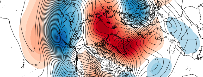
What exactly could a ridge in the Kara Sea, the remnants of Hurricane Nicole, and a circulation in the stratosphere all have in common? They’ll all have significant impacts on a changing weather pattern in the Northern Hemisphere over the next two weeks. Meteorology is a fickle, uncertain, and highly detailed process in almost every regard. But every once and a while, the fluid process that runs through our planets entire atmosphere can give us a show — where multiple processes come together, and they can be easily visualized and understood.

What’s occurring over the next 7 days is, by and large, a hemispheric pattern change. The progressive pattern across the United States, which has been dominated by a Pacific Jet and relatively uneventful disturbances, will undoubtedly shift. Changing wavelengths are likely to make the pattern changes effects even more dramatic. But the most interesting aspect is where, when and why these changes are occurring.

Read more

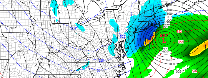
Weekend Nor’easter increasingly likely, but impacts still uncertain

Forecast models have come into better agreement, over the past day or so, in regards to the eventual atmospheric pattern evolution over the next several days. The evolution of the pattern has been a topic of major discussion over the past several days, with hints of the potential for a Nor’Easter several days ago. After a few blip model runs which showed the storm system, operational and ensemble guidance was a mess — with each suite showing separate evolution’s and resultant solutions in regards to the track and intensity of a developing surface low off the East Coast.

On Wednesday, however, global model guidance came into much better agreement on the evolution of a few major features, all of which will play a major role in the development of a powerful Nor’Easter from Sunday into Monday. The majority of global model guidance, including ensembles, agree on this. The question moving forward will be, as it always is, in the details and nuances of the setup. Those will decide whether or our area receives a glancing blow, or significant impacts and potentially a late-season winter storm.

Read more

(Premium) Will There Be An East Coast Snowstorm March 4th-5th?

After the midweek storm which is likely to be all rain, we are watching for the potential for storm system to develop near the Southeast US in the March 3-5 period.

Strong high pressure with much colder air will follow behind the midweek storm. Meanwhile, a shortwave will dig downstream off the West Coast ridge over the Rockies. This shortwave will become part of the southern stream and cause a low pressure storm system to develop over the Central or Southern Plains. Models indicate this storm will track towards Southeast or Lower Mid-Atlantic coast by Friday.

Read more