Significant Nor’Easter becoming increasingly likely next week

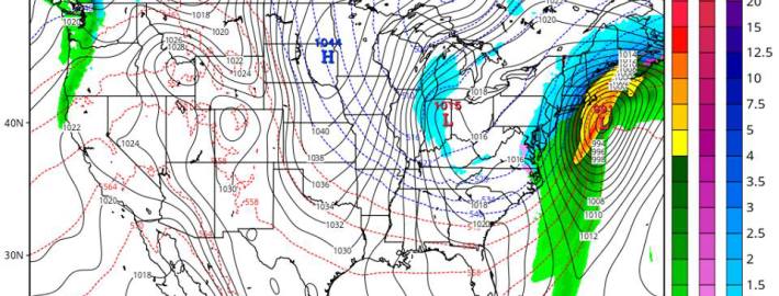
Forecast models have come into better agreement in regards to the evolution of a mid and upper level pattern during the upcoming week which will eventually lead to the development of a significant Nor’Easter on Wednesday. Although specific details, in regards to the storms track and intensity (as well as the resulting precipitation type and amounts in our area) remain uncertain, confidence is increasing fairly quickly that the significant storm will in fact develop. This means there is a high likelihood that travel will be significantly impacted by hazardous weather — on the busiest travel day(s) of the year.

While it is too early to speak about precipitation totals, accumulations, and timing, the likelihood of the storm system impacting the area with multiple facets of hazardous weather means that it is prudent to prepare and adjust your travel plans adequately. And, despite the increased confidence in the storm system, the evolution of the pattern and disturbances that are working to develop the storm system remains extremely intricate — with the forecast prone to major changes over the next few days.

Read more

Weather rollercoaster could end with Thanksgiving Nor’Easter

As most of you could probably tell by simply walking outside, another mid-winter airmass has filtered into the region today, and will set up another very cold night tonight. As high pressure settles into the region this evening and tonight, winds will subside to nearly calm levels. When this is combined with clear skies and a very dry atmosphere, ideal conditions for radiational cooling will be generated. This leads to lows in the upper teens in the interior, and lower 20s near the coast, with perhaps mid 20s in the warmest urban areas.

Afterward, the trend will be for moderation. This is because the high pressure will be sliding off the coast, giving way to a ridge and a return southwest flow. This will help to significantly warm temperatures aloft, but surface temperatures may be a bit more stubborn to warm up due to the presence of high pressure wedging the colder air. Still, though, the shift in wind direction and the ridge will be enough for temperatures to warm to around 40 or the low 40s tomorrow afternoon.

It won’t be until a warm front crosses the area tomorrow night that the weather will start to get a lot more interesting.

Read more

Watching Possible Snowstorm For March 12th-13th

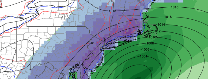
There is growing confidence that a possible snowstorm will affect the Northeast U.S. during the middle of next week, as the ingredients needed for one to occur are beginning to consistently show up on the models. It seems this winter has been relentless with the constant cold and frequent snowfalls. This type of pattern just does not want to let go — not yet, at least.

Significant winter weather event possible next week

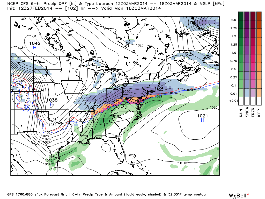
Forecast models have come into much better agreement regarding a storm system which is forecast to impact the area early next week. Several days ago we mentioned in a blog post that the next significant precipitation event wouldn’t come until early this coming week — and that idea continues. A powerhouse upper level trough will slam into the West Coast over the next day or two, providing much needed rains. But more interestingly for us, the associated energy will de-amplify somewhat, but eject northeastward towards the Tennessee and Mississippi Valleys. As a result, a surface low pressure system will develop from the Arkaltex towards the Mid Atlantic coast.

To our north, a piece of the Polar Vortex will be meandering in Southeast Canada, maintaining an impressive low level cold air source. The result of the ejecting shortwave and cold air to the north will be an impressive thermal gradient and stalled frontal boundary, which will extend from the Central US towards the Mid Atlantic. Along this thermal gradient, a plume of moisture is forecast to develop in response to enhanced lift from the aforementioned disturbance. Accordingly, areas to the north of this thermal gradient (including much of our forecast area) will be in line for a potentially significant winter weather event.

GFS model showing a large-scale winter weather event impacting the Eastern United States early next week.

GFS model showing a large-scale winter weather event impacting the Eastern United States early next week.

Read more