(Premium) Record Breaking Cold Possible Sunday Morning… Another Storm Next Week?

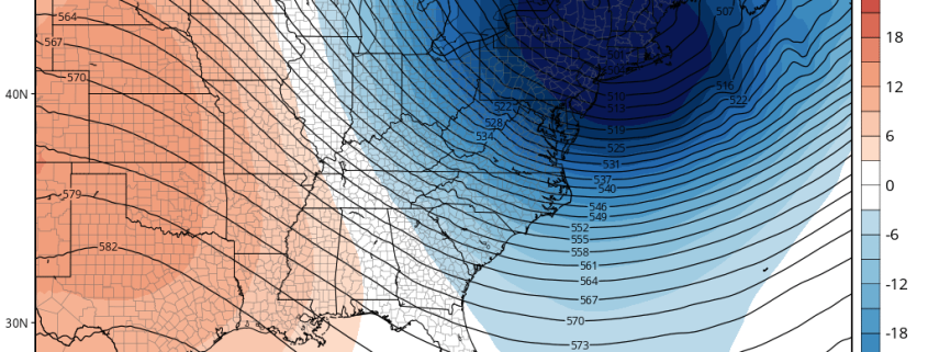
A piece or lobe of the Polar Vortex will swing south over the Great Lakes and Northeast. This supports an Arctic front passing through Friday night. Some snow showers or snow squalls are possible again tomorrow night with this front. Behind this front will be a potentially historic cold airmass for parts of Northeast. Saturday will see temperatures fall from the lower 20s to teens and single digits during the afternoon hours. Winds will also be increasing, as wind gusts between 30mph to 40mph are possible during the day. Thus, windchills will drop to near or below zero and may approach dangerous levels by Saturday evening.

Read more

Long Range: Winter is Coming…January Pattern Change Details

So far this winter has been mild here with historic warmth. We released a previous premium article stating the reasons why. This is still in much dismay of snow-lovers, while a blessing to many others. But we’ve been discussing a pattern change here for January for a while, and now it appears that some parts of that pattern change are coming together a little sooner than we thought. Some of the climate patterns we discussed are going through major changes.

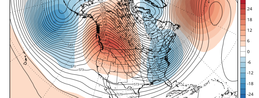
The pattern change will begin with the development of a large ridge over Scandinavia next week. This ridge builds into a very strong, anomalous ridge over the Barents/Kara Sea next weekend. Meanwhile a deep low/trough near the Aleutians causes another large ridge develop over Western Canada. Both ridges cause the polar vortex over the high-latitudes to begin elongating or splitting, from northwest to southeast. These changes will cause the AO to fall into the negative phase and the PNA to rise into the positive phase. This process results in a large trough with seasonably cold temperatures over the Eastern US shortly after New Year’s Day.

Read more

The meteorology behind this weekend’s Nor’Easter

This winter has not had a fair share of wintry events. The snowfall we have received has generally come from clipper systems, and the larger storm systems have been rain. But the weather pattern is changing towards one that favors major east coast storm development and potentially large snowfall events. It is not a slam-dunk by any means, since there are a lot of moving parts, but the pattern over the next few weeks certainly piques the interest of any meteorologist looking for potential winter weather events.

One of the main problems for getting major snowstorms this winter has been the very fast flow across the Pacific and Atlantic basins. This means that any large storm that tried to amplify would get flattened out, as any ridging in the Pacific would get flattened like a pancake. This is going to change as we head towards this weekend.

Read more

What to expect from Wednesday’s significant Nor’Easter

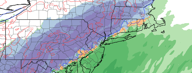
An early season winter storm will impact the area on Wednesday, during one of the busiest travel days of the entire year. Making matters more difficult for forecasters is the fact that the system goes against most climatological analogs, not only including time of year but general atmospheric teleconnections as well. With a +AO value and +NAO value, the idea of this storm system producing snow in our area is quite far fetched. Yet, forecast models and the general evolution of the mid level and surface pattern argues that someone in our area will, in fact, see significant snow.

Forecast models are now in good agreement that a mid level shortwave will slide eastward from the lower Mississippi Valley to the Southeast States on Wednesday. A trailing disturbance, surging through the Plains states, will eventually interact with the initial disturbance over the East Coast. As this occurs, a surface low pressure system will develop off the East Coast of the United States. Forming initially off the Southeast Coast near the Georgia and Carolina coasts, the storm will slide northeastward while strengthening, eventually ending up at a position near the 40/70 Benchmark.

Read more