Today has been a beautiful day in contrast with the previous few days across the entire area as temperatures have climbed into the mid-upper 40’s the afternoon underneath mostly sunny skies. While it does feel more comfortable outside, these temperatures are still below-normal for this time of year. Some gusty winds were noted this afternoon as a large area of high pressure situated to our south and a quick-moving low in Canada create a pressure gradient over the Northeast. As we head into the evening, the winds should subside a bit, but as the aforementioned low pressure in Canada begins to move to the south east, some broken high clouds should begin to take over. This is part of a frontal system associated with the low in Canada that could bring the threat of some light rain or snow to western areas of NJ and eastern Pennsylvania.
While precipitation should remain quite light for those who do happen to experience any rain/snow this evening, no significant accumulations are expected at this time as the frontal system begins to slow its approach towards the New York City metro area until tomorrow. Temperatures will vary quite significantly this evening, with lower 30’s possible around coastal areas and close to the city, but locations that are more inland should see temps drop into the 20’s for an overnight low.

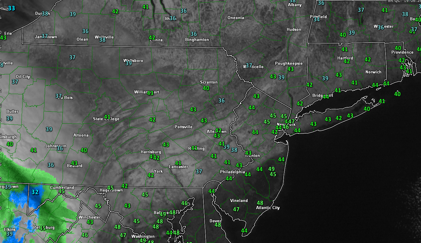
Latest visible satellite imagery with temperatures for the entire area-note the white on the image is actually snowcover and not clouds (Credit: GREarth)
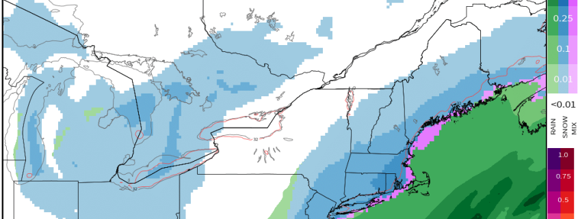
As we move into tomorrow, there is potential for some snow starting very early Saturday morning as the low pressure in Canada begins to move into the Great Lakes region, which will act to push the stationary front towards the area. Clouds should increase in earnest tomorrow morning with an early threat of some light rain or snow, but mainly a mix of rain and snow is expected for New York City, Central New New Jersey, Long Island, as well as locations to the south. Since we are getting further into March, ground temperatures will be an issue-as is the case with tomorrow’s initial batch of precipitation. Since the rain/snow mix will be quite light in nature along with warmer surface temperatures, very little to no accumulations are expected for these aforementioned regions. Since thermal profiles will be more supportive of an all-snow scenario to the North and West, some light accumulations can be expected-especially on grassy surfaces. Even though accumulations should be relatively minor with this first batch of precip, they may create slick driving conditions even if they are in the form of plain rain, so please use caution.

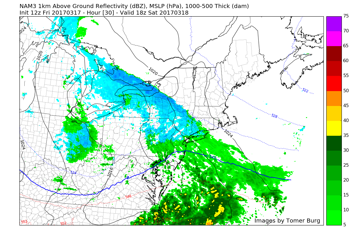
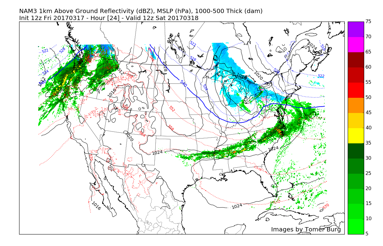
3km NAM simulated radar valid at 9am tomorrow morning showing a very light mix of rain and snow over the area (Credit: Tomas Burg UAlbany)
The associated upper level energy with system at about 500mb (or 18,000 feet) is very potent with this system. As it dives down from Canada, it will cause the main low pressure system in the Great Lakes to slowly die and subsequently fill-in. As the upper level energy continues east, it will also trigger the development of a secondary-low pressure system that will form off the Mid-Atlantic coast Saturday afternoon or early evening. This is what is called a Miller-B type storm development with a primary transferring all of its energy to the coast so that a secondary low can take over and drop more significant precipitation. As the low begins to form off the coast, colder air from the North/North East will begin to wrap into the low pressure system from which should help to turn any precipitation over the area into mostly snow by evening. As we talked about, the upper level trough associated with this system is quite impressive and as it moves east, energy will rotate underneath the base of this trough and work to strengthen the low at the surface while it continues to the east.
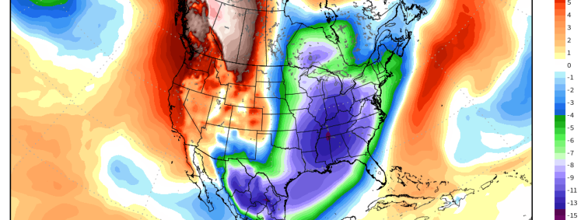
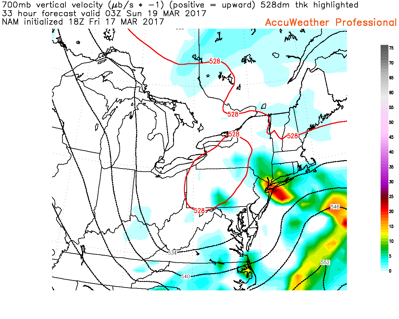
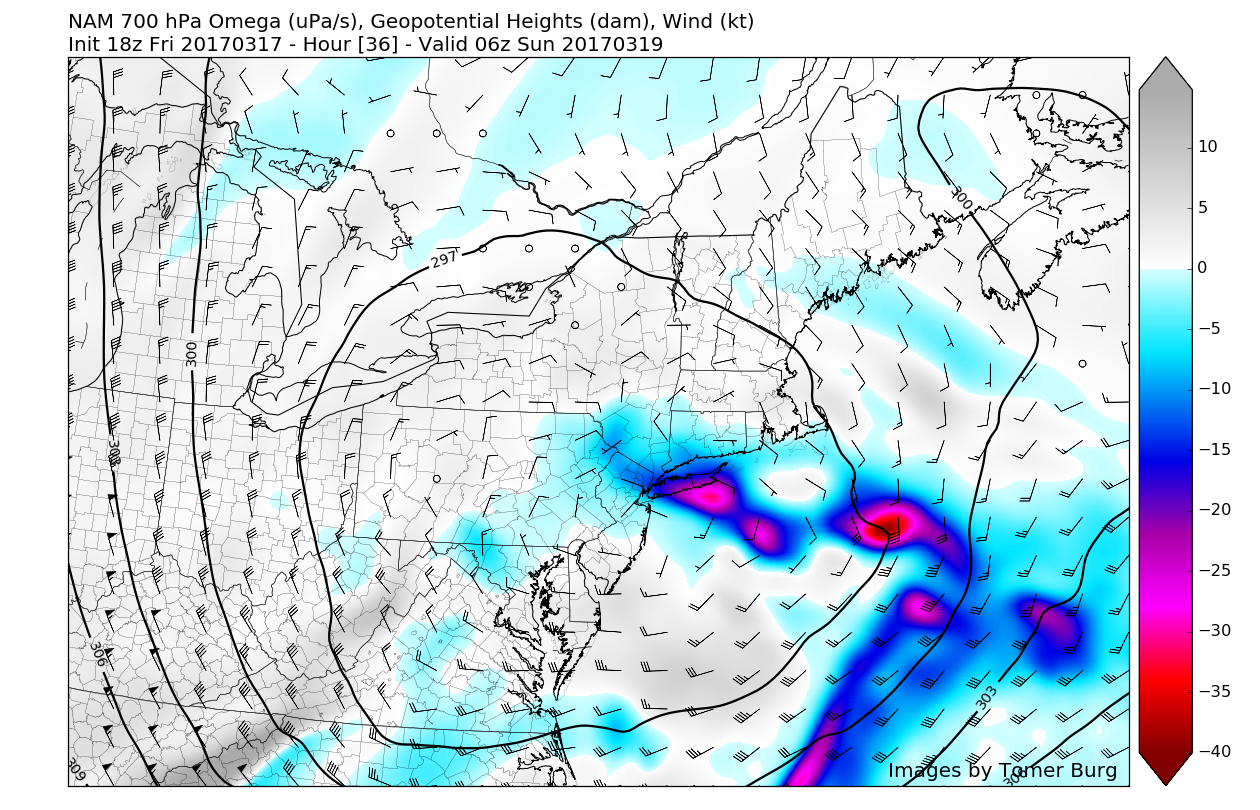
This advection (or movement) of energy will allow steadier precipitation to break out across the area as the atmosphere becomes much more conducive for snow during the evening. As we have mentioned a few times this winter, “lift” is very important if you want to see heavier snow rates, especially since these areas of heavier snow can also work to cool the local environment (which would help accumulations). As of this afternoon’s computer model runs, we have noticed a trend where the higher resolution models are hinting at the potential for such lift to exist over Long Island, Connecticut, and even portions of Northeast New Jersey. As we get later into the Winter season, it is a bit tougher to get accumulating snow in a marginal setup like this with no fresh cold air supply. So to counter that, you need the snow to fall more quickly than it can melt at the surface. This is achieved through these favorable dynamics mentioned above, and coupled with cooling from the strengthening surface low which should allow snow to accumulate at a more steady pace across the area on most/if not all surfaces through Saturday night.

12km NAM showing very favorable lift (in yellow, orange, and red) for heavier snow on Saturday evening
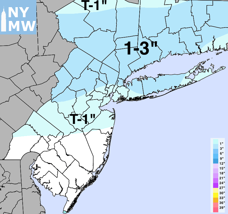
At this time, with the high uncertainty, we are still maintaining our snowfall total forecast for light accumulations. But will be likely be reevaluating our forecast later this evening, as new model data comes in. Nevertheless, there will still be huge bust potential on either the high or low side, with snowfall totals, if model guidance is poor in handling where the heaviest snow and amount of cooling that will take place. The storm should move far enough offshore to for more clearing by Sunday evening.
Overall, next week is looking relatively seasonable with some cool nights in store as a few frontal systems move through the area with a chance of some light rain. Later in the week, a ridge of high pressure should begin to build over the area, which would allow for more continued quiet weather with potentially warmer weather in the longer range.
For more information and posts like this one, make sure you sign up for Zone Forecasts — where multiple detailed articles, videos, and interactives are posted each day. Also, come interact with our staff and many other weather enthusiasts at 33andrain.com!
Have a great evening!
Steve Copertino
-2")