-2")
Unsettled Period Taking Shape With Multiple Rain Threats
Good Evening!
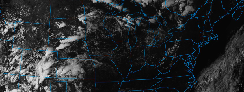
Today was a rather beautiful day across the entire Northeast, as a elongated area of high pressure centered off the New England coast remains in control. Dry air in the mid levels of the atmosphere associated with subtle mid level height rises over the Mid Atlantic allowed for a mostly clear start to the day across the area, which allowed temperatures to gradually rise into the low to mid 80’s. Today also features some refreshingly low dewpoints courtesy of the high pressure system, and when coupled with light and variable winds, conditions were near perfect for enjoying the outdoors. These conditions lasted throughout the entire afternoon hours and into the evenings hours, and should prevail after dark as well. A weak mid level system passing just to the north of Michigan may be able to create some upper level cirrus clouds to develop late this evening, but no shower activity is expected with this unimpressive system. As the evening progresses, this cirrus activity may actually wind up putting a cap on the potential for radiational cooling as all the other factors are quite favorable, however the increased cloud cover may limit just how much temperatures can fall. Regardless, overnight lows should be able to drop down into the upper 50’s to lower 60’s area-wide, with some inland locations possibly dropping to the lower 50’s.
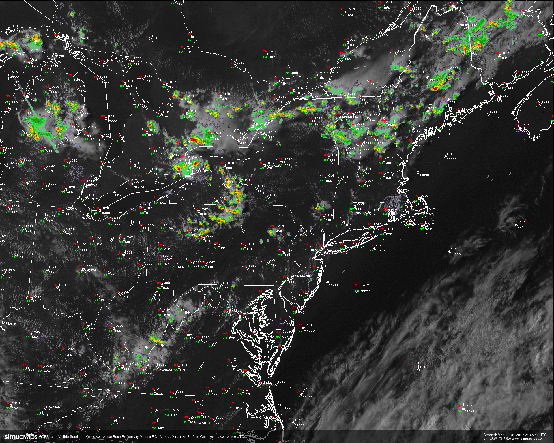
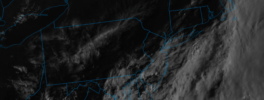
This evenings latest high resolution 500m GOES 16 visible satellite imagery, regional radar mosaic, and surface observations, showing a very pleasant and calm evening across the entire Northeastern region. (Courtesy of Simuawips.com GOES-16 data is preliminary and non-operational)
Thursday Into Friday
Thursday will likely start off with a few high clouds due to the aforementioned weak disturbance gradually moving off to our north. Although with the elongated area of high pressure moving off to our south and east, enough mid level dry air should remain in place so that as the morning hours progress, these high clouds will gradually dissipate, giving way to mostly sunny skies. Another positively tilted mid level trof out over the Great Lakes region will help to build an area of ridging overhead during the day tomorrow, which should advect warmer temperatures into the area once again. With winds out of the south over much of the area, clear skies, and warm mid level temps, expect high temperatures to once again reach into the low to middle 80’s by tomorrow afternoon. A weak wave of low pressure may try to pass to the south of our area tomorrow afternoon, which would potentially bend winds back to the southeast along coastal portions of NJ/LI/CT. This would allow some cooler air via a sea-breeze to work its way inland, but the degree to which this cooler air penetrates the coasts will be something that will need to be monitored tomorrow in real-time. Skies will remain mostly clear up until the evening hours before some thicker high level cirrus clouds begin to move into the area just in time for sunset. Depending on the degree of the southeasterly winds tomorrow, some localized patches of fog may be possible, though this should likely remain patchy in nature. Overnight lows will likely once again drop into the upper 50’s to lower 60’s-with some locations inland seeing slightly lower temperatures.
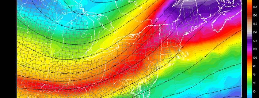
On Friday, we finally lose our support from the broad area of high pressure, and a large mid level trough from the Great Lakes region will begin to move in early Friday morning. As this trough approaches, the southwesterly flow will begin to advect a moist airmass with higher dew points into the area, which should also increase cloudiness quite a bit during the day. The entire region will likely see more clouds than sun during the day on Friday, and this will also put a cap on just how warm it will be able to get. With mid level temperature remaining rather steady during the day, there won’t be too much of difference, but highs will likely remain in the low to middle 80’s across the area. The increased dewpoints and clouds cover will also make Friday seem much more dreary than the previous two days as well. Any shower activity on Friday will likely remain to the west of the area, as the best mid level forcing and jet stream dynamics will be placed off to our north and west. Cloudy conditions should preside over the rest of the day, lasting into the evening hours as well. With cloudy conditions, warm mid level temps, and increased humidity, temperatures will likely only be able to fall a few degrees, with lows likely reaching into the low to middle 60’s Friday evening.

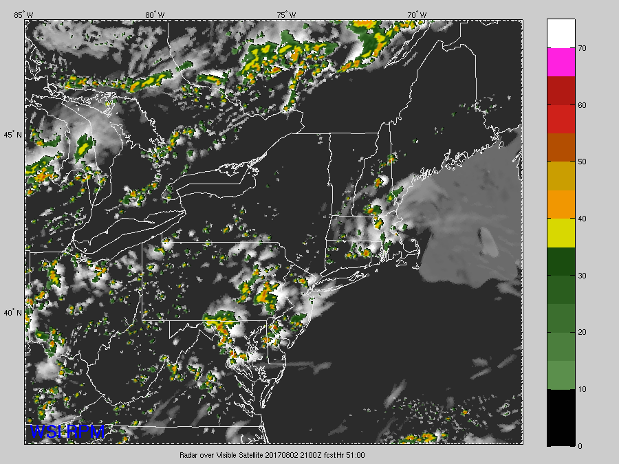
This evenings NAM model showing the progression of a mid level trough that has the potential to brings some rain to portions of the Northeast Friday and into the weekend (Courtesy of College of DuPage)
This Weekend and Beyond
Cloudy conditions should continue to dominate the area on Saturday as a frontal system associated with the mid level trough continues to march eastward and over our area. As this system heads east, better forcing and upper level dynamics will also begin to move over the area on Saturday, so showers and possibly a thunderstorm appear likely during the day. With increasing moisture and a strengthening upper level jet streak providing divergence over the area, some of these showers and isolated thunderstorms may have the potential to produce some locally heavy downpours, but a lack of instability and weak vertical wind shear should mitigate any severe threat during the day on Saturday. Highs during the day on Saturday should once again be limited to the low to middle 80’s due to the threat of showers and enhanced cloud cover over the area. The frontal system will then approach the area late Saturday afternoon and into the evening, but any additional shower activity associated with this frontal system will be highly dependent of the overall strength of the remaining forcing with this wave. At this time, it appears that forcing should not be overly impressive and the jet dynamics may be disjointed just enough to keep the bulk of the heavier showers and potential storms to the north and west of the NYC metro area Saturday evening.
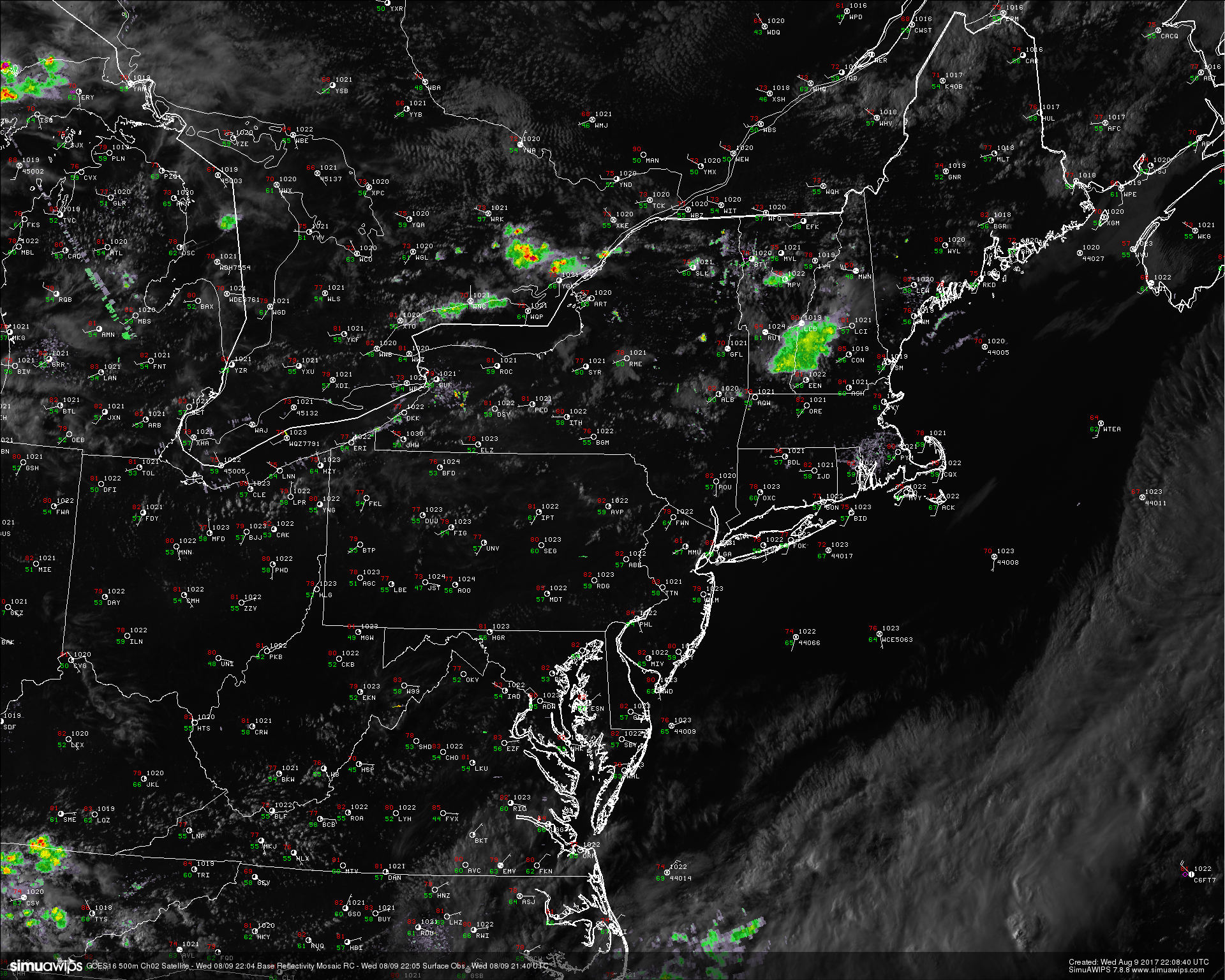
Conditions may briefly clear up on Sunday, but this should be rather short lived as another area of low pressure associated with a mid level trof begins to move out of the central US. The next threat for widespread rainfall appears to be on Monday when a wave of low pressure along a frontal boundary begins to push just to our south. Current model guidance has a very expansive and favorable upper level jetstreak overhead, with deep tropical moisture feeding in from the south. Confidence in this scenario is very low at this time due to the models potentially putting too much emphasis on a tropical area of low pressure interaction with this front and enhancing rainfall. This will likely have to be revisited later in the week when details become more clear. Overall, expect an unsettled and potentially rainy start to work week next week, with temperatures around average for this time of year.
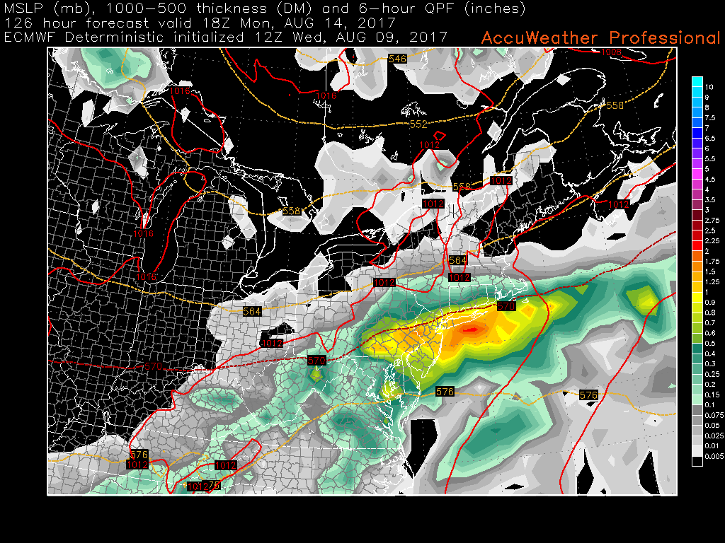
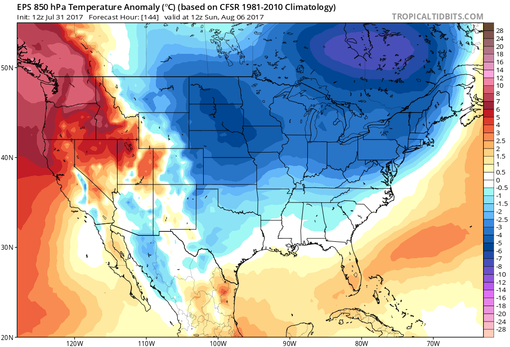
This afternoons European model showing the potential for unsettled conditions starting early next week over the area (Courtesy of Accuweather Pro)
For more information and posts like this one, make sure you sign up for Premium Forecasts — where multiple detailed articles, videos, and interactives are posted each day. Also, come interact with our staff and many other weather enthusiasts at 33andrain.com!
Have a great evening!
Steve Copertino