-2")
A Brief Overview of the Weather for the Next Few Days
After the storm we had on Tuesday moved out of the area, we saw sunny skies and chilly weather on Wednesday as cold air filtered into the area behind the storm system. Today and Friday will have quite similar conditions, as a zonal flow across the county will not allow for any major dips in the jet stream to support strong storms.
A strong high pressure system has moved into the eastern half of the country, just to our south. This will provide our area with sunny skies and westerly winds for today, with temperatures in the mid 40s for most of the area. Tonight/Friday morning’s low temperature should be in the upper 20s in most of the region, with low 30s in more urban locales.
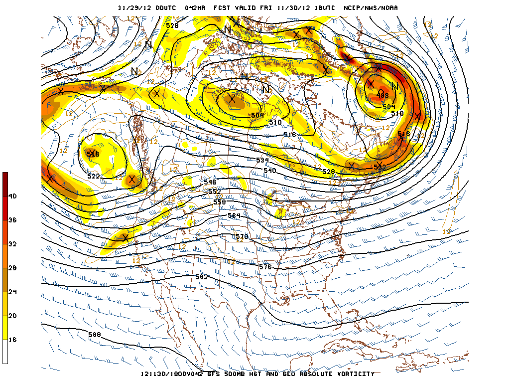
The 00z GFS forecast at 500mb, valid for Friday at 2pm. The pattern across the country is zonal, leading to no major storm systems for our area.
For Friday’s forecast, I’m going to show a couple of visuals. At 500mb, you can see the zonal flow across most of the country, which is helping to keep things quiet, for the most part. There is a ridge of warmth in the Central Plains which is heading eastward, which will warm us up a tad for Saturday and especially for Sunday and the days after that. Also, you can see a very weak area of vorticity in Michigan associated with a small shortwave trough that is heading eastward. This, combined with the fact that the warm air to the south and west will be overrunning the chillier airmass to the north and east will help to provide clouds and showers to the region for Saturday. The rain, if any, though, should be quite light and not cause too many problems.