Record breaking cold makes its presence felt

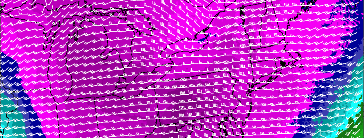
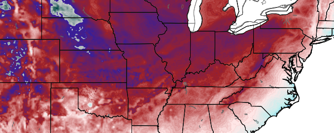
This was the coldest morning in the United States since 1976. How’s that for a statistic to start your day. The average temperature in the United States fell to 19.4 F at 12z this morning, beating the 19.9 F average reading from 1976. That average temperature is simply a statistical testament to the breadth and intensity of the cold air which has surged into the United States this week behind a powerful storm system and associated cold front. Temperatures were in the single digits this morning throughout much of the Central United States, and in the teens all the way through the Ohio Valley and Northeast. A remarkable 85.3% of the United States was below freezing, and 58.2% below 20 F.

In our local area, the cold surged through Monday Night into Tuesday morning and made its presence felt immediately. Temperatures fell easily below 30 F in New York City’s Central Park. This was the first time this season that the park fell below freezing. Wind Chill values were in the teens and single digits with blustery west-northwest winds blowing from 10 to 20 miles per hour. Today will be a winter-like day in the truest sense. High temperatures will struggle past the freezing mark (although the actual “daily” high temperature will be 45 F which was registered at midnight in NYC). Wind chill values will remain in the 20’s. And the westerly winds will continue surging cold air into the area tonight, when temperatures will fall even further.

Read more

Coldest air of the season arrives Monday Night

With news of an impending rain storm and warmup on Monday, hope may be rising for increasingly pleasant weather during the next week. That hope will come crashing down as quickly as Monday Night, along with temperatures throughout the forecast area. An arctic blast, straight out of Canada, will rush into the area on Tuesday behind Monday’s storm system, bringing the coldest air of the season into the area.

Forecast models have been consistent in hinting at this potential for 7 days or more, but are just now beginning to focus in on the intensity of the cold air. Anomalous and impressive, the cold air will surge in from Central Canada. First into the Ohio Valley, and then into the Northeast — straight to the coast

Read more

Rain on Monday, Arctic Blast on Tuesday and Wednesday

We hope you’ve been enjoying your weekend so far! After a very chilly start, the airmass has warmed a bit today, as winds have shifted to the southwest ahead of a developing storm and cold front. However, thickening clouds may largely prevent us from warming at the surface much more than yesterday. If clouds were to break, high temperatures could approach 50 degrees; otherwise it’s likely that we stay in the mid 40s.

Meanwhile, a strong storm system continues to develop, amplifying heights out ahead of it. This leads to strong mid-level warm air advection, and will continue to moisten the atmosphere. This warm air advection may lead to some showers developing well ahead of the low by around 11:00pm, and it may come down moderately at times in the pre-dawn hours. This will also lead to temperatures holding steady in the mid 40s.

Although there has been a warming trend with this storm, SW winds take a longer time to warm up the hills of NW NJ, and interior SE NY. This leads to the possibility of a bit of snow and ice on the onset for western Passaic and Sussex Counties in NJ, Northern Fairfield County in CT, and Orange and Putnam Counties in NY. Winter weather advisories have been issued for those areas, where up to an inch of snow is possible, and less than a tenth of an inch of ice. The timing would be from around 11:00pm through 7:00am. It may be wise to leave a bit of extra time for an early-morning commute. After 7:00am, enough warm air will be around to raise temperatures in these areas above freezing.

Some data is hinting that there may be a bit of a break in the action for a few hours from about 6:00am through 9:00am or so, where rain becomes much more scattered. This is because we’ll be in between the initial lift from the overrunning, and the core of the heavier rain from the warm conveyor belt of the storm.

Read more

First snow of the season tonight for many

No, this is not going to be a crippling winter storm. But the first true taste of winter is on its way tonight, as rain is likely to change over to snow in most locations.

A few days ago, most computer modeling data had little-to-no precipitation at all for the area. But that has changed over the past few days, as guidance has picked up on a few features which will increase the dynamics of the atmosphere tonight.

A potent mid-level disturbance is moving through the Great Lakes and into Western Upstate NY. This helps to strengthen the jet stream in New England over 130 knots, which helps to favor lifting in the atmosphere for precipitation. Additionally, this disturbance is triggering another shot of cold air advection, which is running into the warmer Atlantic Ocean, which also aids in the development of precipitation.

Read more