Some Sunshine and Showers/T-Storms This Week

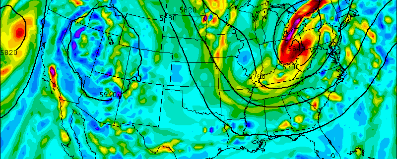
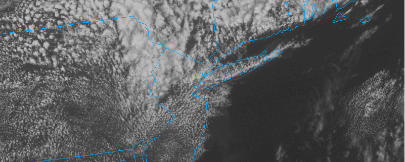
After some dismal weather this past weekend, the tri-state area enjoyed of lots of sunshine this morning with temperatures in the middle or upper 60s and low humidity. An upper-level trough to the north is causing more clouds to mix with sunshine this afternoon. A few isolated showers could pop late this afternoon and evening, well north and west of New York City. Most of the area will stay dry this afternoon. Temperatures will reach in the middle to upper 70s with light southwest winds. Tonight, skies should become mostly clear with low temperatures in the lower 60s and 50s inland.

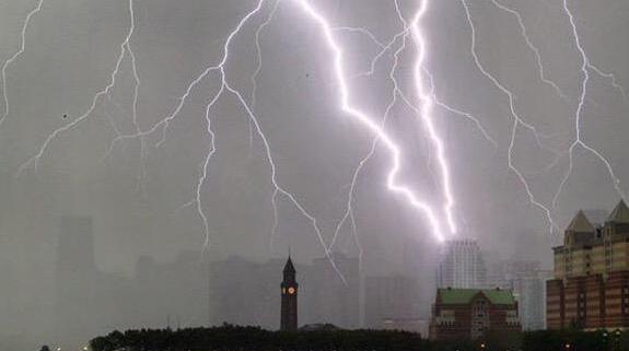
A warm front will begin moving through region tomorrow and tomorrow night. Ahead of it, light winds will turn more out of south-southeast off the cooler Atlantic waters. However, partial sunshine and 850mb temperatures around 14 degrees celsius during the afternoon, will help temperatures reach the upper 70s to lower 80s for much of the area. Near the New Jersey shore and the south shores of Long Island and Connecticut, high temperatures will be slightly cooler– likely in the middle 70s. A few showers or thunderstorms are possible well north and west of New York City, late in the afternoon. But scattered showers and thunderstorms are more likely later tomorrow night for the rest of us. Model guidance shows low instability and high precipitable water values, or atmospheric moisture co tent. Any thunderstorm will capable of producing heavy rainfall and cloud to ground lightning. Despite this, we aren’t anticipating organized severe weather or hazards at this time. 

Read more

The June 23rd Severe Weather Outbreak in Review

“Them’s the breaks”, my father often says when things don’t quite go as planned. While this grammatically errant statement may not seem immediately applicable to meteorology, most of our staff were thinking something similar on Tuesday afternoon. Our meteorologists had forecasted an organized — potentially significant — severe weather event days in advance. While this event did in fact occur over New England, Southern New Jersey, and the Mid Atlantic, the brunt of the severe storms curiously “skipped” over New York City and much of Northern New Jersey as well.

Severe thunderstorm events, inherently, are difficult to forecast. Not only for their technical aspects and intricacies, but for their often isolated nature. One town may see wind damage and hail, while the next one down the road only sees light rain — or in some cases, no rain at all. What this means for forecasters is that communicating the scattered nature of thunderstorms becomes very important.

This time, however, the storms weren’t necessarily scattered in nature. The atmospheric pattern favored widespread thunderstorm development, with lines and bowing segments of severe thunderstorms moving from northwest to southeast while affecting a large area. Hence, our verbiage “Widespread organized severe weather”.

Read more

Weekend Outlook: Heavy Rainfall Late Saturday, Better Weather on Sunday

High pressure will gradually shift to the northeast Friday night and Saturday. Clouds will increase on Friday night. An amplifying ridge over the Western United States will cause shortwave energy to dig and form into a closed upper-level low over the Ohio Valley/Great Lakes.  This will cause a double-barrel surface low-pressure system to organize over the Eastern US on Saturday. A deep southerly flow will transport a plume of moisture from the Gulf of Mexico and the Atlantic into our area. Most of the model guidance agrees on a widespread heavy rainfall throughout the area starting on Saturday and continuing into Saturday night.

Saturday will feature mostly cloudy skies with some intermittent rain and drizzle breaking out from southwest to northeast across the region. This will gradually occur during the morning and early-afternoon hours. A strengthening southerly low-level jet and precipitable water values approaching two inches will cause rain to become steadier and heavier at times, late in the afternoon and early Saturday night for the region.

Read more

Vivid sunset wows NJ and NYC behind severe storms

Some have told us that last nights sunset was the “best they’ve ever seen”. While that certainly is a variable statement, the sunset which cast New York City and New Jersey in orange and red hues after Tuesday’s storm was certainly one of the best in recent memory.

After strong and severe thunderstorms brought tornado warnings, hail, wind, and dangerous lightning to much of the area, clouds began to thin out in the wake of a cold front. The result was multiple quick moving cloud decks. Mid level clouds created a beautiful layer as low clouds swept by, and the departing Suns red and orange Rays were able to shine off both of them.

The resulting photos were both phenomenal and captivating with their colors; exposing both the beautiful colors and amazing landscape we are fortunate enough to be able to experience. We have included some of our favorites below. If you have some of your own, reply or email them to us!

Read more