Weekend Overview: Pleasant Saturday, then the heat arrives

Good evening! We hope you all have enjoyed this absolutely lovely stretch of weather we’ve had over the past few days, because it’s going to heat up. This is thanks to a large ridge which will be developing across most of the US and will extend into our area. This large ridge will be accompanied by very slow upper-level winds, making it quite slow to move, which means the warm pattern from the ridge will be sticking around.

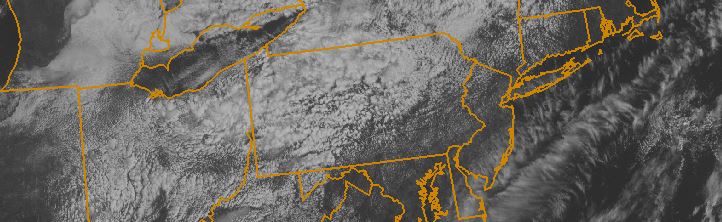
Fortunately, we have one more very pleasant evening tonight. The warm airmass will be gradually arriving, but we’ll still only be on the periphery of it. This means that the airmass will only be slightly warmer than last night, and humidity will still be pretty low. Temperatures will generally be around five degrees warmer than they were last night.

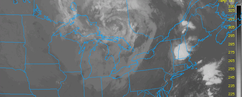
While some ridging will certainly be in-place tomorrow, allowing winds to shift to a more southerly component with a bit of a warmer airmass, some northern stream troughing in New England will help flatten the ridge somewhat, preventing temperatures from soaring tomorrow. This will also push in some drier air as well, which should be able to keep humidity levels quite comfortable, but also a bit higher than they were today. This means that Saturday looks like another lovely day.

Here are the weather highlights over the next few days:

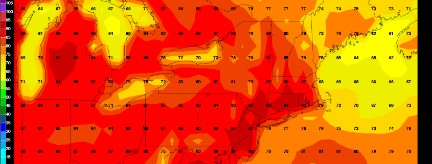
  • Tomorrow will have mostly sunny skies with temperatures in the mid to upper 80s. While humidity will be a tad higher than today, it will still be at pleasantly low levels.
  • The humidity will continue to increase on Saturday night, as the ridge becomes a bit more established and the trough moves away. While it won’t be humid, the changes will start to be a bit more noticeable. Overnight lows will generally be in the upper 60s.
  • The true heat starts on Sunday. Temperatures are expected to be in the upper 80s to low 90s across the area, though perhaps a bit chillier along the immediate shores, particularly south-facing shores. Dewpoints will have risen into the low to mid 60s, which will make it a bit uncomfortable, but not unbearable. Overnight lows will be around 70.
  • Once early next week comes around, the heat ridge will have fully established itself. This should lead to widespread low 90s for highs, with dewpoints generally in the mid to upper 60s, but sometimes around 70. This will make it feel quite hot and humid — a summery heatwave looks to be in-store. This hot weather looks to stick around through at least Thursday, and perhaps even longer than that.
  • For the most part, we are expected to remain dry. There is the slight chance for very isolated showers and thunderstorms on Sunday and onward, but this should generally be relegated to inland areas and should not be enough to cancel outdoor plans.
  • Tropical Storm Erika has continued to track south of forecast guidance, which limits its ceiling for strengthening. The forecast for it remains quite uncertain, but the general trend has been wagons south, which could even place it in the Gulf of Mexico. The NHC may eventually shift their cone southward if these trends were to continue.

Afternoon Roundup: Ridiculously pleasant weather

While the eyes of many have been focused on Tropical Storm Erika (and rightfully so), the weather in our local area has taken a turn for the better over the last 24 hours. Behind a cold front which moved through the area earlier this week, the airmass has undergone a dramatic change. The departing moisture and humidity has given way to comfortable air, plenty of sun, and a lovely breeze. High temperatures are still reaching into the lower 80’s, keeping things pleasantly warm as well. The trend will continue through the next few days as high pressure remains firmly in control.

Read more

T.S Erika, and her future over the next week

It is always interesting, this time of year, when a Tropical Storm or Hurricane forms to the east of the Lesser Antilles. While, obviously, no two meteorological patterns are exactly the same, tropical systems that form in this general area seem to have a tendency to catch the attention of those on the United States East Coast and Gulf Shores. It’s no surprise, really, given the history of such storms making landfall somewhere within the United States. An equal amount of systems, still, recurve “harmlessly” out into the open Atlantic Ocean or, in the case of Hurricane Danny just days ago, succumb to shear and unfavorable atmospheric conditions and die.

Tropical Storm Erika (with a “K”) formed last night in the Tropical Atlantic Ocean, with maximum sustained winds of around 45 miles per hour. Erika is expected to continue on a generally northwest heading over the next few days, gradually strengthening as she heads toward the Bahamas. Intermittently poor atmospheric conditions (albeit, no prolonged periods of strong shear) should keep the strengthening “Gradual” without any rapid intensification.

Read more

Morning Roundup: Cold front finally scours out humidity

Good morning! What had previously looked like a period of widespread showers and thunderstorms is now merely an isolated threat. While a potent trough and cold front is approaching the area, the front itself is weakening. Additionally, these potent troughs often have areas of vorticity, or counterclockwise spin in the atmosphere, which lead to lift. But there has actually been a large area of negative vorticity advection, which has limited the lift in the atmosphere. And by the time the negative vorticity advection has gone away, the front will have moved too close to the area, and dry air filters in from behind the front.

Because of this, as well as warm ocean temperatures fueling some instability, the best chance for a shower or thunderstorm will be in Long Island and Connecticut — probably from Suffolk County and eastward. A few showers and thunderstorms may be around this morning in areas further west, but they look very isolated.

For the most part, by the time the afternoon comes around, skies will be clearing, and westerly winds will be taking over and lowering dewpoints as the cold front crosses, making conditions quite pleasant. Temperatures should be able to reach the upper 80s.

Here are the weather highlights for the rest of the week:

  • Wednesday, Thursday, and Friday all look beautiful. Skies will be partly cloudy skies with very low humidity and temperatures will be in the low to mid 80s. Overnight lows will generally be in the upper 50s and low 60s, but mid 60s will be common in urban areas. The air will have an early autumn crispness.
  • Some instability cumulus clouds will be developing during these days as the large trough provides cold temperatures aloft, while the initial sun provides a warming ground. These will not be causing any precipitation — all they will do is occasionally make skies partly sunny or mostly cloudy in an otherwise sea of partly cloudy and mostly sunny skies.
  • As high pressure slides offshore on Saturday morning, a return flow is likely with some Atlantic ridging. This will lead to southerly winds, higher humidity, and warmer temperatures for the weekend. The airmass does not seem hot enough to promote excessive heat, however.
  • Tropical Storm Erika has formed in the Atlantic and will be approaching the Lesser Antilles in the next few days, where Tropical Storm Warnings have been issued. Afterward, it is expected to perhaps strengthen into a hurricane and not get torn to pieces like Danny. Thus, this system bears watching, though we do not anticipate a direct impact in our area.