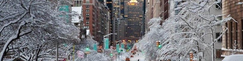
We like Slate. Their pieces are innovative, their writing is professional, and their staff is talented. The research they conduct is often top-notch, and their social media presence is impressive.
We don’t like the piece they published earlier today. Neither should any meteorologist, professional forecaster, hobbyist, or reader, for that matter. The article, A Very Early Yet Highly Accurate Guide to This Coming Winter is already irresponsible in its title. The piece goes on to elaborate on the fact that, due to the increasing confidence of an El Nino, forecasters can see what’s coming this upcoming winter with high confidence. From California to the Pacific Northwest and Urban Northeast, the article proclaims that the forecast certainty is higher than ever. Not surprisingly, it also calls for snowier than normal conditions here in the Northeast.
https://www.nymetroweather.com/wp-content/uploads/2015/08/slateheader.jpg207815John Homenukhttps://www.nymetroweather.com/wp-content/uploads/2024/02/Empire-2000-x-300-px-2.pngJohn Homenuk2015-08-18 13:27:512015-08-18 13:27:51There are no highly accurate guides to winter in August
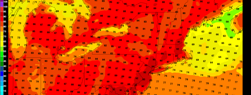
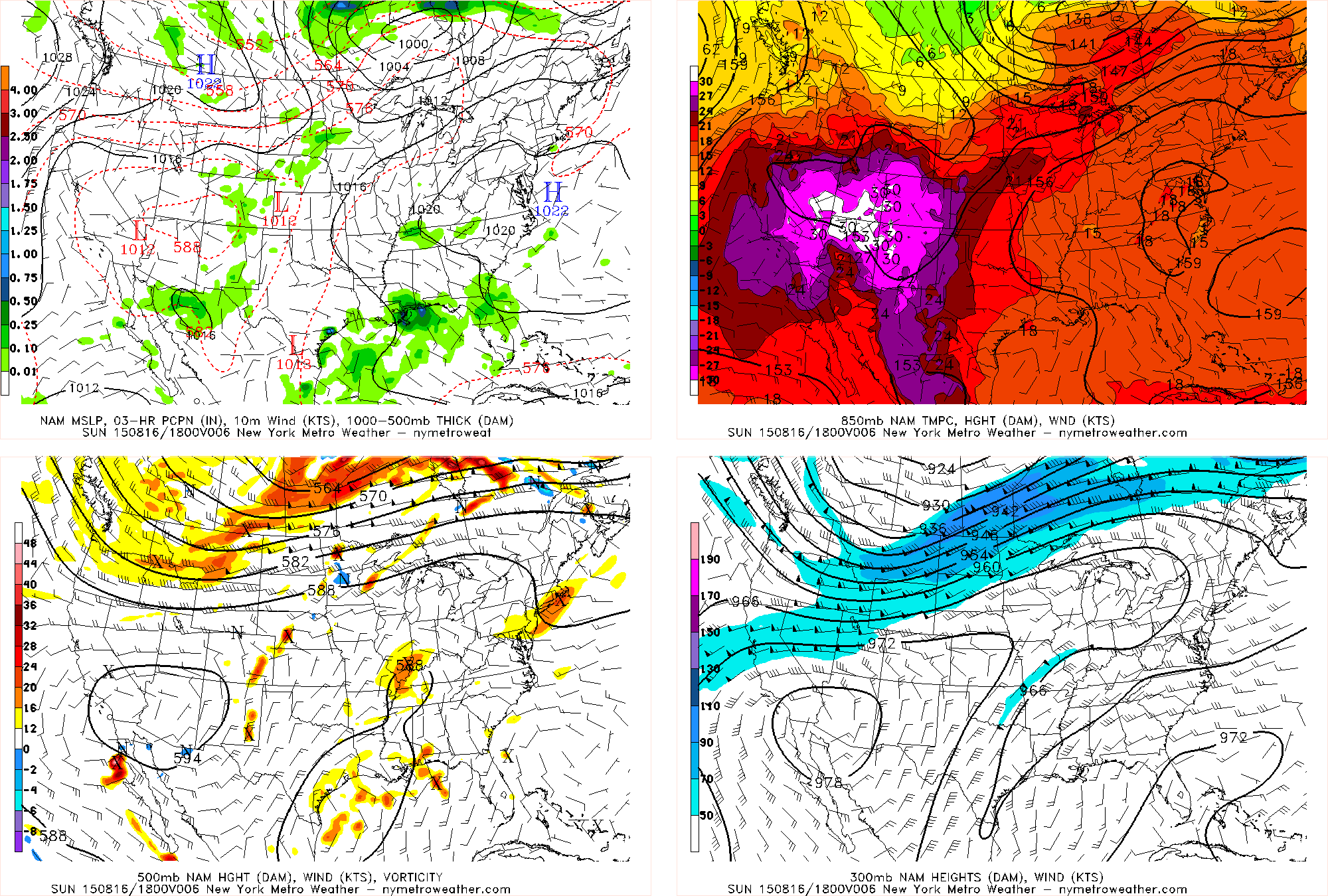
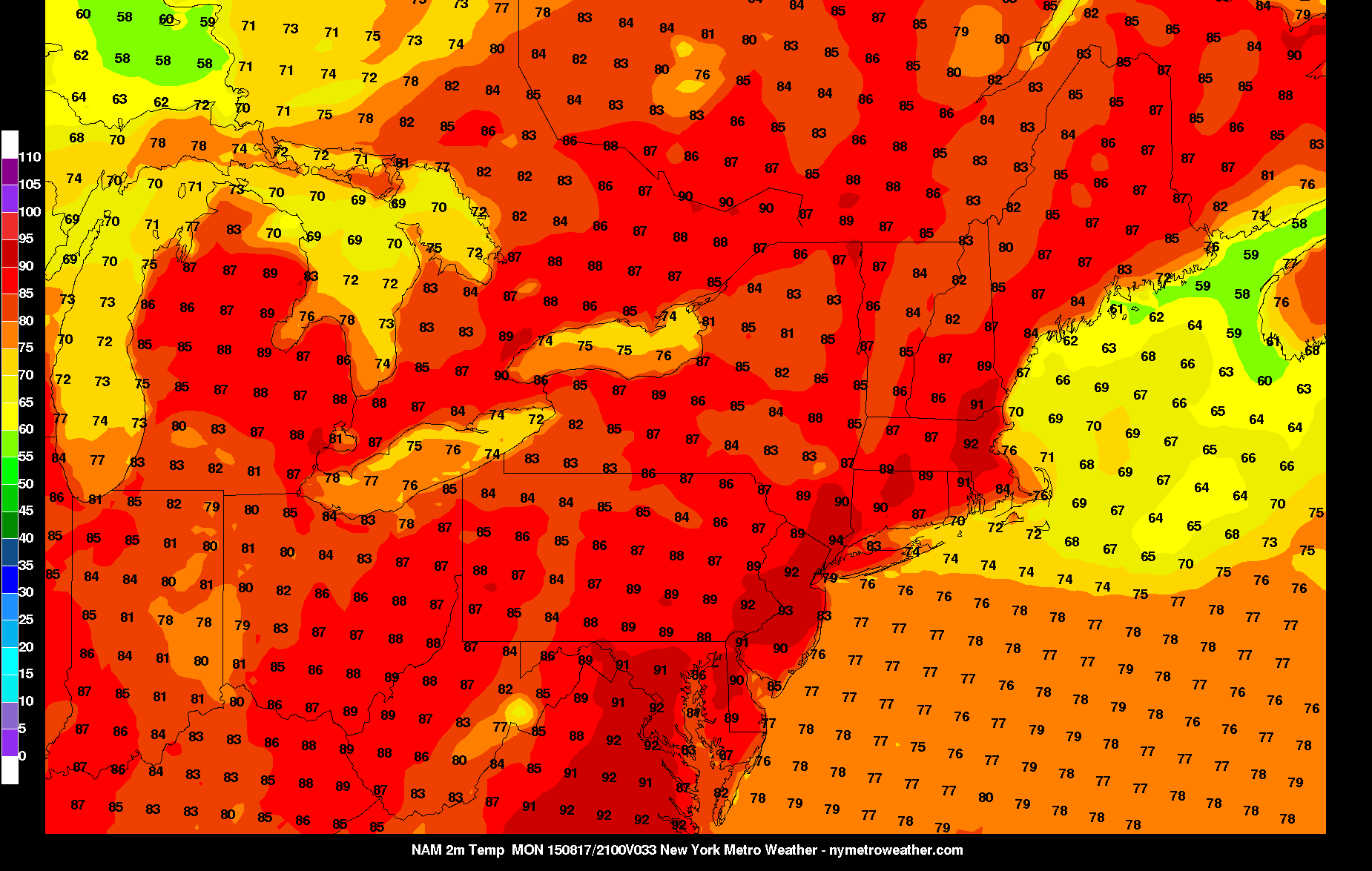
Good afternoon! If you haven’t noticed by now, it’s pretty hot outside, with temperatures generally in the low 90s as we speak. This hot airmass has settled in thanks to a large heat ridge stretching across most of the country, as well as an area of high pressure offshore, further helping to pump in southwesterly flow.
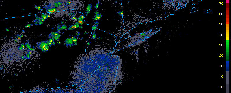
There is a weak shortwave and area of vorticity in our vicinity on the downstream side of the ridge. When this is combined with an already hot surface, a few showers and thunderstorms are possible as the afternoon progresses. However, with almost no wind shear whatsoever and some subsidence from the ridging and offshore high pressure, any shower or thunderstorm will beisolated. It still may be a good idea to keep an eye out on the radar, regardless. Clouds will be on the increase in the vicinity of these storms.
Generally with these large heat ridges stretching across most of the country, the mid and upper level winds are very slow. This causes a stagnation in the pattern, keeping this hot riding in our area for several days. It won’t be until a large trough comes down from Canada later this week that the ridging will finally get dislodged, albeit temporarily.
Here are our weather highlights for the next several days:
A warm, muggy night is in-store tonight, with low temperatures generally around 70 degrees.
Perhaps the hottest day of this heat stretch will be tomorrow, with highs in the low and perhaps mid 90s in some spots. This is because there will be a bit more of a westerly component to the wind. Skies will be mostly sunny. A few showers and thunderstorms are possible on Monday night into Tuesday morning as the airmass becomes more tropical.
As the trough digs more on Wednesday, it will actually increase the ridging out ahead of it, making Wednesday perhaps sunnier and hotter than Tuesday, with a smaller chance of rain. Temperatures around 90 degrees with high humidity will be common.
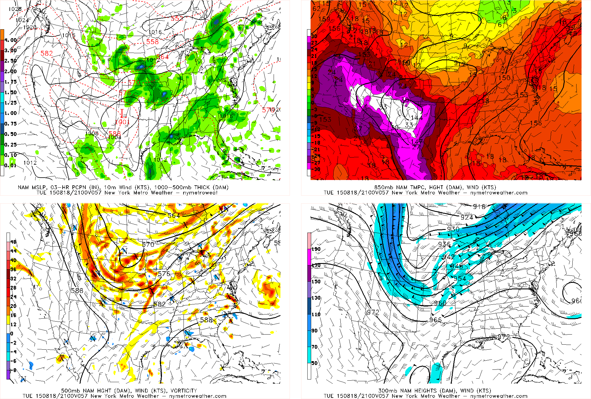
The trough itself will finally move into the area on Thursday, increasing the chances for showers and thunderstorms. With the ridging still somewhat holding on to the east, the trough may be over the area in a several-day period, leading to afternoon thunderstorms from Thursday through Saturday. They could be strong, but we are not expecting severe weather at this time. Warm and humid conditions will still prevail, but clouds may prevent widespread 90s.
https://www.nymetroweather.com/wp-content/uploads/2015/08/3_32.png11751850Doug Simonianhttps://www.nymetroweather.com/wp-content/uploads/2024/02/Empire-2000-x-300-px-2.pngDoug Simonian2015-08-16 15:10:182015-08-16 15:10:18The dog days of August are here
Good afternoon! It has for the most part been quite the pleasant day, as a cold front came through last night and made conditions much less humid and more pleasant today than yesterday. For the most part, this nice weather looks to continue for the next several days.
However, since yesterday’s inclement weather was caused by a large trough, there is still leftover energy rotating on the back side of the trough, which is where we are located. There are pieces of vorticity, or counterclockwise spin in the atmosphere, which can often trigger localized areas of lifting. Usually, when the airmass is as dry as it is currently, it is hard for thunderstorms to form. But when you are sitting under a large upper-level trough, cold temperatures aloft combined with a heating surface can still yield instability, and the vorticity causes the lift that taps into the instability. This is why some isolated thunderstorms have formed in our northwest suburbs.
Elsewhere, there has been a general increase in cumulus clouds, which is generally for the same reasons; though it is still quite pleasant. As the afternoon progresses, a few of these storms could hit the region, but they are looking very isolated, so most areas will not see a storm at all, and any storm that does arrive will be quick-hitting. Temperatures will generally remain in the low 80s. The most likely spot for a storm is in our NW suburbs.
The dry airmass will prevent the storms from getting too strong and from having too heavy of downpours, but the cold and dry air aloft from the trough may help the storms generate some downward momentum in the form of wind gusts up to 40mph.
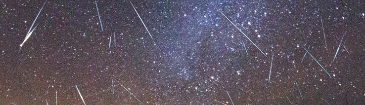
The annual Perseid meteor shower peaks tonight into the early morning hours of Thursday, and astronomers are suggesting the potential for up to 100 meteors per hour.
There’s something humbling about laying in the grass and watching meteors streak throughout the night sky. The Perseid meteor shower provides arguably the best show of meteors in the night sky each year. Its annual occurrence during warm summer nights makes it easily the most comfortable meteor shower to watch of the bunch of “major” showers, many of which fall during the colder winter months. This year, a very dim moon will make viewing even more ideal during the peak of the meteor shower.
Why is the moonlight so important? To put it simply, it upstages the light of the meteors streaking throughout the sky. When the moon is full, you may still see meteors — but the smaller, dimmer activity (which is typically more frequent than the bright ones) is blocked out by the bright light of the moon in the sky. This year, the thin crescent moon is not expected to interfere at all.
https://www.nymetroweather.com/wp-content/uploads/2015/08/meteors.jpg213738John Homenukhttps://www.nymetroweather.com/wp-content/uploads/2024/02/Empire-2000-x-300-px-2.pngJohn Homenuk2015-08-12 09:11:392015-08-12 13:05:48Perseid meteor shower peaks tonight, here’s how to see it
Hi friends! Our website uses cookies to provide an optimal browsing experience for you. New "Cookie Consent" laws mandate us to inform you of this. As long as you're cool with it, just hit OK. You'll only see this message once.
We may request cookies to be set on your device. We use cookies to let us know when you visit our websites, how you interact with us, to enrich your user experience, and to customize your relationship with our website.
Click on the different category headings to find out more. You can also change some of your preferences. Note that blocking some types of cookies may impact your experience on our websites and the services we are able to offer.
Essential Website Cookies
These cookies are strictly necessary to provide you with services available through our website and to use some of its features.
Because these cookies are strictly necessary to deliver the website, refusing them will have impact how our site functions. You always can block or delete cookies by changing your browser settings and force blocking all cookies on this website. But this will always prompt you to accept/refuse cookies when revisiting our site.
We fully respect if you want to refuse cookies but to avoid asking you again and again kindly allow us to store a cookie for that. You are free to opt out any time or opt in for other cookies to get a better experience. If you refuse cookies we will remove all set cookies in our domain.
We provide you with a list of stored cookies on your computer in our domain so you can check what we stored. Due to security reasons we are not able to show or modify cookies from other domains. You can check these in your browser security settings.
Other external services
We also use different external services like Google Webfonts, Google Maps, and external Video providers. Since these providers may collect personal data like your IP address we allow you to block them here. Please be aware that this might heavily reduce the functionality and appearance of our site. Changes will take effect once you reload the page.
-2")