microburst_62016

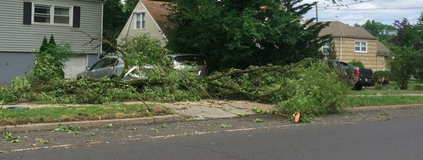
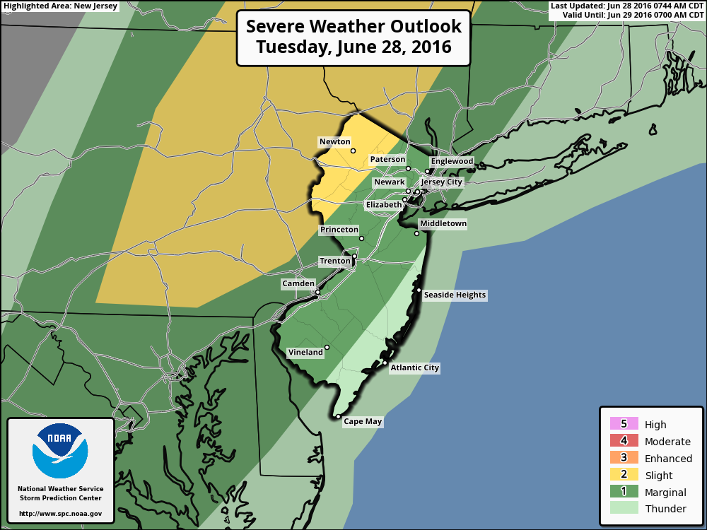
NWS confirms microburst in Union County on Tuesday

The National Weather Service in Upton, NY has confirmed that straight-line wind damage, originating from a microburst, was the cause of significant but localized damage in Union County, NJ on Tuesday Night. A severe thunderstorm moving through the Watchung Mountains and into Union and Essex counties showed signs of rotation and strong winds on terminal doppler radar, but no evidence of a tornado has been found as of yet.

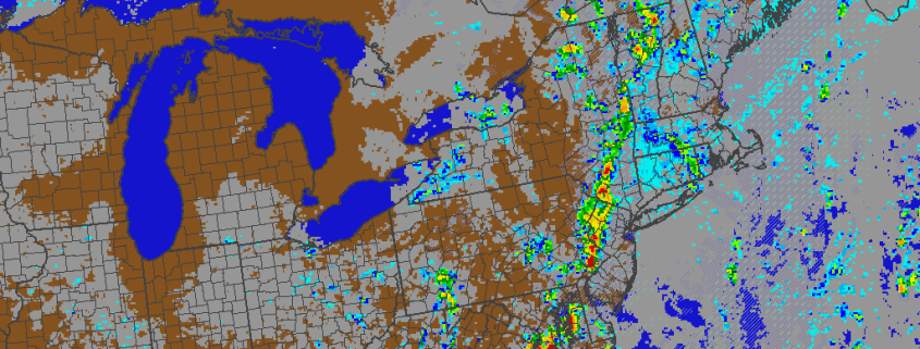
The line of showers and thunderstorms formed over parts of New Jersey on Tuesday evening in association with a frontal boundary, which was approaching the area from the west. A localized area of favorable instability and wind shear allowed the storms to briefly strengthen, despite the overall weakening trend which was being observed as storms were approaching the more stable air near the coastal plain.

Read more

Premium: More heat, storm chances on the horizon

The atmospheric pattern so far, for the majority of Spring and now into the first week or two of calendar summer, has been a bit of an enigma. There have been transient bouts of warmth, with showers and thunderstorms, but cooler periods have followed. For the most part, our area has avoided widespread or organized severe weather events as well. Over the next few weeks, that pattern looks to slowly undergo some changes.

While these changes aren’t expected to be sudden or dramatic, the gradual transition will certainly have an impact on the weather that our local area experiences. In todays premium post, we break down what is driving the changes to the pattern, how we anticipate it will evolve, and what the effects on our sensible weather will be — including temperatures, precipitation, and hazardous weather opportunities.

Since the Spring, the pattern has been dominated by a recurring theme of troughiness in Southeast Canada. While ridging has become established over the Central United States, at times, higher latitude blocking — and, often times, an amplified northern jet stream — has allowed for troughs in Southeast Canada to impede the northward extension of that ridging.

Read more

Tuesday Overview: More showers & t-storms later this afternoon

Unsettled weather continues this afternoon, with a cold front and upper-level trough slowly approaching the region. Skies clearing to the west will cause instability to increase enough for showers and thunderstorms to develop over Central and Eastern Pennsylvania later this afternoon by early this evening. These thunderstorms will gradually move into western parts of New Jersey and the Lower Hudson Valley by early this evening. Strong or severe thunderstorms will be capable of producing heavy rainfall and isolated damaging wind gusts. For this reason SPC has placed Northwest NJ and Orange County NY in slight risk for severe weather. 

A marginal risk remains for Northeast New Jersey New York City and rest of Lower Hudson Valley. More cloud cover and onshore flow will keep the rest of region in a more stable airmass, most likely causing stronger thunderstorms to weaken, as they approach the coast this evening. Some heavy downpours and lightning are still possible with showers and thunderstorms this evening.  Where clouds break for any sunshine later this afternoon, temperatures will slowly rise into the upper 70s or lower 80s. Other areas, especially closer to the Coast, may remain cooler. Showers and thunderstorms may linger around until late tonight with the cold front and shortwave trough still moving slowly through the region. This storm system could have an impact on the Yankees Game tonight. Read more

Atmospheric pattern may support periods of heat by mid July

Warmer temperatures have returned this week, with highs reaching back into the middle and upper 80s. But the pattern still has yet to change to support any type of heat waves — and it doesn’t look like it will over the next week or so. Another cooling trend during the latter half of next week will bring an end to the month of June. For those who are looking ahead to the warm, hot days of summer, or trying get a heads up on any excessive heat for crops — this may escalate the amount of questions in regards to how this summer will turn out. Are there any changes expected to the atmospheric pattern over the next few weeks?

A ridge amplifying over the West Coast early this week will lead to a large trough over much of the Central and Eastern US for the later half of this week and into the July 4th holiday weekend. This pattern evolution can be largely attributed current +PDO influence and MJO progression during neutral ENSO conditions thus far this meteorological summer. This pattern should continue for another couple of weeks, before any significant changes take place to support more heat over Northeast US..

Ahead of this large trough this week will be a slow-moving cold front that could cause some showers and thunderstorms with possibly some heavy rainfall from late tonight through Wednesday. After this cold front moves passed the region, high pressure builds in briefly for Thursday with temperatures near average in lower or 80s. Then more embedded disturbances moving around this trough could provide more chances for showers and thunderstorms on Friday and then possibly over the July 4th holiday weekend.

Read more