How long will Winter’s hiatus last? Look to the Pacific

Before the warmth has even arrived, signals of a changing weather pattern have begun once again. This is, honestly, par for the course in the hemispheric pattern that we have been locked into over the past several months. The progressive nature of the pattern itself has not allowed any particular regime to become stagnant. In other words, the pattern is changing quite consistently, and no overly cold or overly warm regime has become established locally.

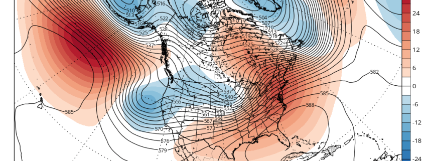
While this idea fits within our overall winter forecast, there is something to be said for emerging signals of a return to a colder, more active pattern before a warmer pattern has already begun. Lets not get confused, though — the warmer than normal pattern is still on the way. In fact, temperatures are likely to average above seasonal normals in the Northeast US for quite some time from late this week through Christmas and into the first week of January.

Read more

Forecast Soundings and Radiational Cooling

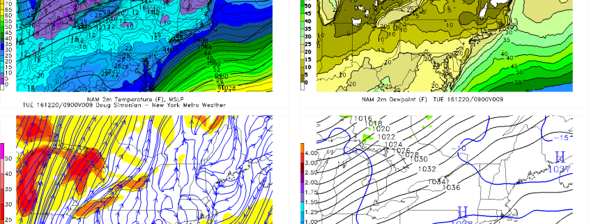
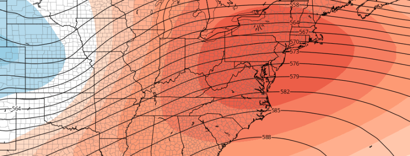
850mb temperatures are only around average or slightly below average. There is a large Southeast ridge with positive 500mb height anomalies. The previously large North Pacific block that generated our cold and snow last week has been replaced by negative height anomalies, cutting off the US from any cold airmass. So why is it so cold tonight? What it essentially comes down to is surface high pressure and radiational cooling.

On the heels of the piece of the Tropospheric Polar Vortex that got sent towards the US from the aforementioned North Pacific block was a very large surface high pressure system with Arctic origins. While the Polar Vortex quickly retreated back into the Arctic and the US was being replaced by a much warmer airmass aloft, this surface high pressure system was massive enough and had enough initially very cold source regions to deposit incredibly cold air into the US. The coldest temperatures were to our west in the Central Plains, where places in Texas dropped from the low 80s to the upper 30s within one hour! This cold air got modified somewhat as it headed east, but it still packed quite a cold punch on Monday, as temperatures in NYC did not get out of the 20s during the afternoon.

Read more

Premium Weekly Outlook: A Look into Christmas and Hanukah Weekend

After brief mild surge in the 50s over much of the region yesterday, another artic airmass has moved back over the region today. Despite only some high cirrus filtering sunshine, temperatures for the rest of this afternoon will likely only reach the lower 30s. This is airmass is not cold as last week. But it’s another reminder that we are still only in December.

Another very cold night is store for tonight. High pressure building over the region, will result in mostly clear skies and calmer winds later tonight. This will allow for more radiational cooling, especially for the suburbs.  The only cavet for ideal radiation cooling conditions will be with more high clouds early tonight with a weak shortwave trough passing through. But these clouds should move out overnight.  Temperatures will likely drop well down into the teens and lower 20s over the much of the region. Some of the interior valleys and the Pine Barrens may drop into the signal digits, if skies clear out enough.

Read more

Winter hiatus expected to close out December

Before we start, to sign up for daily articles (like this one) videos, discussions, interactives and more, contact our team here.

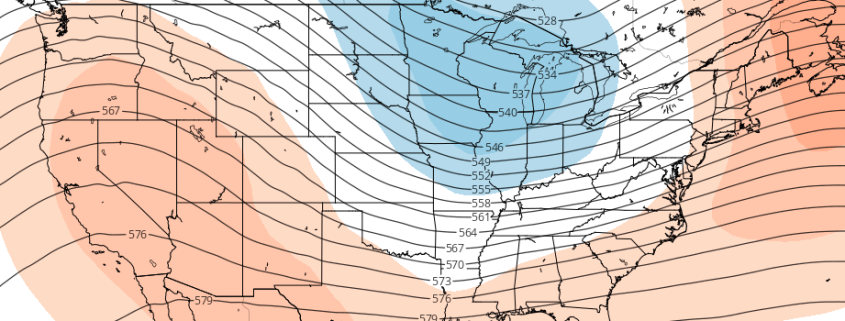
After a two week period featuring a polar vortex intrusion, colder than normal temperatures, and frequent winter weather opportunities (especially in the interior) the pattern this week will be one of transition. The hemispheric pattern is undergoing some fairly significant changes, which are working to take then cold air back to its source region by late this week, over the arctic and north pole.

Yes, the arc is swinging back the other way, as the same cold air which was disrupted and pushed southward into the Northern 1/3 of the United States is retreating fairly dramatically. In the stratosphere, the polar vortex is tightening and strengthening over the North Pole, a dramatic difference from the vortex we observed earlier in the season which was stretched, nearly split, and elongated.

Read more