Good Evening & Happy Friday!
Today has been a rather cool but cloudy day across much of the Northeast with a couple of scattered showers over the immediate New York City area, but further north conditions are quite messy. An area of low pressure along a frontal wave is pushing through the Ohio Valley this afternoon, and producing a modest area of precipitation across portions of the Northeast. As we talked about on Wednesday, this area of moisture surging northward from the Gulf of Mexico and into North will be met with the same strong area of high pressure located over southern Canada that has been responsible for the past few cold evenings. As precipitation began to work its way into the region this morning, stubborn low level cold air held its ground as warmer temperatures aloft began to push overhead. This caused a concern for an area of freezing rain to develop over portions of the Lower Hudson Valley and other locations across southern New England. While some ice pellets and freezing rain was observed, the vast majority of the precipitation over New England has been in the form of snow, especially as we head into northern New England, where temperatures are still in the lower 20’s. The models struggled to show the low level cold air holding on as long as it did over portions of New England, and this led to the snow forecasts to be a little more conservative then they should have been. Regardless, moderate to heavy snow continues over portions of New England, with freezing rain and sleet still falling over portions of southern New York and Massachusetts.
This area of precip should begin to diminish as we head into the evening hours as the main area of lift associated with the first frontal wave weakens. Winds from the south will increase to around 5-10 mph as a surface warm front continues to lift northward and over portions of the Mid-Atlantic, but is once again stopped by the same low level cold air. As this cold air presses down once again, a second wave of energy will push to the south of our region and spawn a low pressure system just off the Mid-Atlantic coast. This second system will lead to more widespread rain developing to the south as the evening goes on. Low temperatures this evening will vary heavily based on location, with portions of southern Connecticut remaining at or around freezing, and locations to the south rising into the 30’s and lower 40’s.

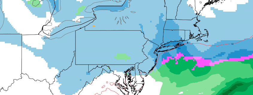
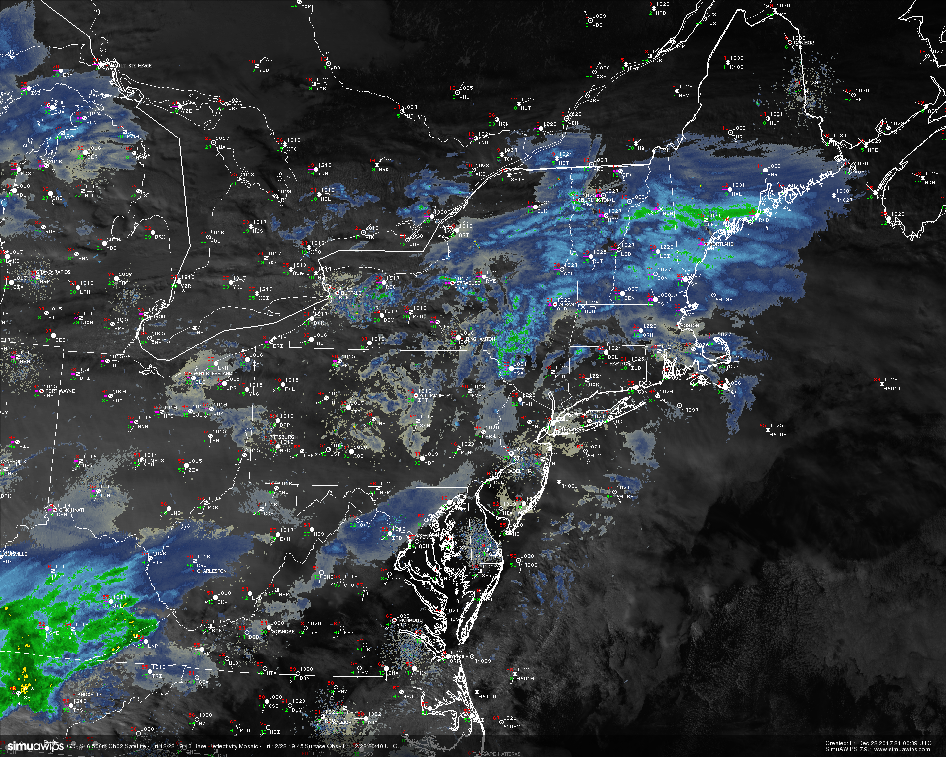
This afternoons high resolution visible satellite imagery, regional radar mosiac, and surface observations showing an area of showers over the NYC area, with snow (some heavy) over New England
Holiday Weekend Outlook
As mentioned, more steady rain looks to overtake the region around daybreak tomorrow as a warm front lifts northward over the region. Expect mainly dreary conditions tomorrow as temperatures surge into the well-above normal territory with highs in the lower to middle 50’s for locations closer to the coast, with middle to upper 40’s likely as we head farther north and west from the city. These high temperatures will likely happen later in the day as the low level jet strengthens over the Northeast throughout the day, maximizing warm air advection just around sunset. After the sun sets, the game changes once again as a cold front will quickly move from west to east across the East, which has the potential to bring some gusty synoptic winds, rapidly dropping temperatures, the possibility for some leftover snow showers for locations to the north and west of the city before dry air begins to take over. Lows will likely be able to fall into the middle to upper 20’s and lower 30’s across the entire Northeast during the overnight hours.
Sunday will start off much clearer and cooler as dry air from the backside of the cold front takes over. Mainly dry conditions are expected with a few high level clouds possible as the day goes on and some weak mid level energy begins to move through the area ahead of the next disturbance. Highs will likely remain in the middle to upper 30’s during the day on Sunday, which will be only slightly above normal for some locations. Things begin to get quite interesting later in the evening on Sunday evening as a shortwave trough looks to approach the coast and begins to amplify, leading to the likely development of a weak low pressure system off the Mid Atlantic coast by late Christmas eve. The initial shortwave over the Ohio Valley will likely have a modest amount of snow accompanying it late Sunday night and into the evening hours as it heads east. Conditions should remain dry until around dawn or so, until mostly cloudy skies give way to a mix of light rain/snow for early Christmas morning.
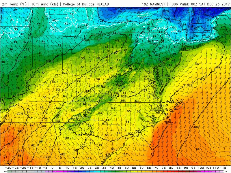
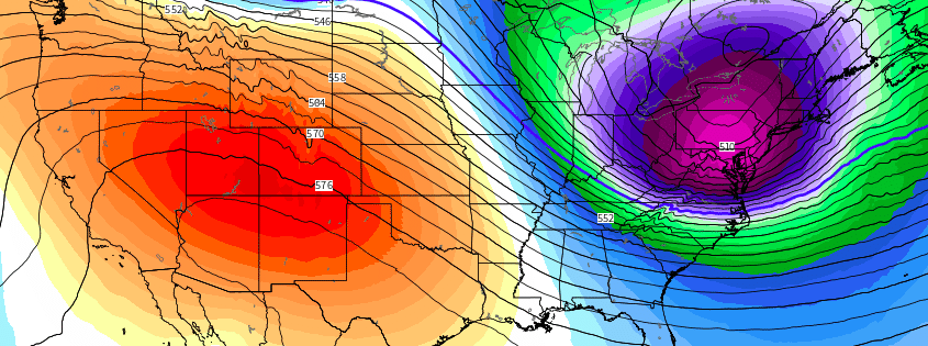
This afternoons NAM model showing the progression of a strong cold front over the East, bringing a return to colder conditions.
Christmas Day and Beyond
A mix of rain and snow will be possible for portions of the area during the pre-dawn hours on Christmas day for locations mainly to the north and west of the NYC area. As the low pressure system off of the Mid Atlantic coast begins to intensify and mature by sunrise, a changeover to all snow may be possible for the remainder of the area. This changeover to all snow may be very breif for locations closer to the coast, and any significant accumulations will be hard to accomplish. For locations to the north and west, this changeover may happen earlier in the morning, and a general 1-3″ may be possible for this reason in those areas. The low pressure system will continue to strengthen through the early afternoon hours, as it quickly heads north and east. Any leftover snow will be quick to shut off, with more significant accumulations likely taking place over southern New England and northward. The rest of the day will likely be quite cold, with highs in the middle to lower 30’s and gusty winds possible.
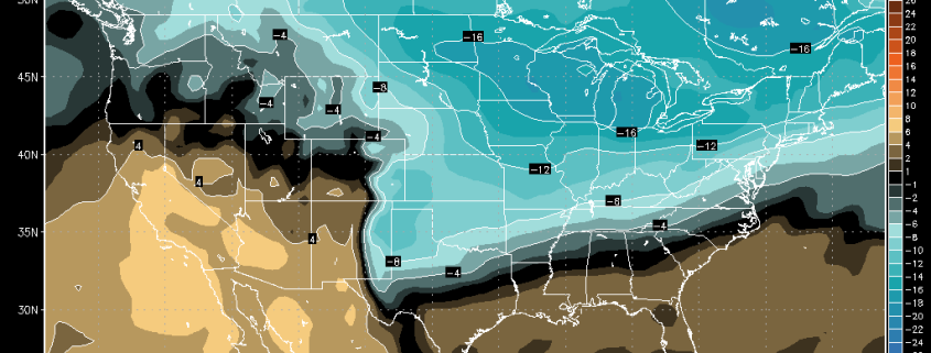
The end of next week will have the potential to be quite interesting as well as very deep sub tropical moisture will begin to crash into a deep polar airmass located over the northern half over the country by Tuesday. The models have been shifting quite a bit with regards to the surface features, but are rather consistent with the overall synoptic features. The pattern shown from Thursday into late next weekend will be one to watch, as similar ones have produced some rather substantial snow amounts in the past, and it would not take all that much luck to be able to see some plowable snow across the Northeast by the end of the week next week. We”ll have updates on this potential system and the Christmas storm over the weekend with a special announcement sometime around Christmas day!
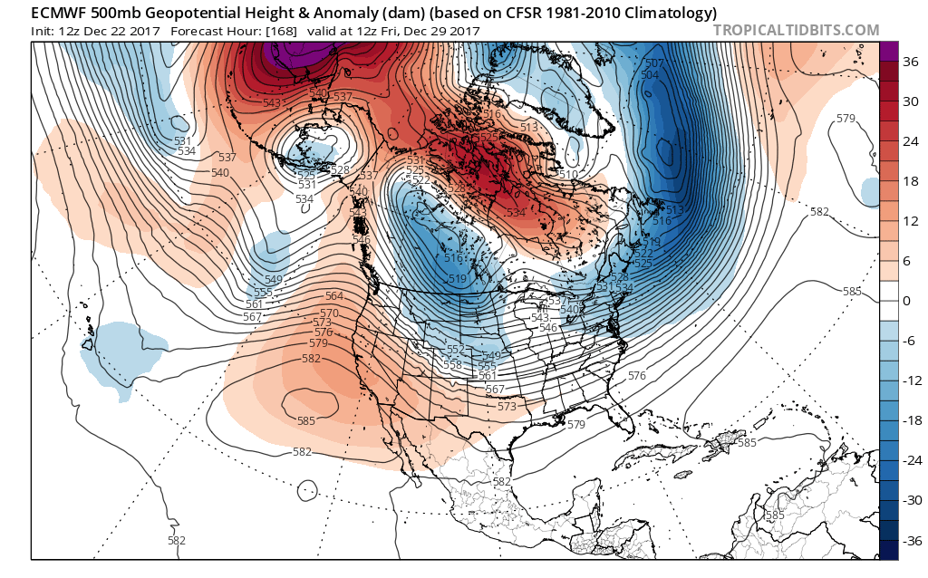
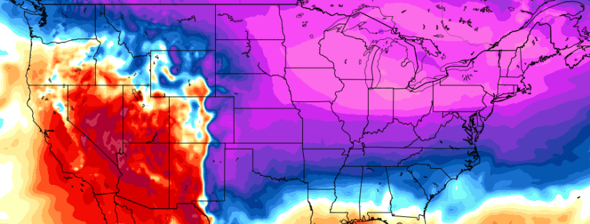
This afternoons European Ensembles Mean, which shows a pattern in the mid levels that is quite supportive of cold and potentially snowy conditions across the east.
Have a great night!
-2")