-2")
Light Wintry Mix Likely Thursday Night, Coastal Storm Possible Sunday into Monday
Good evening!
Today has been a rather cold and typical winter day across the entire Northeast after the system that impacted the region on Monday left some fresh snow cover for eastern locations. A large area of energy associated with the tropospheric polar vortex has been meandering just to the north of the Northeast, which has allowed for some light snow flurries to break out earlier this afternoon and into this evening. These flurries were mainly confined to the northern sections of upstate New York and portions of northern New England as moisture and forcing was rather meager with this system. Regardless, some limited moisture in the middle to upper levels of the atmosphere allowed for some spotty clouds to break out during the afternoon hours. Despite the peaks of sun during the day, high temperatures were pretty cold across the entire Northeast, with most of the New York metro area seeing readings stay in the upper 20’s to lower 30’s. Locations to the north and west were a little colder, with highs in the lower to middle 20’s. Calm and cold conditions will last through the evening and into the overnight hours tonight as an area of high pressure located to our south exits off the Mid Atlantic coast. As this area of high pressure moves to the south and east, surface winds winds will begin to shift to a more southerly component as mid level winds turn to the southwest. This mid to low level flow will allow slightly warmer mid level temperatures to work in from the south, allowing surface low temperatures to only drop into lower to middle 20’s for the vast majority of the region. The increased southwesterly flow will also allow for more mid to high level clouds to take over as the night progresses.
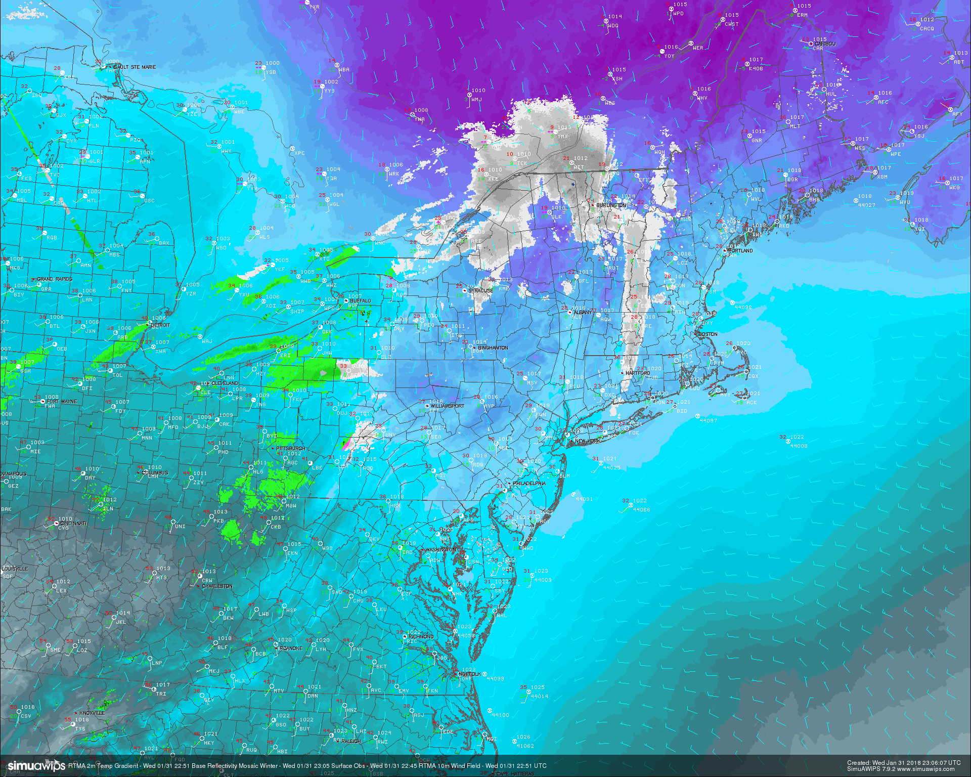
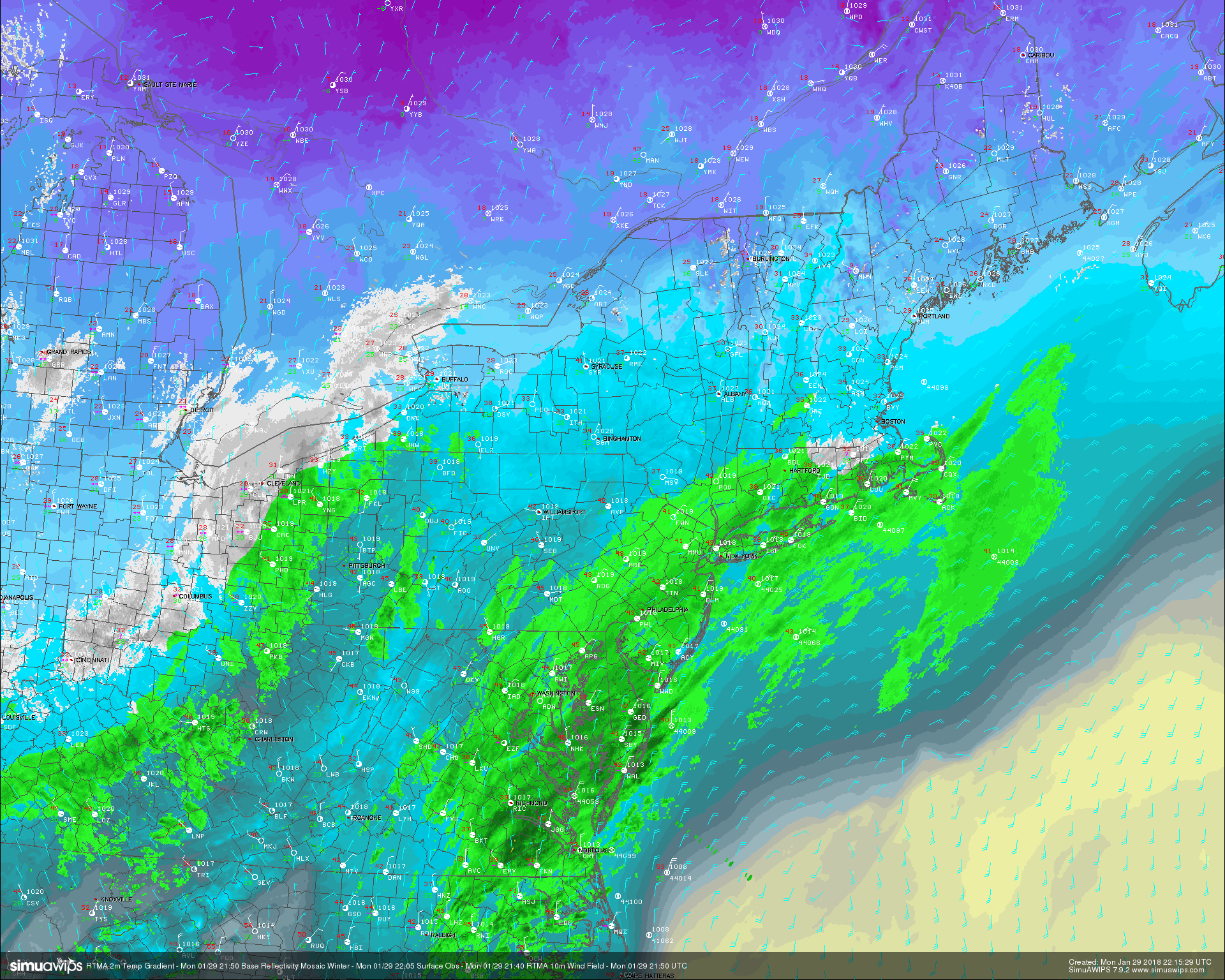
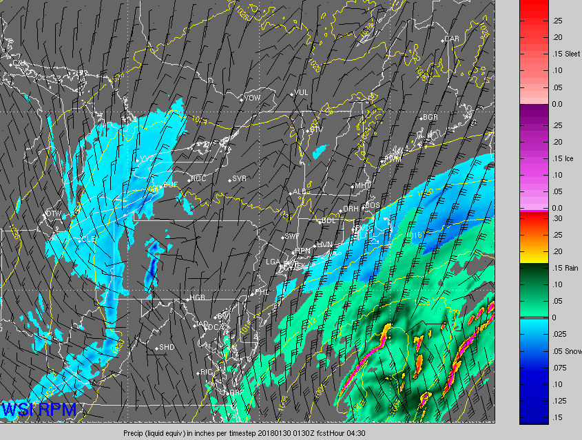
This evenings latest 2m RTMA temperatures, surface observations, and regional radar mosaic. Note the weak area of light snow and flurries over New England associated with some disorganized energy over southern Canada.
Thursday Through Friday
Thursday will likely start off cold, but rather cloudy across the majority of the Northeast as stout southerly flow continues to pump in and over the region. The majority of the day should be generally quiet as we await the passage of a weak cold front that will be moving in from west to east over the area. Ahead of this front temperatures will likely rise above freezing by the mid afternoon hours, with highs likely getting into the lower to middle 40’s across much of the Northeast. Some light rain showers will be possible over southern portions of New Jersey and Pennsylvania tomorrow afternoon as low level moisture continues to increase. The best chance for precipitation will come towards the late evening hours as all levels of the atmosphere become saturated as the front briefly interacts with some residual moisture off of the Mid Atlantic coast. Temperatures will be above-freezing to start off, but this afternoons model guidance has become a little more bullish in showing sub-freezing temperatures arriving just a little after the mid-way point in the precip. Areas from west to east should see a rather gradual shift from rain to snow, with some light accumulation possible. Trace amounts are expected, but 1-2″ cannot be ruled out in some of the higher terrain. The main threat with this front will be any untreated roadways quickly freezing over as temperatures quickly drop behind the front.
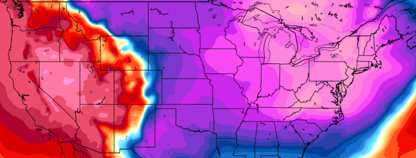
The cold front and any remaining precipitation should be moving quickly off of the coast on Friday morning, leaving much colder temperatures and gusty winds in its wake. Fresh Polar air will be blasting through the East during the morning and early afternoon hours, easily making Friday the coldest day for at least a week. The combination of the fresh Polar airmass, dry mid levels, and gusty winds will leave highs in the lower to middle 20’s with upper teens likely off the north and west. There may be some isolated strands of snow showers during the afternoon hours on Friday due to the upper level trough being directly overhead. These snow showers may be capable of temporarily reducing visibility, but any accumulations should be insignificant. Friday night will be a very cold night as an area of high pressure builds just to our south overnight, allowing for near-perfect conditions for radiational cooling to take place. Expect for lows to drop down in the lower to middle teens across the NYC metro area, with single-digits likely off to the north and west.
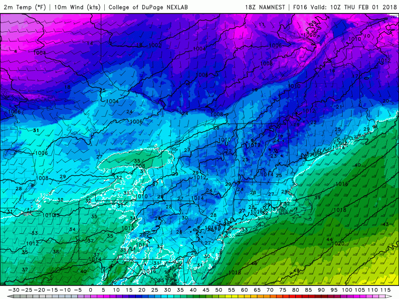
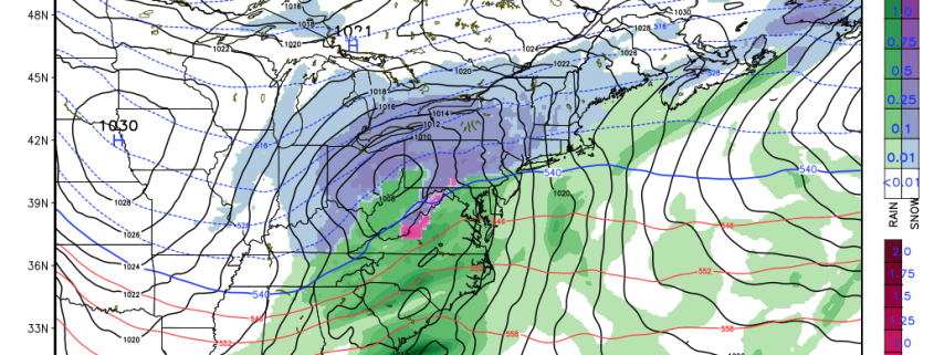
This afternoons high resolution NAM model showing the passage of a cold front and the impressive Polar airmass looming behind it
A Messy Super Bowl Sunday Possible Across the East
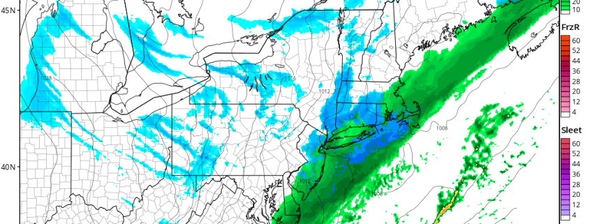
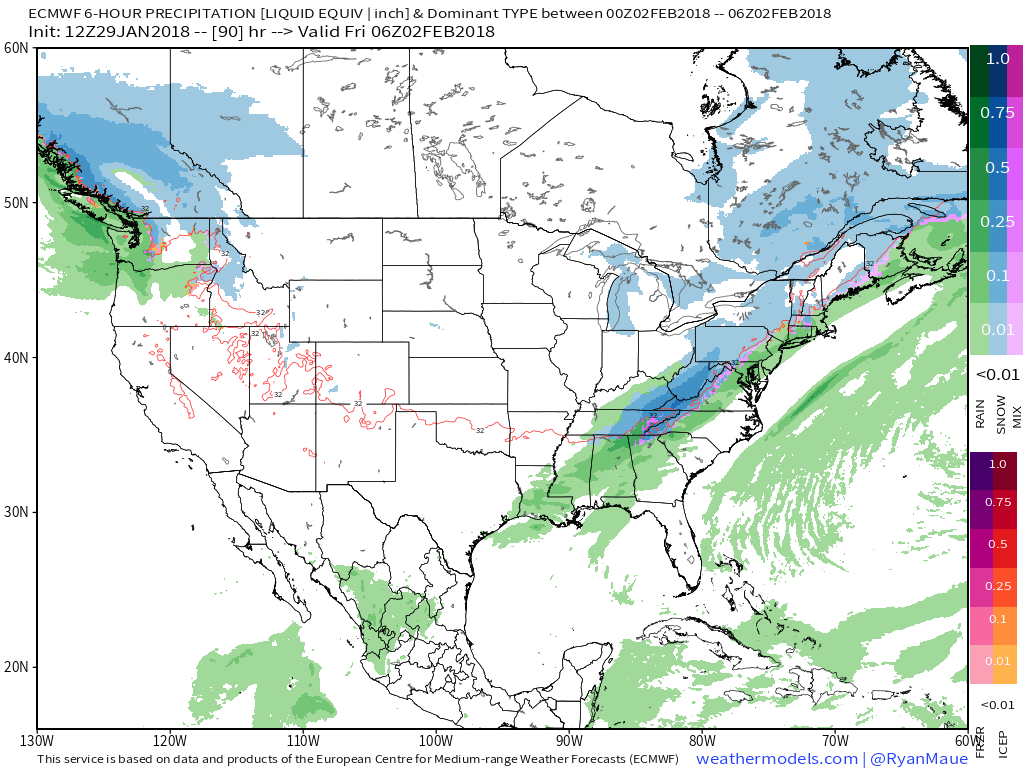
Surface high pressure will continue to dominate the weather over the east coast on Saturday with clear skies and cold temperatures. Highs will likely be a couple degrees warmer than Friday, but still in the middle 20’s to lower 30’s across the entire Northeast. As we head deeper into the day on Saturday, the bigger story becomes focused on energy diving into the Plains states as our high pressure begins to retreat to the east. As the high leaves us, southerly flow will begin to overspread the region as a low pressure begins to form over the Ozarks. Temperatures will begin to rise steadily on Sunday as the low pressure system approaches from the southwest, leaving the majority of the Northeast above freezing. At this time, it appears likely that precip will start later in the afternoon on Sunday, becoming rather steady by the evening hours. As of right now, this setup does not look to be supportive of widespread snow at all due to the lack of a high pressure to the north to provide some kind of cold. Additionally, this system will be moving very quickly as the mid level energy remains broad and disorganized. For now we expect mainly rain on Sunday, with the possibility of a changeover towards the end of the evening. We will continue to monitor the progress of this system carefully over the next couple of days and provide updates when necessary!
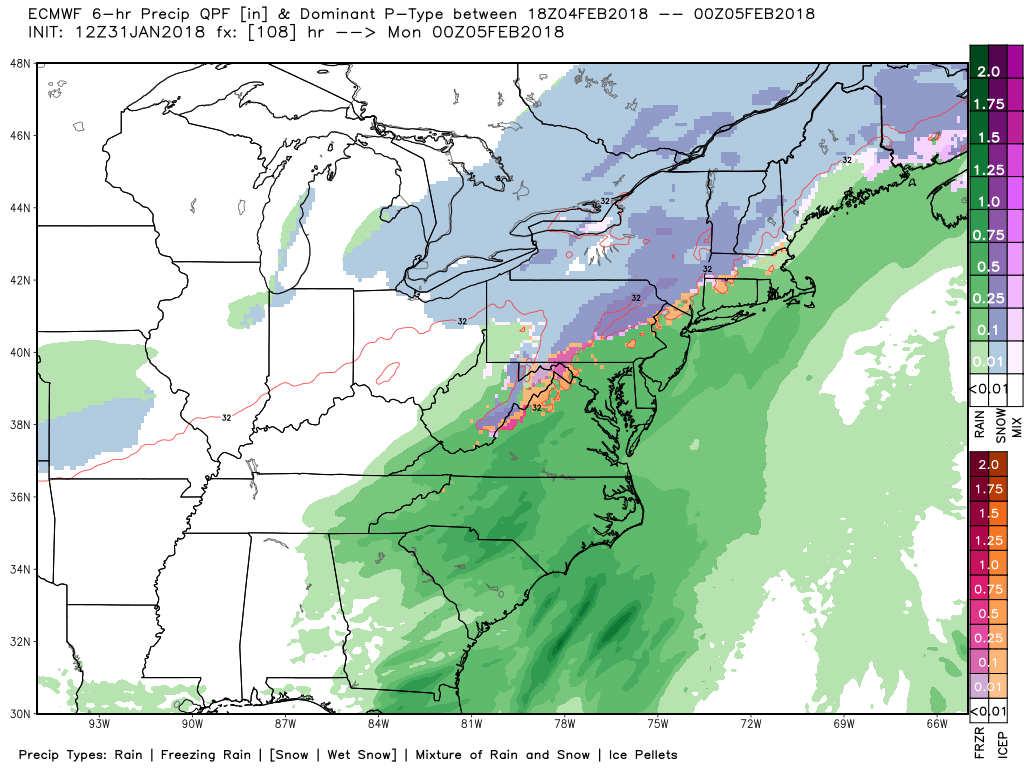
This afternoons European model showing a rainy Sunday evening across the NYC metro area, with some snow off to the far NW regions
Have a great night!
Steve Copertino