Good evening!
Today has been another cold, but seasonable day across the entire Northeast as an area of high pressure continues to push off the Mid Atlantic coast this afternoon. Mid level heights have been rising over much of the East coast ahead of a large, but a disorganized mass of energy moving through the central Plains over the past 24 hours or so. These mid level height rises have allowed warm mid level temperatures to move in from the south and over much of the Mid Atlantic region and Northeast, which is the beginning of a more above-normal airmass arriving. With relatively clear skies, stout southerly mid level flow, and light surface winds, we were able to see much of the Northeast rise up into the middle to upper 30’s, with locations off to the south seeing highs get back into the 40’s. Generally clear and calm conditions will exist into for the rest of the evenings and into the overnight hours as dry air exists throughout the low to mid levels of the atmosphere. We should see low temperatures drop a good deal this evening as high pressure remains in control for the most part. Winds will be light from the south, and when coupled with cool and dry mid levels of the atmosphere, we should see readings range from the lower to upper 20’s across much of the NYC area, with lower to middle 30’s possible over southern New Jersey.
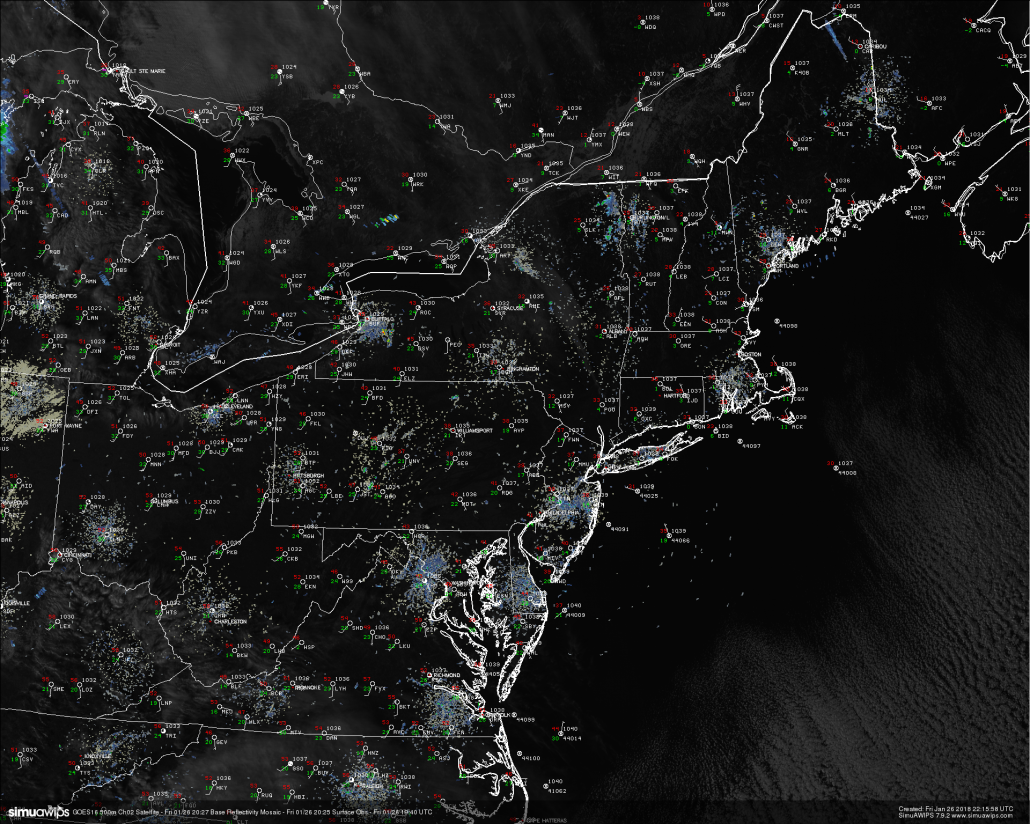
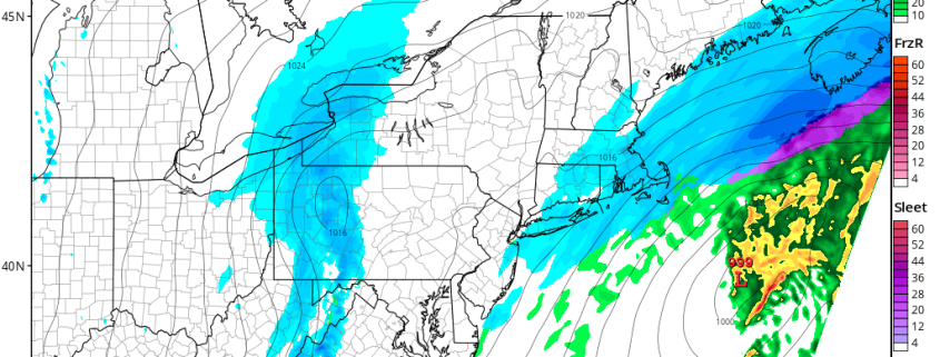
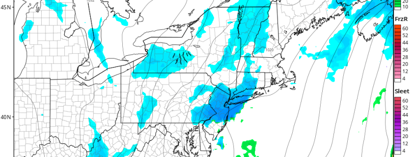
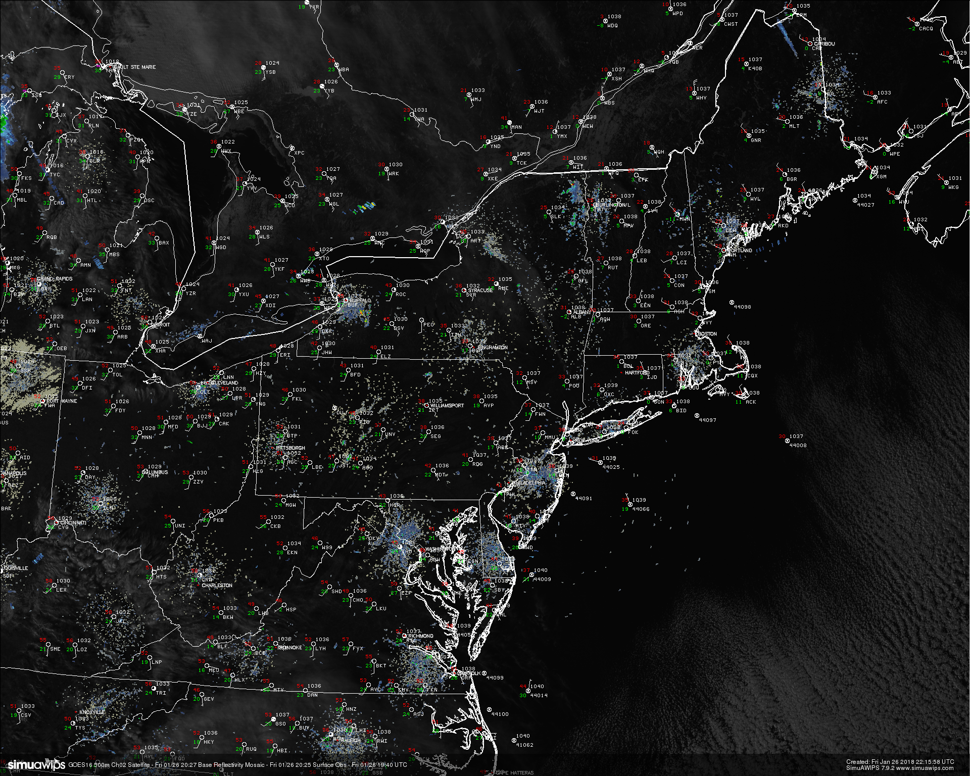
This afternoons latest high resolution visible imagery, regional radar mosaic, and surface observations showing a cold, but seasonable day across much of the Northeast
This Weekend
Saturday will likely start off as another cold and clear morning as the area of high pressure off the Mid Atlantic coast hangs on for control of the weather for our area. Stout mid level flow from the southwest will continue to pour in from the southern Plains, which will finally cause surface temperatures to respond in a big way. The combination of clear skies, southerly winds and stronger mid level flow should cause highs to get into the middle to upper 40’s across much of the region, with some locations likely breaking into the lower 50’s during the afternoon hours. This will be quite a bit above normal for this time of year and should make for an excellent day to spend outside. Calm and warm conditions will last through the late afternoon hours and into the evening as the mid level ridging begins to wane to our east. As the mid level ridging backs away, a cold front will begin to make its way into the Northeast by 8-10pm. Cloud cover should rapidly begin to increase as moisture streams in from the south and begins to saturate the lower levels of the atmosphere. Showers should gradually overspread the Northeast overnight, with more steadier rain working its way from west to east by around 2-4 am. Though this front will have Gulf moisture linked to it, the moisture content will not be all that deep, so precip rates and amounts should generally remain in the light to moderate range. We could also see some gusty winds ahead of the front, with winds clocking in around 20-35 mph at times.
Light to moderate rain should last into the early morning hours of Sunday as the cold front continues to move rapidly from west to east. By the afternoon hours the front is expected to be located offshore and we should begin to see dry air from the west begin to fill in behind the front. This should lead to gradually clearing skies and a more westerly/northwesterly winds for the remainder of the day. As skies clear, we should still see temperatures be capable of rising into the lower to middle 40’s with some locations seeing highs in the upper 40’s once again due to warmer low level air lingering around. Sunday night should be rather pleasant as continued clearing and winds from the northwest will remain prevalent over the Northeast.
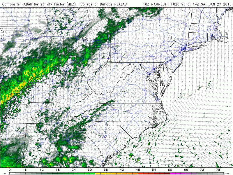
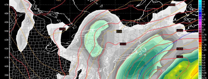
This afternoons high resolution NAM model showing the progression of the cold front progged to move across the Northeast from Saturday night and into Sunday
Watching the Coast on Monday and Tuesday
Things turn interesting starting Monday morning as mid level energy begins to dive into the southern Plains and Ozarks as an area of ridging begins to amplify over the West coast. As this area of energy continues to dig to the south and east, a healthy upper level jet streak will begin to develop overhead. This will promote the development of precipitation off of the southeast coast, which will in turn help to form a weak area of low pressure moving to the northeast by late Monday afternoon. What happens from this point is highly uncertain at this time, but there do appear to be two scenarios that stick out at this time. The first scenario is that the energy in the Tennessee Valley is not far enough south and compact to support the weak area of low pressure strengthening close to the Mid Atlantic coast. In this scenario, the upper level jet streak would be the main driving feature for any precipitation, which would likely be confined to the immediate coast and should be light in nature by Monday night and into Tuesday morning. The next scenario is that the area of energy is stronger and more amplified that what the current computer models are showing, therefore allowing the development of a stronger low pressure system close to the Mid Atlantic coast. As the storm strengthens, the already favorable upper level jet streak would enhance precipitation over the Northeast and some locations could be looking at a light to moderate snowstorm from Monday evening and into Tuesday afternoon.
As of this afternoon, the models are not in agreement with one another, with a wide variety of scenarios being shown. Given the lack of upstream blocking to slow down the mid level energy and allow the low to strengthen, this would usually be a pretty cut and dry forecast, however we have seen a very distinct trend this Winter where snowstorms like to trend more amplified and closer to the coast inside of two days. As of right now we are leaning on the side of caution and using a blend of some of the models that have been performing particularly well this winter. Henceforth, there is a possibility of accumulating snow along coastal and interior locations late Monday evening and into Tuesday. Amounts should generally be light, with coastal locations likely seeing a period of mixing due to the weaker nature of the low pressure system.
However, we must say that there could be some significant model shifts in the next 48 hours that could potentially bring more moderate snow into play, and therefor we will be closely monitoring this system so make sure to check back for updates!
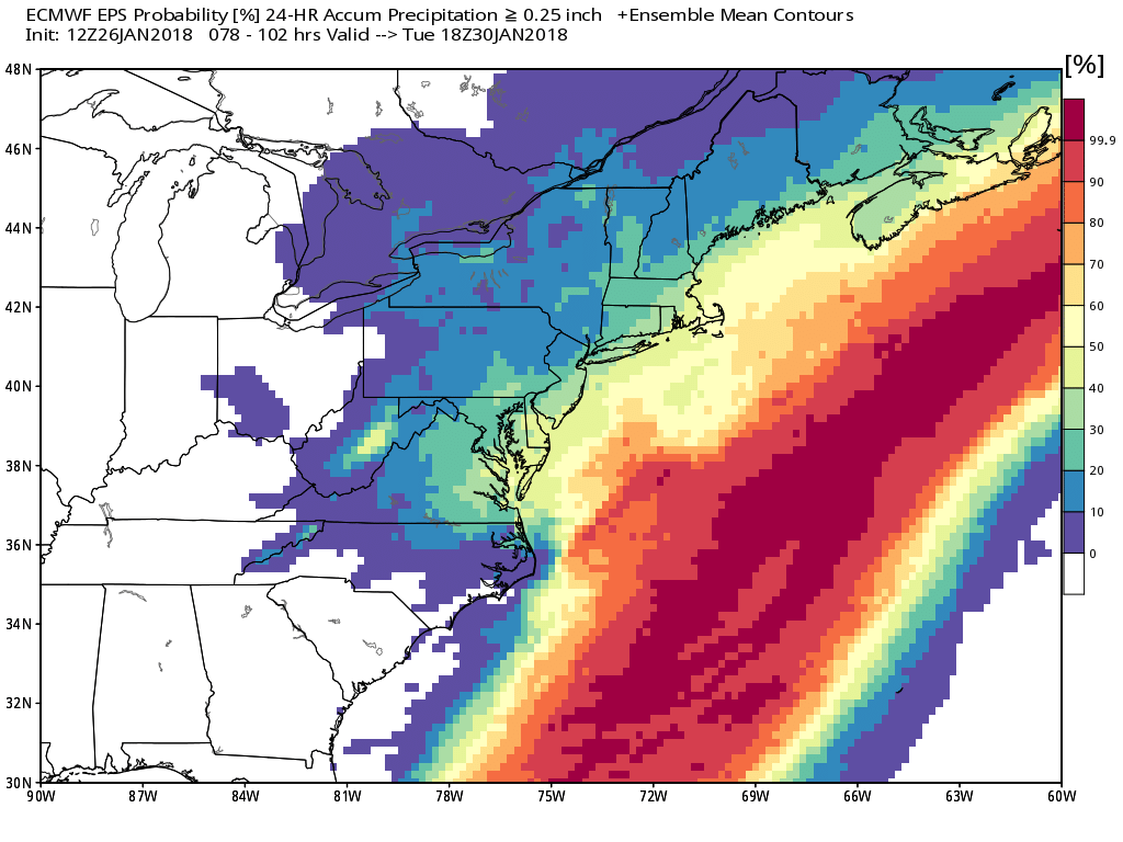
This afternoons European Ensembles showing a low-medium potential for a moderate impact from the potential coastal low on Monday night
Have a great weekend!
Steve Copertino
-2")