Good evening!
Today has been a rather dreary and cool day across the entire Northeast as sharp trough over the Plains continues to send weak mid level energy east, and into our area. This mid level energy had been responsible for mostly cloudy conditions with some light to moderate showers passing through the Mid Atlantic states most of the day in association with a weak warm front at the surface. Despite the occasional light showers and drizzle, it appears that the best lift for sustained rain will be off to our south and west, so mainly cloudy conditions with a chance at some light showers and drizzle will be commonplace across the majority of the Northeast. Mostly cloudy skies and a rather marginal airmass have allowed temperatures to climb into the lower to middle 50’s across much of the New York Metro area, with some locations closer to the coast and off to the north and west staying in the middle to upper 40’s. Temperatures should remain slightly above-normal through the overnight hours, with lower to middle 40’s likely, due to the thick cloud cover. Some, cooler lows in the middle to upper 30’s are possible for interior locations, though the overall theme of the evening will remain the same.
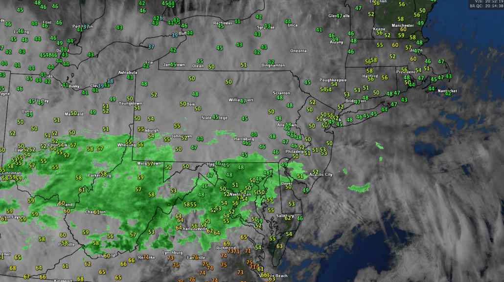
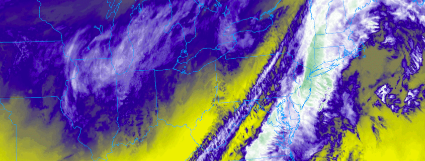
This afternoons visible satellite imagery, regional radar mosaic, and surface temperatures, showing a rather gloomy day across the Northeast.
Thursday and Friday
Thursday morning should start off rather mild and cloudy, as the same upper level trough over the Central US continues to draw closer to the Northeast. As it does so, mid level lift should begin to increase over the Mid Atlantic and Northeast, providing a better chance at some more showers, likely starting during the late morning hours and into the afternoon. As the day continues on tomorrow, an area of high pressure off the Southeast coast will begin to press up against the incoming trough to our west and provide some impressive warm air convection into portions of the Mid Atlantic and over southern New Jersey. While conditions are likely to remain mostly cloudy throughout the afternoon, the cloud deck may thin just a bit over this region, allowing just enough mixing to bring in some much warmer highs tomorrow afternoon. This warmer mid level airmass from the south will also work into the Northeast, but will be moderated somewhat by thicker cloud cover and mid level moisture. Expect highs to get into the lower to middle 50’s across much of the New York City metro area, with lower to middle 60’s possible across portions of Southern New Jersey and Pennsylvania. We should see the surface low pressure system begin to strengthen a bit over portions of the Ohio Valley tomorrow evening, which will likely drag another warm front through the Northeast.
As of right now, it looks like mid level ridging off the southeast coast will be just strong enough to bump the plume of moisture extending from the Gulf of Mexico and into the Northeast just off to our north and west tomorrow night. Most of the NYC area should remain generally quiet, with the exception of some isolated light to moderate showers passing from southwest to northeast. Lows will be quite mild tomorrow night, with readings in the NYC metro staying in the middle to upper 40’s. Further south, lows will likely remain in the lower to middle 50’s thanks to the increased warm air advection.
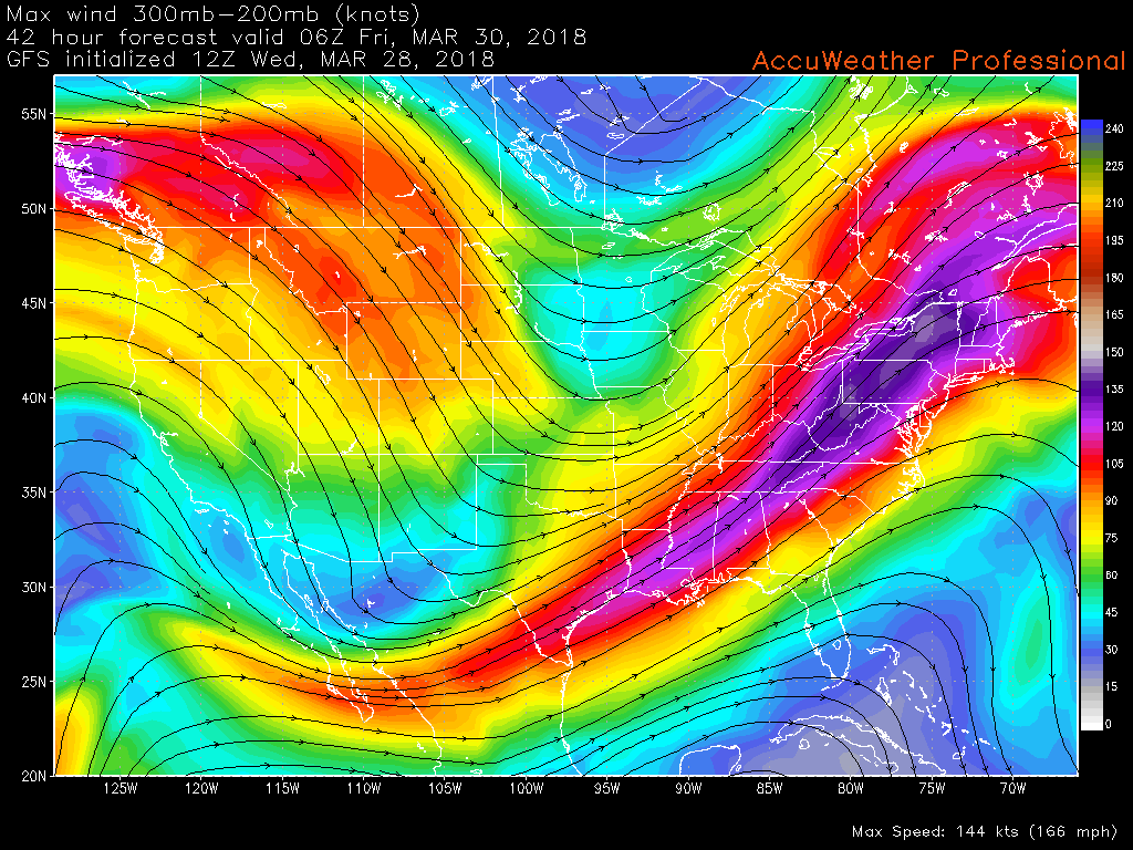
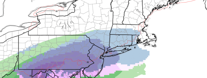
This mornings GFS model showing an impressive and expansive upper level jet streak extending from the Gulf Coast and into Canada. This upper level jet will have the potential to enhance dynamics and create some potentially heavy downpours on Friday morning.
It appears that the surface cold front will be over Central Pennsylvania by the very early morning hours of Friday, with warm and moist air filtering into the region from the south. Surface low pressure should be over portions of Central New York by 8am, with increasing lift and moisture over the Metro area. In response to this increasing lift and marginally unstable airmass, some of the higher resolution models have been developing an area of heavy showers and thunderstorms over the Mid Atlantic, which eventually could impact the AM commute on Friday. Severe weather Friday morning is highly unlikely unless the timing of this system dramatically changes in the next 48 hours, however, some heavy rainfall, gusty winds, and thunder are all possible if we see the development of convection along/ahead of the cold front Friday morning. The surface cold front should clear the Northeast by the mid to late afternoon hours on Friday, but it appears that the Northeast will likely remain at least partly cloudy for the remainder of the day on Friday. Highs will likely be reached during the morning hours, but temperatures should drop back down into the middle to upper 40’s-with some 50 degree readings likely. The main upper level energy looks to pass over the Northeast on Friday night, so expect some showers to gradually make their way through as this upper level system begins to finally exit the country. Conditions on Friday night should be much colder than the previous two days, with lows likely getting down into the lower to middle 30’s over much of the Metro area. Areas well to the north and west will have the chance to drop below freezing, making for a much below average night across the area.
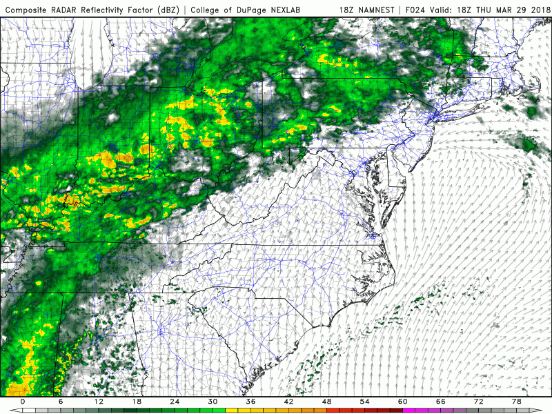
This afternoons NAM model showing the potential evolution of the storm system off to our west
Winter Weather…in April?!
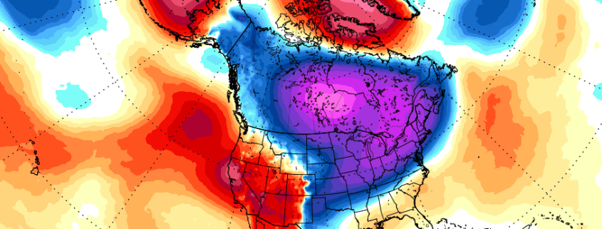
The short answer to this questions, is yes, its certainly possible. It has happened a few times in the past, with some major snowstorms taking place during the first half of April. Of course we aren’t saying that a major snowstorm is likely during the next two weeks, but if you haven’t checked already, Doug Simonian wrote an excellent article yesterday as to why its looking like we may have to watch this upcoming pattern closely. Jumping right into things, it looks like we’ll have another high-latitude blocking episode take place over portions of Greenland and into central Canada by the middle of next week. However, unlike the previous blocking period in mid-late March, we’ll have much more cooperation from the Pacific side of things, as an area of ridging sets up over the Aleutian islands. We know that a negative NAO helps significantly when it comes to slowing a pattern down and creating the chance for a snowstorm, but why is the Pacific a big deal? Well, in short, a ridge just to the west of Alaska helps to funnel cold air down directly from the Arctic. This is crucial when looking for any kid of Spring snow in the Northeast, as there are many things working against snow during this time of year, and a fresh Arctic airmass would certainly help provide the cold air. We expect the major synoptic players will be present by early next week, but as Doug stated in his post, we usually have to wait until these features are beginning to wane to really get a shot at yet another snowstorm for the East.
While nothing is a lock this far out regarding snow, it does appear that we are heading back into a more wintry pattern next week, starting with much colder than average temperatures for this time of year. We’ll have to see how things progress over the next couple of days, but I would not be surprised at all if we we’re once again talking about a snow threat within the next 7-10 days. We will continue to provide updates on this pattern as more information comes in!
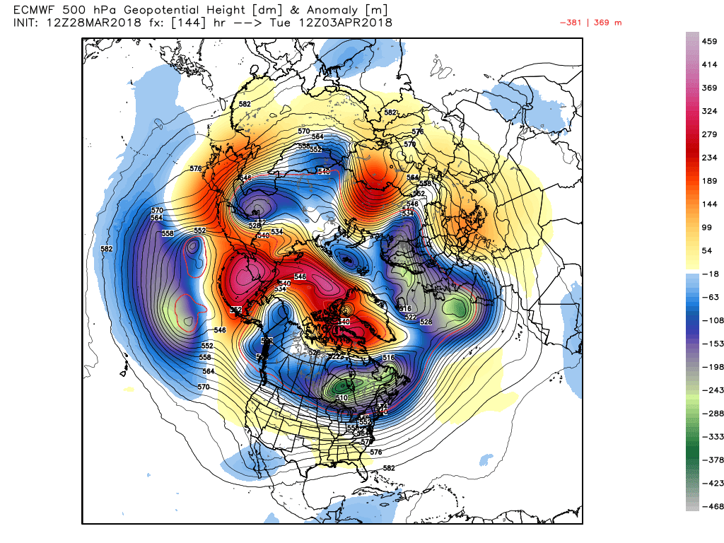
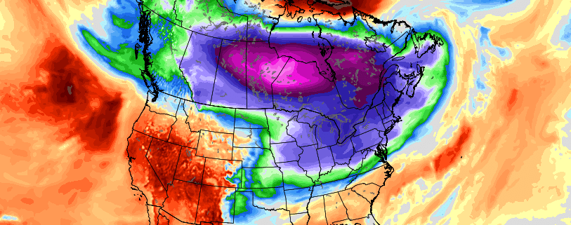
This afternoons ECMWF model showing a very impressive pattern for cold and some potential snow beginning to take shape as early as next week
Have a great night!
Steve Copertino
-2")