Weekend Outlook: A brief respite from anomalous heat

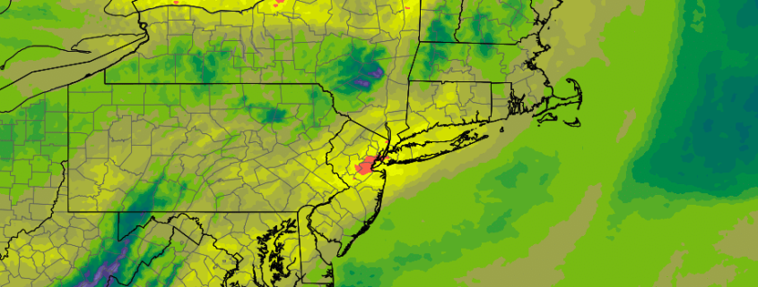
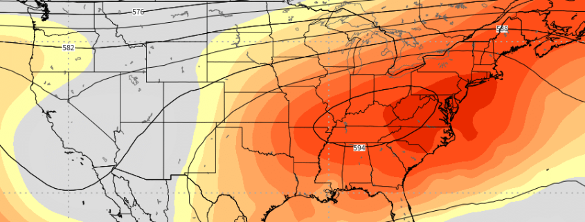
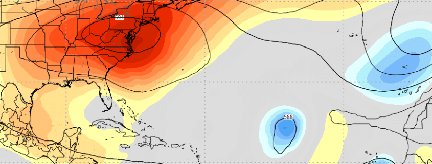
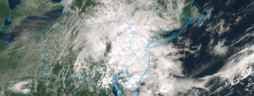
Cloudy, drizzly, and cool weather has taken over today throughout the Mid Atlantic and Northeast states, with the exception of far northern New England. The cooler weather comes as a welcomed break from oppressive heat and humidity, which to this point has become a steady feature in the areas weather during the second half of August. With meteorological Autumn set to begin on Saturday, many are turning their attention to the potential for cooler, more crisp airmasses. They will have to wait, as heat will return once again next week.

To back up for a moment, the weather for the remainder of today looks cloudy, wet, and cool. Temperatures will actually run below average for the first time several days, thanks mostly to showers and clouds. As a disturbance continues to shift by, models suggest sporadic periods of rainfall are possible into Saturday morning.
Read more

You just experienced one of NYC’s most humid summers ever

Meteorological Autumn is set to begin in just a few short days on September 1st. As we wrap up meteorological summer here in NYC, it is hard not to consider feeling like we have sweat through our shirts every day since June. The crazy thing is – such a thought wouldn’t really be an exaggeration. This has been one of the most humid summers on record in the NYC Metro Area, and throughout the Mid Atlantic and Northeast states for that matter.

The numbers are staggering. Kennedy International Airport (JFK), for example, has spent nearly 1000 (one thousand) hours with a dew point over 70 F this year. LaGuardia Airport (LGA) checks in at around 550 hours. Central Park (NYC) clocks in well over 650 hours. The same goes for Newark (EWR) with well over 600 hours of dew point temperatures over 70 F. All of these numbers are roughly double the average over the past 30-40 years.

Read more

PM Update: Heat continues, to be followed by more heat

Temperatures soared into the middle and upper 90’s today throughout the New York City area and, in fact, a large majority of the Northeast states. The heat was good for some records during the day (daily record at Islip, NY) and at night (many record warm overnight low temperatures were set). The temperature wasn’t even the real issue with the uncomfortable air – it was the dew point, which hovered in the low to middle 70’s.

Not much improvement is expected through the evening. Temperatures will remain very warm and dew points will remain very high, leading to another uncomfortably warm evening. Through tonight, a blend of weather models suggests the temperature will only fall into the upper 70’s or lower 80’s in and around the New York City metro area, which suggests record warm overnight low temperature records will be broken for the day again.

Read more

Ridge over troubled waters: Tropical Atlantic ready to wake up

It has been a long, quiet summer. While heat and humidity have been recurring forecast themes in the Eastern and Central United States, the weather pattern throughout the tropical Atlantic has remained stagnant, if not dormant. There have been a myriad of factors that have contributed to a very quiet start to the season in the Atlantic – ranging from Saharan dust to anomalously cool sea surface temperatures and everything in between. Over the next week or two, however, the pattern is set to change and the implications could be notable.

The 2018 Atlantic hurricane season got off to a fast – and in retrospect, ironic – start with Alberto on May 25th. There have been a few other storms that have meandered around since then (the most notable being Hurricane Chris) but the season has thus far been sporadic at best. It can be more accurately defined as unusually quiet. The weather pattern in place has been arguing vehemently against the development of any tropical cyclones in the Atlantic, specifically in the MDR (Main Development Regions). Sinking air, Saharan dust, and unfavorable wind shear have all been major contributing factors, and unusually cold sea surface temperatures have made the environment even more hostile. 30-Day Accumulated Cyclone Energy (ACE) was running near or below the 25th percentile.

Read more