NYC Area Forecast: Strong storms possible today, cooler weekend

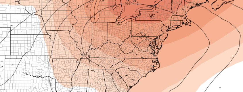
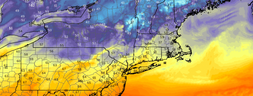
Heat and humidity are expected to reach a relative peak today in the Mid-Atlantic and Northeast states, with rising dew points and temperatures leading to oppressive Heat Index values once again. The National Weather Service has extended the Heat Advisory (which was already in place) into Thursday evening, with Heat Index Values expected to rise near 100 F in many areas from New Jersey into the NYC Metro Area and Connecticut.

As you may be aware, the Heat Index value is a function of both temperature and dew point, and although temperatures will reach the lower 90’s later today the main story will be the dew points. They’ll rise well into the 70’s, which will leave the airmass feeling hot, thick and sticky. It will also be unstable as a result, and with a frontal boundary approaching during the afternoon, the instability will serve as fuel for the development of thunderstorms.

Read more

Florence strengthening, track close to USA still possible

Hurricane Florence is still a few thousand miles away from land in the Atlantic Ocean, but forecast models have been throwing up all kinds of red flags in regards to her potential track – and impacts – over the past 48 hours. The systems eventual evolution remains incredibly complicated, modulated by several different features in the mid and upper levels of the atmosphere – and likely will not become clear for several days. Still, trends and ensemble signals have become more worrisome over the past few days in regards to Florence’s eventual future.

The system is currently located in the open Atlantic Ocean, 1210 miles away from the Northern Leeward islands. Florence is a Category 2 hurricane on the Saffir-Simpson scale, still shy of Major Hurricane status, but strengthening. It is doing so despite a relatively unfavorable environment, with sub-ideal sea surface temperatures and light to moderate wind shear. Forecast models have largely underestimated the systems intensity thus far.

Read more

PM Update: Heat continues, brief respite expected this weekend

The Heat Index reached well over 90 F in the NYC Metro Area again today, and the temperature reached over 90 F for the 20th time this season in Central Park. It was another oppressive day, and the weather pattern that has been providing those temperatures is expected to continue for the next few days. Heat and humidity will be commonplace, and although temperatures on Wednesday will be several degrees cooler than today, the humidity levels will still make it uncomfortable.

Opportunities for showers and thunderstorms will begin to increase late week, and thereafter we anticipate a brief respite in the heat. Brief will be the most significant aspect, once again, as the heat and humidity look likely to return again in the Days 7 to 10 time frame. The pattern overhead is stagnant, and it doesn’t look to be going away any time soon.

Read more

NYC Area Weekly Planner: Heat & Humidity Returns This Week

Happy Labor Day! We hope you have been enjoying the last holiday weekend of the summer. We saw a break from the heat and oppressive humidity over the last few days, but heat will return again early this week as another strong ridge builds over much of the Eastern US. Although the heat and humidity won’t be quite as oppressive, it will still be uncomfortable. For more details, read on!

Read more