PM Update: Heat continues, brief respite expected this weekend

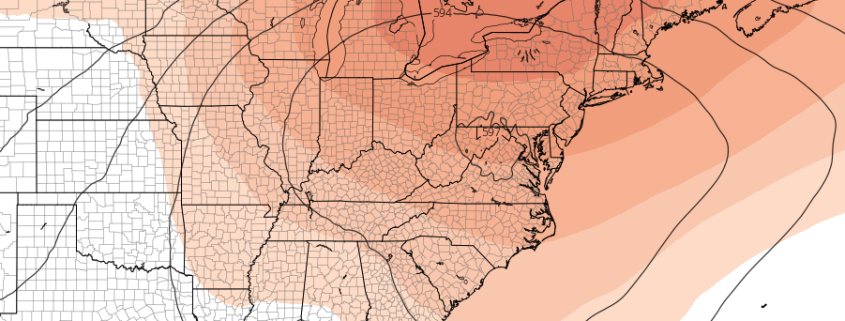
The Heat Index reached well over 90 F in the NYC Metro Area again today, and the temperature reached over 90 F for the 20th time this season in Central Park. It was another oppressive day, and the weather pattern that has been providing those temperatures is expected to continue for the next few days. Heat and humidity will be commonplace, and although temperatures on Wednesday will be several degrees cooler than today, the humidity levels will still make it uncomfortable.

Opportunities for showers and thunderstorms will begin to increase late week, and thereafter we anticipate a brief respite in the heat. Brief will be the most significant aspect, once again, as the heat and humidity look likely to return again in the Days 7 to 10 time frame. The pattern overhead is stagnant, and it doesn’t look to be going away any time soon.

Read more

NYC Area Weekly Planner: Heat & Humidity Returns This Week

Happy Labor Day! We hope you have been enjoying the last holiday weekend of the summer. We saw a break from the heat and oppressive humidity over the last few days, but heat will return again early this week as another strong ridge builds over much of the Eastern US. Although the heat and humidity won’t be quite as oppressive, it will still be uncomfortable. For more details, read on!

Read more

The Tropical Atlantic is awake: Latest on Gordon and Florence

Happy Labor Day, friends! We hope you are able to enjoy it with family and friends. As expected for quite some time, the tropical Atlantic has emerged out of its slumber as we move into the early part of September. Long range forecast models and the synoptic pattern progression in the atmosphere did a great job of signaling this potential. Earlier this morning, Tropical Storm Gordon formed over the upper Florida Keys. Gordon is expected to move northwestward into the Gulf of Mexico in the coming days.

Meanwhile, Tropical Storm Florence continues on its slow and steady trek into the Atlantic Ocean. The initial suggestion that Florence would track harmlessly out to sea is, well, no longer the only suggestion. The storm system is set to encounter a very complicated path as it moves into the Atlantic – and it may find itself precariously close to the Eastern United States in a weeks time.  Read more

Weekend Outlook: A brief respite from anomalous heat

Cloudy, drizzly, and cool weather has taken over today throughout the Mid Atlantic and Northeast states, with the exception of far northern New England. The cooler weather comes as a welcomed break from oppressive heat and humidity, which to this point has become a steady feature in the areas weather during the second half of August. With meteorological Autumn set to begin on Saturday, many are turning their attention to the potential for cooler, more crisp airmasses. They will have to wait, as heat will return once again next week.

To back up for a moment, the weather for the remainder of today looks cloudy, wet, and cool. Temperatures will actually run below average for the first time several days, thanks mostly to showers and clouds. As a disturbance continues to shift by, models suggest sporadic periods of rainfall are possible into Saturday morning.
Read more