NYC Area Forecast: Strong storms possible later today

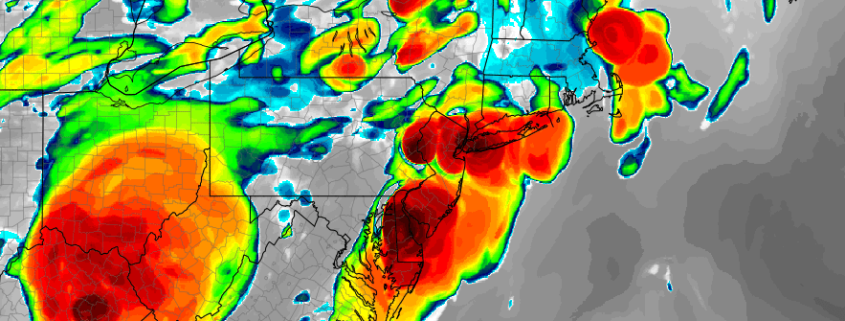
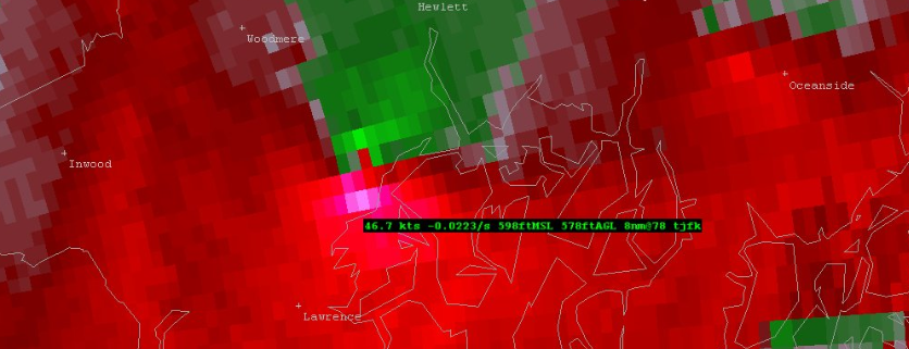
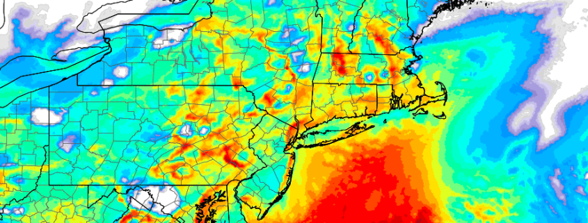
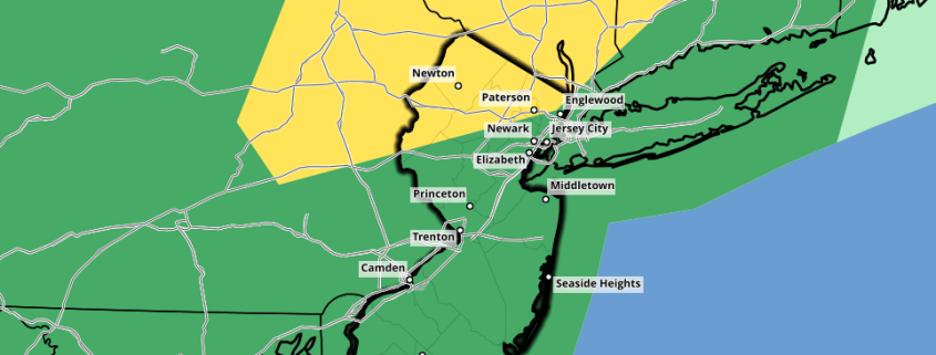
In what seems to be becoming a bi-weekly occurrence, strong thunderstorms are again possible throughout the Northeast later today. In all seriousness, another frontal boundary approaches this part of the country today – the second this week to do so with some vigor. The airmass ahead of it is once again expected to be humid and unstable, and the lift associated with a pre-frontal disturbance will be significant enough to aid in thunderstorm development later today. SPC has placed parts of the Northeast in a Slight Risk for severe storms later today and tonight. 

As is often the case with thunderstorm events, the devil is in the details – and the details are uncertain. The latest observations this morning suggest that forecast models were a bit over-aggressive with their depiction of morning showers and thunderstorms across the Northeast. This is both good and bad news; it means a drier and more pleasant morning, but it allows the atmosphere to become more unstable later today.

Read more

NYC Forecast: After the heat, strong storms possible Friday

Update [500pm]: The SPC has upgraded Friday’s severe weather threat to a Slight Risk (Level 2 on a scale of 5) in parts of New England including Northern NJ and Southeast NY. The main threats with severe storms will be lightning, gusty winds and heavy rain. We’ve got more below. Previous post follows:

Another day, another Heat Advisory! If it hasn’t been the heat lately, it has been flooding rains and lightning. So we’ll take the quiet, hot days while we can get them I suppose. Thursday will be another one of those, with temperatures into the 90’s during the afternoon hours and heat index values getting up there as well.

The NWS has issued another Heat Advisory through Thursday night (there have been a lot of those this summer), and an Air Quality Alert is also in effect. Translation: Take it easy out there. Limit outdoor exposure if you can, and be sure to remain hydrated if you’re outdoors for a prolonged period. As always, keep a close eye on children, the elderly, and pets.

Read more

Not just scud: It was a wall cloud over Nassau county Tuesday

Tuesday evening, strong to severe thunderstorms moved through Eastern New Jersey and towards New York City. In fairly typical fashion, they also proceeded eastward toward Western Long Island before emerging into the Atlantic waters and weakening. The storms were particularly intense in terms of lightning, and even produced some strong wind gusts throughout the New York City Area. Unfortunately, three people were struck by lightning in the 5-Boros. We are awaiting further information on their status, but all three have been hospitalized.

Also notable was a brief area of rotation in one of the stronger storms over Queens and Nassau counties. If you weren’t paying close attention, you may have missed it. In fact, even using Doppler radar out of Upton, NY (KOKX) or Mount Holly, NJ  (KDIX) wouldn’t necessarily have keyed you in to the rotation. But a zoom into Terminal Doppler Radar Data (TDWR) out of JFK Airport revealed something more interesting.

Read more

NYC Area Forecast: Additional strong storms possible later today

Strong and severe thunderstorms moved through parts of the Northeast states on Tuesday evening, producing frequent and dangerous lightning as well as strong, gusty winds and torrential rain. There was even a wall cloud spotted in Queens and Nassau counties, as an area of distinct rotation appeared on terminal doppler radar out of Kennedy Airport. This was the third instance of rotating thunderstorms in the NYC area in just over a week.

The threat for strong thunderstorms will continue today as a frontal boundary slowly sinks towards the region. Instability is expected to build once again by this afternoon across the Northern Mid-Atlantic States with ample heating and a continued source of moisture (you may have noticed that it is very humid outside). As better forcing for storm development approaches later today, thunderstorms are expected to increase in coverage once again.

Read more