Video Discussion: Bitter Cold and a Couple of Snow Chances

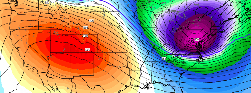
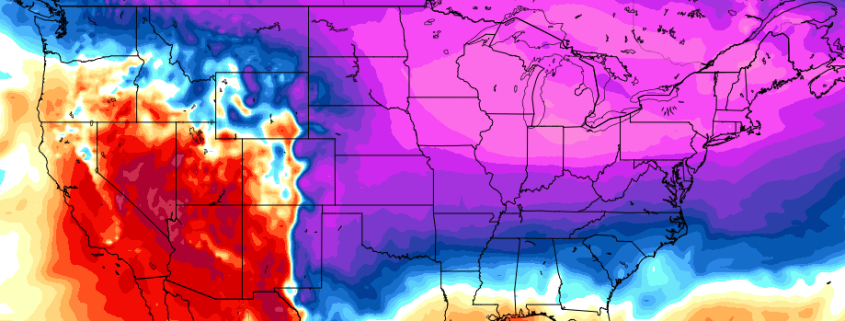
Good evening! The stretch of bitter cold is here and it’s just beginning, with the biggest cold still yet to come. We are going to see multiple areas of large, Arctic high pressure sprawling across the entire US with a bitterly cold air source. These areas of cold and high pressure will be reinforced by departing storm systems, and the shot of cold air on New Year’s Eve will be more impressive than the one we have now.

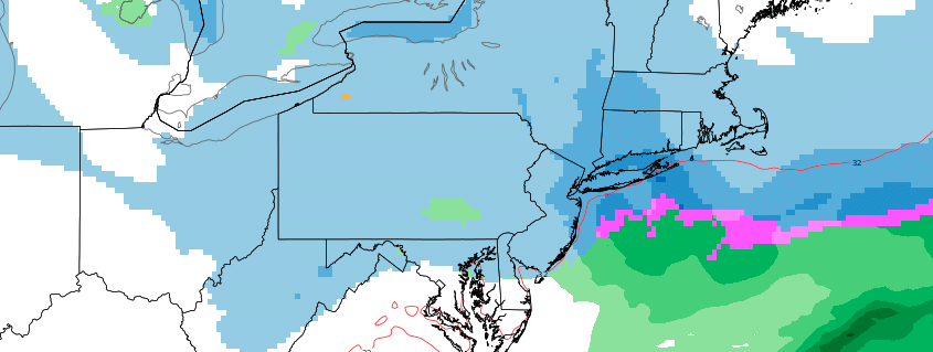
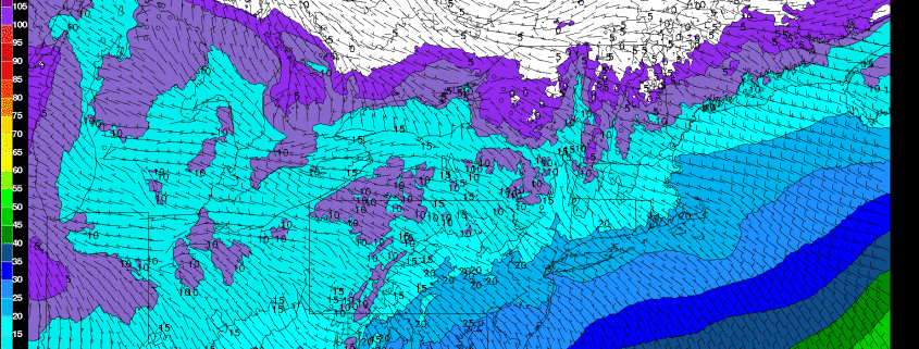
Our latest video breaks down why these Arctic high pressures are so impressive and why this is leading to such extreme cold, and the potential low temperatures that may be realized during this cold stretch. It also discusses the potential for light, fluffy snow from an Arctic wave on Saturday, and the potential for a bigger storm in the January 3-5 period.

The first half of the video is about the storm(s) and the pattern evolution, while the second half of the video is about the cold.

Have a great night!

Weekend winter storm threat lingers in Northeast

We’ve discussed for a few days the threat for wintry weather this coming weekend – and while the evolution of the forecast has changed in the atmospheres mid and upper levels, the threat for wintry weather still does exist. With that being said, forecast model guidance continues to offer little help in regards to consistency and confidence as we move forward. A complicated situation is set to evolve across the Great Lakes and Northeast States this weekend.

An initial disturbance is still likely to drop southward into the Great Lakes, well from the northwest, associated with Pacific energy. It will undercut a piece of what is known as the “tropospheric polar vortex” – or the polar vortex that exists in our troposphere, where we experience most of our weather. The interactions between these two disturbances will be critical, and forecast model guidance is struggling with exactly how the two of them will behave.

Read more

Tuesday PM Update: Frigid temperatures arrive, snow chances ahead

Good evening! Are you cold yet? High temperatures today throughout the Northeast ranged from the 20’s to lower 30’s, well below normal for late December. Even colder weather is on the way for the rest of the week, so get ready to bundle up and dress in layers. A few storm chances will likely follow – and we’ll dive into the forecast model depictions, including which make sense and which don’t.

For tonight, arctic high pressure will build over the Northeast states, supporting mostly clear skies and calmer winds. Temperatures are likely to drop into the teens overnight many areas – some of the interior valleys (including the Pine Barrens) may drop into the single digits. Forecast models suggest the core of this airmass, characterized by 850mb temperatures between -20 and -25 C, will move over the Northeast states late this week. High temperatures will fall all the way into the teens and lower 20’s, with single digit temperatures overnight.

Read more

Tuesday AM Brief: Bitter cold arrives in Northeast, a few storm chances ahead

Good morning and a happy Tuesday to you! Bitter cold has arrived in the Northeast states this morning, in case you haven’t been outside or walked near a window yet. Discussed for quite some time, arctic air has finally surged into the Northern 1/3 of the United States, bringing bitter cold and anomalous temperatures (well below normal in many areas). The worst of the cold is currently situated across the Northern Plains, but is quickly making its move eastward towards the Great Lakes, Ohio Valley and Northeast States.

The National Weather Service has, in fact, issued Wind Chill Watches and Wind Chill Warnings for these areas – which isn’t insignificant, especially given the fact that these watches and warnings are tailored by geographical location. In other words, a Wind Chill Warning in Minnesota has a colder threshold than a Wind Chill Warning in New York City.  Temperatures in Minnesota and the Dakotas will fall below -20 F tonight.

Read more