Posts

Monday Musings: Warmer, unsettled, cutoff low

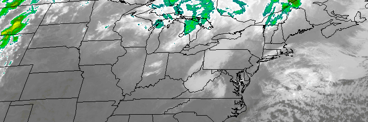
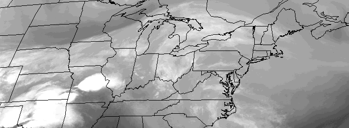
So far, Spring 2016 has been absent, despite calendar arguing otherwise. The trend looks to continue this week, and as we look forward into the medium range, forecast models suggest it may continue even further into next weekend. While we aren’t quite looking at snow, the weather looks likely to be cooler than normal — all thanks to an unsettled pattern through midweek, and then a cutoff low which may impact the area thereafter. The story begins on Monday, as a southwesterly flow brings increasing clouds and the potential for showers.

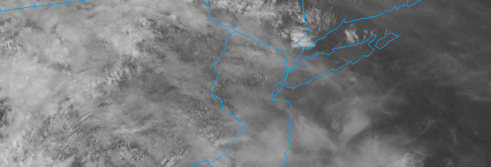
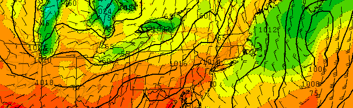
A frontal system will swing through the area on Tuesday, with a period of steady rain possible along the frontal boundary. While the end of the week may be warmer and drier, the potential for a cutoff low exists later this weekend. This idea gains credence given the presence of high latitude blocking, extending essentially from Greenland into the Western Atlantic Ocean, acting like a “wall” to prevent any disturbances from escaping. But, more on that later. Here are the highlights to start the week:

Read more

Warmer Temperatures Return Sunday and Early Next Week

Winter weather is with us through tonight, as temperatures remain quite cool. The good news? Some early spring-like weather is just around the corner, as temperatures will moderate and warm quite a bit on Sunday.

Mid-level height rises and deep southwest flow on Sunday, will help temperatures rise into at least middle to upper 50s with plenty of sunshine. It’s not out the question that some locations, particularly over Central New Jersey, will reach 60 degrees tomorrow afternoon. The southwest winds off the ocean or sound could keep temperatures cooler for parts of Long Island and Connecticut.

Read more

Warmer, muggier to start the week

Regardless of clouds and isolated showers, this weekend ended up being quite pleasant. The sun was out slightly more than anticipated, and heavy/steady rain generally stayed away from the area. So did the big time heat and humidity, and unfortunately the latter will return to the forecast during this week. Humidity values have already noticeably increased as of Monday afternoon, and rising temperatures will make the air feel uncomfortable this afternoon. Scattered showers and storms will be around, but won’t be widespread.

These showers and storms, a function of a transient mid level atmospheric disturbance, will essentially hang around in the forecast for most of the week. While temperatures won’t be “hot” by any means (they’ll top out in the 80’s for the most part), the general airmass will feel uncomfortable and the weather will remain unsettled. Scattered showers and storms will be possible each afternoon within the humid and slightly unstable airmass in place.

Read more

Weekend will bring improving, warmer weather

The stretch of unsettled weather this week brought about temperatures in the 60’s, with an onshore flow and marine air. Plenty of showers marred the forecast from Monday through Friday, and winds off the area waters meant more humid and cool conditions. Although we are fast approaching the summer season, this week felt more like April than anything else. Luckily, the weekend will be the start of improving conditions and a trend toward at least more seasonable temperatures.

Although winds will be variable, and the coast will remain somewhat cooler than surrounding areas, temperatures will warm into the 70’s during the day on Saturday, especially in the interior. The warm sun will be a welcomed addition to the day, after a cloudy start, given the weather we have experienced over the past week. It will certainly feel warmer than it has in a while. Southwesterly winds will eventually try to take over, and bring warmer air into the area as well.

Read more