Public Analysis: Colder air intrudes this weekend, in a sea of warmth

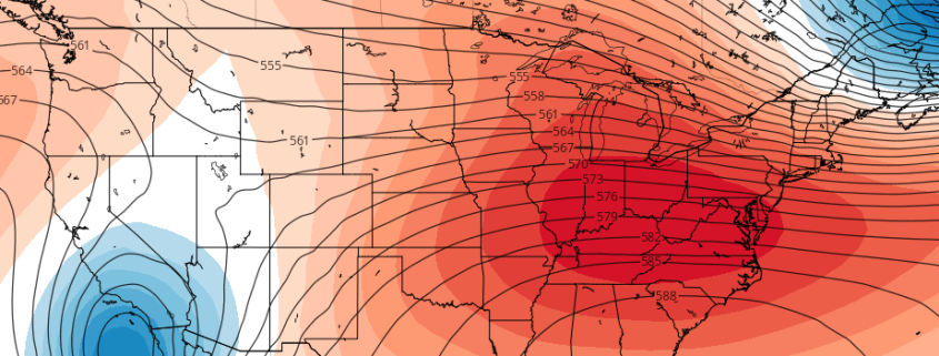
After coming out of frigid airmass early this week, temperatures gradually moderated to above seasonal levels for mid-week period. This is due to more troughiness over the Western United States, and lack of high-latitude blocking, leading to more progressive pattern with a stronger Southeast ridge.

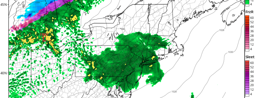
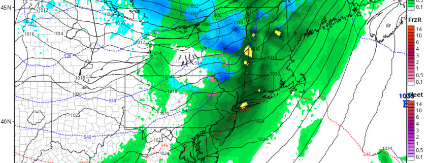
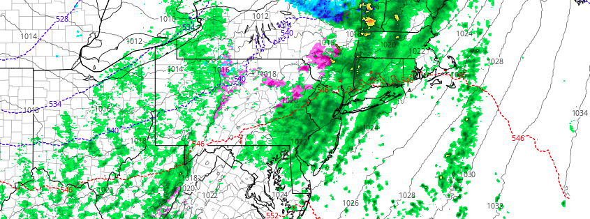
On the periphery of the ridge, the a more southwesterly flow will has allow for warmer airmass to move into Northeast and Mid-Atlantic region. Meanwhile the storm track has shift well to our north and west due the Southeast ridge. This pattern continue will for the next few days. Another low passing over the Great Lakes will push a warm front with some rain likely through the region tonight. Then temperatures tomorrow could rise well into the 50s or even lower 60s, across the area as even warmer airmass moves into region.

Read more

AM Zones Update: More Rain Likely Tonight, Mild on Thursday

More sunshine and dry weather returns today with a frontal system having passed through. Temperatures will remain with highs in the upper 40s to lower 50s. However, some clouds may start increasing again this afternoon, as another low frontal system with low pressure over the Great Lakes moves begins approaching the region.

A warm front with this system will move through region tonight. A strengthening southwesterly low-level will enhance lift and moisture along this frontal boundary. This could to period of steadier rain with briefly moderate to heavy downpours. However, rain will off taper quickly by daybreak tomorrow. So rainfall totals are expected to be mostly under a .50” and not cause any serious flooding issues.

Read more

AM Zones Update: Light snow showers possible this afternoon, then more rain likely tonight

Low pressure tracking over Great Lakes will push a warm front the region late this afternoon and evening. Any sunshine early today will give away to more cloudy skies, as the warm front approaches form the southwest. Some snow showers possible with this front later this afternoon or early evening.If these happen, some light coatings are possible, where temperatures are still below freezing-especially northwest of NYC.

However very dry-air in lower levels, make it difficult for precipitation reach the ground this afternoon. Also lower-level temperatures may warm enough for sleet or rain to mix with in the snow showers. So weren’t aren’t anticipating widespread hazardous travel this afternoon.

Read more

PM Zones Update: Clouds increase, unsettled midweek

After a calm and cold pattern settled into the area over the last 24 hours, clouds began building into the area this afternoon and evening ahead of a developing storm system well to the west of the entire region. This storm will continue building over the next 12 hours, through Tuesday, over the Central United States. A more unsettled weather pattern will build towards the area as the week goes on, with precipitation approaching the area by Tuesday evening.

Much of this precipitation will fall in the form of showers and rain throughout the area, with the potential for some snow and freezing rain over the far interior. In Southern and Central NJ, Long Island and Connecticut zones, however, southerly winds will have taken over the atmosphere before any frozen precipitation can form.

Read more