Weekend Update: Watching another potential snowstorm next week

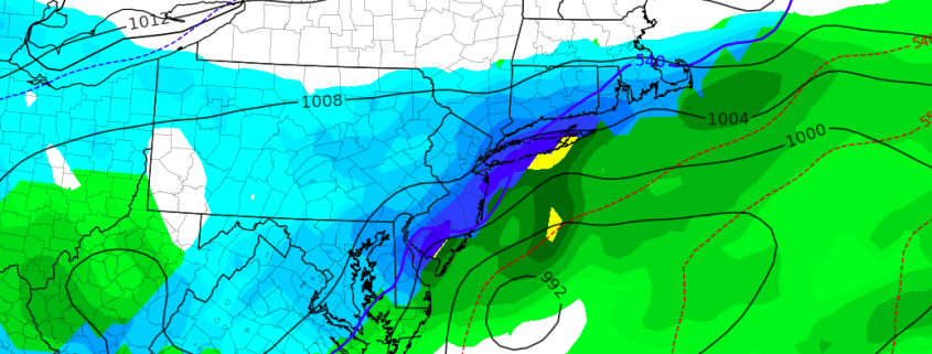
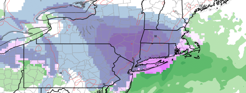
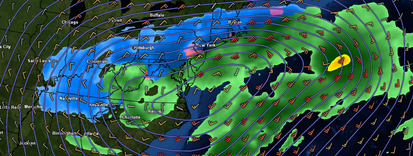
Good morning! We’ve updated our running weekend post to chat further about the weather over the next few days. Calm and pleasant conditions are in place this morning, with temperatures very cold and anomalously cold for this time of year. It will remain cold throughout the day, and through the remainder of the weekend. We’re carefully watching the potential for another significant winter storm during the middle part of next week, but the plot has thickened as model guidance is now not as keen on the storms development.

Cool and Dry Weekend Ahead

Weekend Weather Rating | 5/10 (Fair)

Saturday looks to start off rather clear and cold across much of the Northeast as the northwesterly flow remains intact. An area of mid level energy will quickly pass to the north and east during the day, possibly allowing for some high level clouds to move over the area during the afternoon hours, but the vast majority of tomorrow should be quite sunny. As we move into the afternoon hours, a decaying piece of mid level energy will pass to the south of the Northeast, leaving much of the area dry.  This shortwave will only be capable of dragging a surface cold front through the area as we move later in the day, leaving cold and breezy conditions in its wake. Saturday night will be quite cold, as the surface cold front clears the east. Surface temperatures tomorrow night will drop well into the 20’s once again, with some locations to the north and west of the NYC area possibly seeing lows in the teens!

Read more

NYC Area Forecast: Nicer weekend, winter storm possible next week

Friday’s Weather Rating | 5/10 (Fair)

Friday began with a bit of a different tune than the past few days – although it’s cold this morning, it is not quite as blustery and the risk of snow squalls has been reduced. In other words, the air feels a bit less “wintry”, as the airmass itself begins to modify a bit to its surroundings. It’s still quite cold though and honestly, several degrees below average for this time of year, and you can feel it throughout the majority of the Northeast states today.

The weather over this weekend will remain much colder than average for this time of year. Temperatures are forecast by the European model to run several degrees below normal on both Saturday and Sunday throughout the Northeast states, as arctic high pressure redevelops and aids in funneling cold air southward from Canada. This secondary surge of cold air is being driven by the redevelopment of a Greenland Block, which by this point has become a thorn in the side of many, as it has been the impetus for this late season winter weather surge. Low temperatures tonight throughout a large part of the area will fall down into the mid to upper 20’s and may even reach the teens in some suburbs.

Read more

NYC Area Forecast: Calm weekend, another storm threat looms

Thursday’s Weather Rating | 4/10

Snow squalls and blustery winds have been the tale of the tape here for the past 24 hours as a cold and wintry pattern remains stagnant in the Northeast States. Much of this can be attributed to the powerful Nor’Easter that impacted the region just a few days ago, as it tracked northward and pulled in unseasonably cold air. This will continue for one more day, with snow squalls likely throughout the Northeast states again on Thursday.

Some temporary good news then comes to light as the weekend is expected to be rather quaint. Temperatures will warm up a bit each day as the airmass begins to modify to its surroundings (without a true cold air source anymore) leading to more pleasant and comfortable weather, although temperatures in the Northeast states will still be several degrees below seasonal averages. The lack of storms will certainly be a welcomed addition to the weekend – but it won’t last for long.

Read more

NYC Area Forecast: Improving conditions lead us to midweek

Wednesday’s Weather Rating | 4/10

Okay, take a breath.

Three weeks removed from a large-scale pattern change which featured the development of a classic Greenland Block, we have experienced three Nor’Easters, all of which have been impactful in the Northeast states. As we move towards midweek,  much of the Northeast states will finally catch a break. The departing Nor’Easter will leave blustery conditions with a few snow showers and squalls expected, but overall conditions will improve as high pressure builds in.

Temperatures will remain well below normal, and that will be the theme of the next several days – Cold. Much of this can be attributed to the re-development of another Greenland Block during the next few days, as forecast models suggest the pattern will begin to reload. Greenland Block’s are, in their nature, ridges of high pressure over Greenland and the higher latitudes of the Arctic that dislodge cold air further south into Canada and the Northeast States.

Read more