Snow, sleet and rain all expected to start the week

A prolonged period of benign weather, which has largely dominated the past few weeks, will come to a sudden end this week. Multiple rounds of wintry weather are expected, beginning Sunday Night and continuing through Tuesday Night. The most impactful weather will come on Tuesday morning.

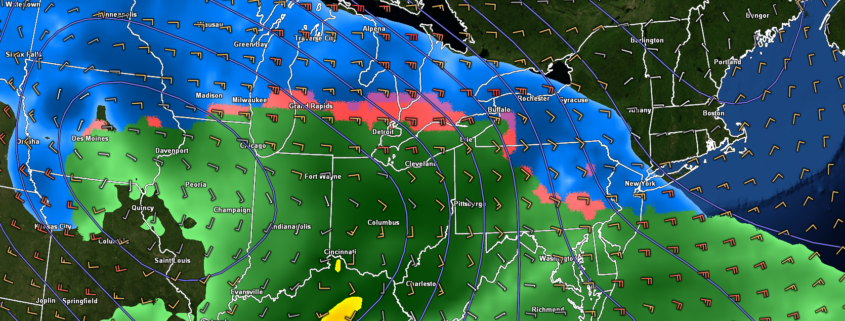
The story begins with a weak disturbance, which is set to pass to the south of NYC on Sunday Night. Just enough lift in the atmosphere and cold temperatures suggest snow will break out across Southern and Eastern Pennsylvania. While the atmosphere remains dry to start, it will moisten up by Monday morning, and support snow. This snow will gradually shift eastward into Central and Southern New Jersey.

Read more

Wintry weather potential increases next week

Good evening and happy Friday!

Conditions have improved substantially across much of the Northeast this Friday afternoon as a rather weak cold front cleared out any remaining cloudy & unsettled conditions.

Read more

Unsettled conditions exit Friday, calm and cool weekend ahead

Good evening!

The beautiful spring-like conditions of the past two days have quickly come to an end, and have instead been replaced with a cool and rather unsettled pattern.

Read more

Updated: Mild and calm conditions turn unsettled later this week

Good evening!

The short-lived, but intense blast of Arctic air last week is now all but a memory as an area of mid-level ridging continues to build over much of the East Coast.

Read more