Posts

Morning roundup: Unsettled, coastal storm slips by

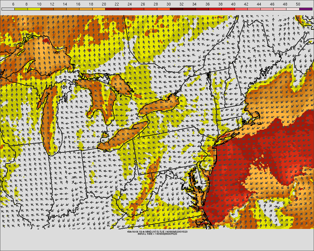
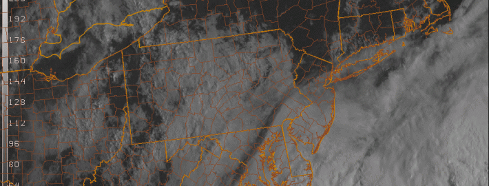
Temperatures in the 50’s and 60’s made this Tuesday morning feel extra Autumn-like, despite easterly winds and an onshore flow. Clouds were more prevalent over southern/eastern areas of New Jersey and Long Island. The marine air will continue pushing westward today, and the gusty winds and higher surf will return to the area shores once again. The clouds and showers won’t necessarily be widespread, but they’ll certainly put a bit of a damper on the day.

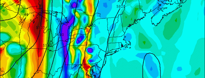
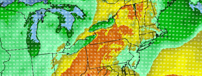
A developing coastal storm, owing to a mid level disturbance passing near the East Coast, will bring a period of rain very close to the New Jersey and Long Island coasts on Tuesday morning and afternoon. But westerly winds pressing on the system aloft will keep the precipitation from spreading inland. Instead, breaks in the clouds will be just as common as scattered showers throughout the area — and so while Tuesday won’t be sunny and bright, it won’t necessarily be a washout either.

Read more

Active, more autumn-like pattern this week

After a hot and humid start to the weekend, a major cold front brought thunderstorms and a drop in temperatures. The pattern which has settled in to start this week is much more autumn-like, with temperatures in the 70’s and lower 80’s and much more comfortable dew points and humidity values. The pattern, however, will turn more volatile by the middle of this upcoming week with multiple storm systems and unsettled weather.

The trend toward more unsettled weather will begin late Monday into Tuesday, as an onshore flow develops and strengthens. Winds will pick up near the area shores, gusting over 25 miles per hour at times as an easterly fetch brings clouds and low level moisture inland from the beaches. This will bring an end to the sunshine which will dominate much of Monday. A mid level disturbance moving northward from the Mid-Atlantic states will aid in the development of showers, spreading into parts of New Jersey from southwest to northeast on Tuesday.

NAM model forecasting gusty winds along the shore Monday Night into Tuesday.

NAM model forecasting gusty winds along the shore Monday Night into Tuesday.

Read more

Foggy Friday followed by heavy rain Friday night

A slow-moving cold front, along with a weak warm front that crossed the region on Thursday, will combine to create interesting changes to our weather — namely the potential for heavy rain on Friday afternoon. The warm frontal passage brought the introduction of a warmer, moist airmass — increasing dew points and precipitable water values. As the cold front shifts toward the area during mid-day on Friday, lifting in the atmosphere will gradually increase which will help to generate heavy rain and even the chance of a thunderstorm come Friday Night.

A large ridge in the Western Atlantic will act to provide plenty of clockwise flow increasing our warmth and moisture. Additionally, to the west, we have a potent trough and associated cold front with plenty of lift. The large ridge is what initially makes the front slow to move eastward, prolonging our fetch of moisture. This is a weather pattern we had often during the beginning of last summer, which is why we had such humid conditions. The initial slower movement of the cold front will keep the heaviest rain to the west of our area during the morning on Friday — but a slow shift eastward is expected.  Read more

Unsettled trend brings heavy rain, cold front

The backdoor cold front which we discussed a few days ago lived up to expectations throughout the area this week. Although not exciting by any means, the front brought cooler air and more clouds as it was expected to — essentially ending the brief period of warmth which saw temperatures on Monday reach into the mid 80’s. The east winds off cooler ocean waters are expected to keep temperatures in the 50’s and 60’s on Wednesday. Additionally, some low level moisture could lead to drizzle in many places, adding to the damp and dreary feel already in the air.

As a storm system approaches our area from the west later this week, the backdoor front will begin to lose some of its grip on the area’s weather. But the damage will have already been done in terms of spoiling what otherwise would’ve been a glorious period of warmth. Thursday looks likely to feature warmer temperatures in the 60’s and 70’s, but a continued trend of unsettled weather including clouds and some showers thanks to a southeasterly wind direction.

Read more