-2")
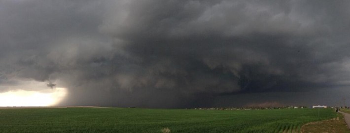
Strong to severe thunderstorms possible this afternoon
1:00pm Update: The NWS Storm Prediction Center has issued a Severe Thunderstorm Watch for Northern New Jersey and Southeast New York until 8:00pm tonight. Thunderstorms are expected to develop over the next few hours and shift southeastward through New Jersey and New York. The combination of developing instability, a nearby frontal zone, and a disturbance aloft will aid in organization of storms. Thunderstorms will be capable of producing frequent lightning, hail, and strong winds.
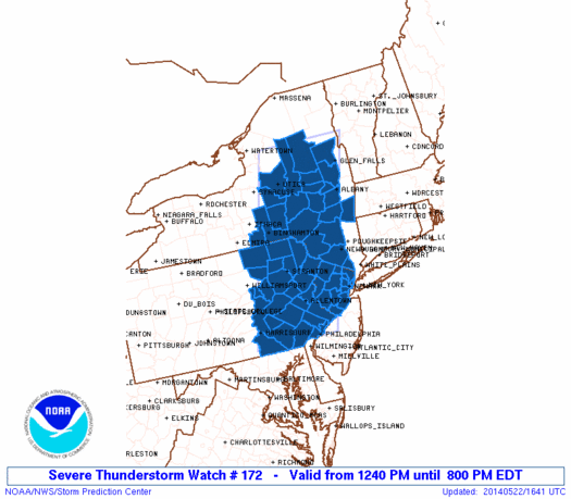
Severe Thunderstorm Watch graphic from the Storm Prediction Center. Blue highlighted counties are included in the watch.
The Storm Prediction Center has placed much of the area in a Slight Risk for severe weather on Thursday, including much nearly all of New Jersey. The Slight Risk area runs to about New York City and Western Long Island northward through Southeast New York and near the Connecticut border. A Slight Risk is issued by the Storm Prediction Center when organized severe thunderstorms are possible, in this case there is a 15 percent chance of gusty winds or hail within 25 miles of any point within the Slight Risk area.