2.20 PM All Zones: Warm, tranquil weather will continue

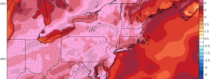
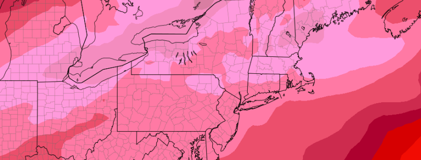
A warmer, tranquil weather pattern has settled into the Northeast US over the past several days, and despite a cooling trend over the past few days, the pattern is expected to generally continue. A cold front moved through the area last night, bringing cold air advection (movement of colder air), and the cooler air aloft quickly brought warm temperatures down towards average. Highs today were 10-15 degrees colder than yesterday in many areas.

The relatively normal temperatures will warm gradually over the next few days, while generally tranquil weather will also persist. Why the change? The answers lie in the Pacific Ocean. A changed pattern there has allowed disturbances, which were previously moving quickly eastwards towards our area, to remain much farther west and approach the U.S.A more slowly.

Read more

2/20 AM All Zones: Cooler Weather to Start the Week, More Warmth Returns Mid-Late Week

High pressure building in from the north, will support mostly sunny skies for this President’s Day. The weather pleasant overall. But it will be much cooler than over the weekend. Temperatures will rise into the upper 40s to lower 50s for highs over much of the region this afternoon. These are temperatures are still several degrees above normal for this late in February.

Read more

2.19 PM All Zones: Warmth today, noticeably cooler tomorrow

Unseasonably warm weather continues this afternoon throughout the area, with temperatures having risen well into the upper 50’s throughout the area. Temperatures in the lower 60’s have been quite common as well, especially across Southeastern Pennsylvania, New Jersey, and the New York City Metro Area. The warm temperatures and sunshine should continue over the next several hours with only some high and mid level clouds interrupting the sunshine.

Lingering to the northwest, however, is a stronger cold front associated with a mid and upper level trough over New England. This trough is associated with a northern stream atmospheric disturbance, which will sink from Southeast Canada into New England. This disturbance will suppress ridging over the area later tonight into Sunday. A cold front sides through the Northeast and brings cold air advection, ending the warmup temporarily.

Read more

2.18 Evening Zones: Mild for now, cooler early next week

Mild weather has built into the area over the past several hours and will continue to remain prevalent throughout the region over the next 24 hours as well. Mid level ridging will continue to build into the region with atmospheric heights rising over the next several hours. All of this is thanks to a collapsing ridge on the West Coast of the USA, which is shifting over the Central and Eastern USA today.

Temperatures this afternoon rose into the middle and upper 50’s throughout much of the region, and even the lower 60’s throughout parts of Southern and Central NJ. Parts of Delaware and the Mid Atlantic, including the beaches, reached the 70 degree mark this afternoon! This warmth is extremely impressive for this time of year.

Read more