After very blustery conditions with harsh windchills the past few days, we’re on tap for a beautiful Presidents Day weekend with clear and dry conditions expected over the entire region
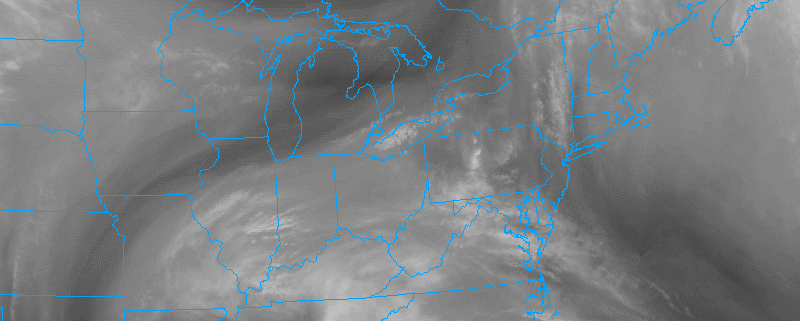
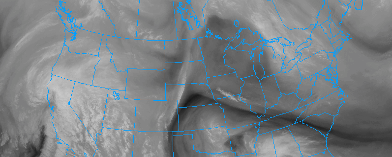
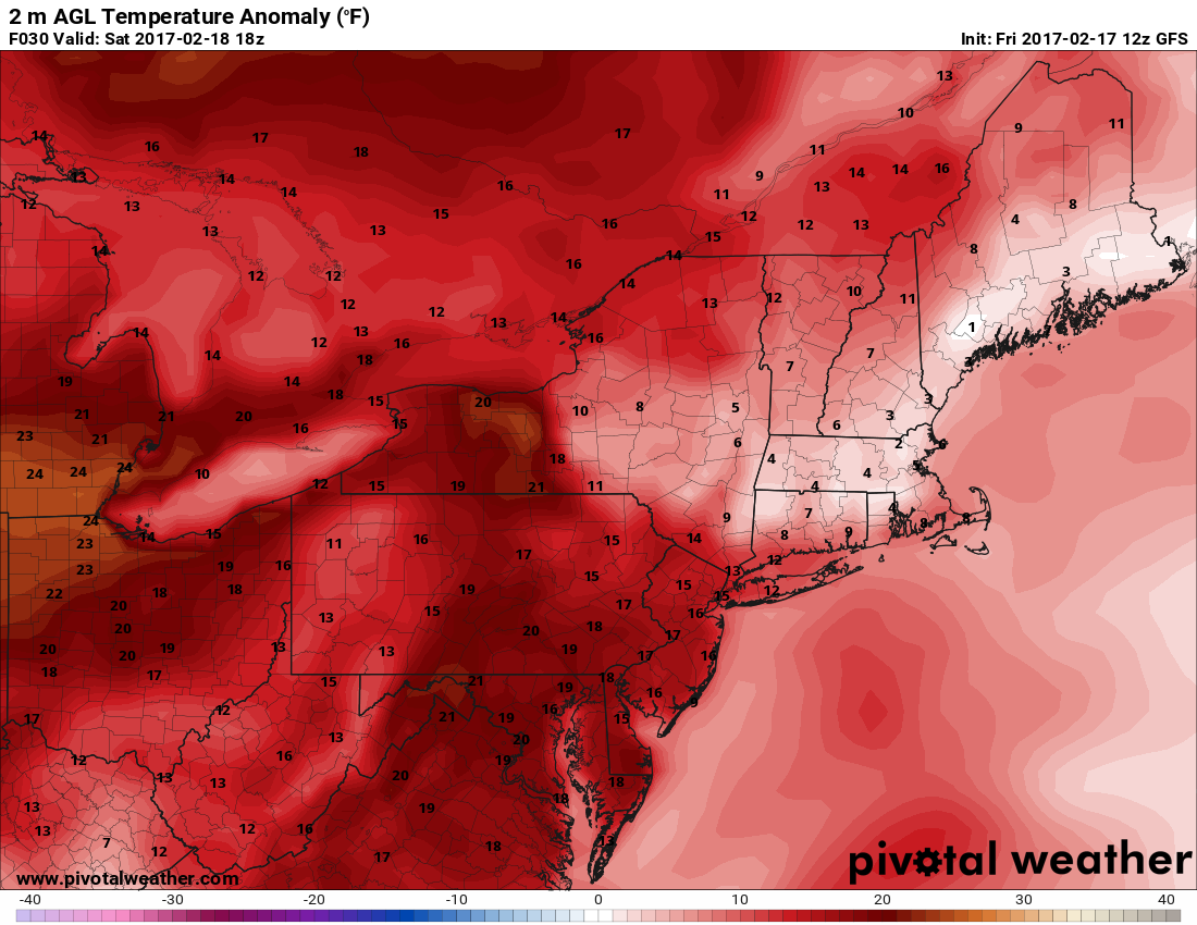
Despite temperatures in the upper 30’s to low 40’s across most of the area this afternoon, the winds that have been present over the past two days due to the large area of low pressure was located to our east has finally moved on. This has allowed the winds to calm significantly and eliminated any real windchills from the area, making for seasonable conditions. This afternoons visible satellite imagery shows very little in the way of any cloud cover as a weak area of high pressure centered near Buffalo, New York remains in control throughout the rest of the day. This should provide a very nice close to the work week with only high clouds possible towards sunset. Later this afternoon and this evening, a warm front located to our south will begin to move to the north and overspread the area by tomorrow morning. This front should initially usher in some mid-level clouds tomorrow morning, but these should be short-lived as tomorrow afternoon should be an excellent day for outdoor activities as the clouds burn off and the entire area sees temperatures climb well into the 50’s for the NYC metro and NE NJ, while locations closer to the coast remain limited to the upper 40’s and low 50’s. It is also quite likely that given the amount of warm air advecting into the region on Saturday, that portions of Central and Southern New Jersey reach temperatures at or above 60 degrees! This airmass is quite unseasonable for this time of year and most of the area will be running 10-18 degrees above normal on Saturday.

Visible satellite imagery of the Northeast showing relatively calm conditions and little in the way of cloud cover (Courtesy of Simuawips.com)
Some high clouds are possible Saturday evening as yet another series of weak mid-level disturbances pass to our north as well the south, but Sunday is shaping up to be very similar to Saturday with yet another beautiful day in store. Temperatures in the immediate New York metro area should be able to reach well into the 50’s, with southern locations once again seeing temperatures 10-20 degrees above normal as they climb into the low 60’s by late afternoon on Sunday. As we progress later into the day Sunday, a backdoor cold front will swing through the northern sections of our area and begin to usher in a more seasonable airmass as winds begin to shift from the south, to a more west/northwest. As this front continues on, we can expect a cooler day for Presidents Day Monday with a sharp temperature gradient from north to south across the area, with southern locations remaining in the low 50’s and 40’s for the northern locations. Overall, Presidents Day should be cooler than this weekend, but should remain dry and with very little cloud cover as a high pressure system from southern Canada begins to build south over the area providing continued calm/dry conditions once again.
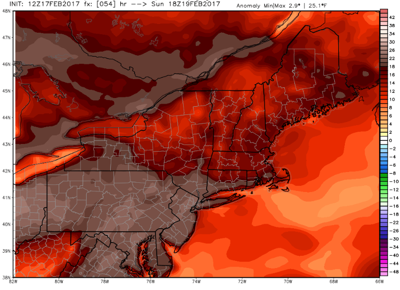
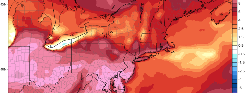
Afternoon European model showing temperatures on Sunday reaching 18-25 degrees above normal for the entire area (Valid 1pm Sunday)
As we continue on into the work week next week, mid level ridging will increase once more so a return to above-normal temperatures is likely over the entire Northeast. As a series of mid to upper level disturbances work their way east from the very active Pacific jetstream, we can expected our first shot of rain on Wednesday with a more significant signal for precipitation showing up just in time for next weekend as a stronger system works it’s way into the central part of the country. While we’re currently in a period of unseasonable warmth, the potential does exist for a return to colder temperatures and a more active weather pattern later this month and into the first few weeks of March. Make sure to stay tuned for any and all updates over the next few days! For more information and posts like this one, make sure you sign up for Zone Forecasts — where multiple detailed articles, videos, and interactives are posted each day.
Have a great Friday and an excellent Presidents Day Weekend!
-2")