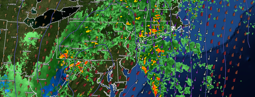
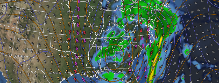
Flooding rains likely to impact holiday travel Friday

Briefing: Heavy rain and possibly flooding concerns Thursday/Friday, colder and calmer pattern will follow…

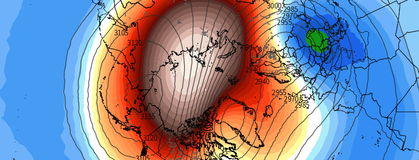
This morning (Thursday) will start off quite cool with temperatures in the upper 20’s to middle 30’s across much of the New York metro area with a few passing mid to high-level clouds for the AM commute. Calm, clear, and cool conditions should last throughout the majority of the day as a large and highly-anomalous upper level trough amplifies over the Southeastern states. As this system amplifies and strengthens off to our south, the low-level flow will gradually shift from southwest to due south, causing a much warmer and increasingly moist airmass to creep northward. Overcast and some spotty showers will be possible by the PM commute, especially for locations south of the city.

Read more

On the Polar Vortex: What is hype, what isn’t, and how it may affect us

The Polar Vortex is coming, and when it arrives it’s going to freeze you, your house, and everything around you – taking you back to the Arctic from where it came. Kidding. Ah, it has been a while since we’ve had to really dive into this. As a meteorologist, these are exciting times. The atmosphere is getting ready to put on a bit of a show, and the community is starting to pick up on it. You may recall the last time the term Polar Vortex went “viral”, back in 2014. It was a media frenzy – the polar vortex was coming to invade the United States.

You may also recall the reality of it – it was cold, and in some places it was snowy – and anomalously so. The truth is that the polar vortex is not unheard of, unthinkable, or unfathomed. It is not new, and it is not appearing for the first time since 2014. It is, however, a very neat atmospheric feature, and it deserves our full attention. It affects the weather greatly, and its positioning and intensity throughout the Winter months is a critical component of many forecasts.

Read more

Clear and cool start to the week, attention turns to Friday

Temperatures were be quite cold to start the day  across the vast majority of the Northeast – and they still are! Dry air has moved in to the region from Canada as well. This will keep any clouds at bay, allowing for a mostly sunny day, with temperatures in the lower to middle 30’s for much of the area, with the usual colder readings off to the north and west. A weak area of high pressure will gradually build-in during the course of the afternoon/evening hours which will continue the cool and clear conditions into the overnight hours. With dry air in place, a building high pressure system, and light winds, radiational cooling will be near-ideal tonight. As a result, low temperatures will once again be quite cold area-wide. Reading should easily drop down into the lower to middle 20’s over the immediate metro area, with teens possible just off to the north and west.

Read more

NYC Area Forecast: Storm departs tonight, calm start to the week

Weekly Weather Rating: Cold to start, but at least it’s dry. Trending milder as the week goes on, with rain likely on Friday. 6/10

Period of rainfall and temperatures in the 30’s and 40’s made Sunday a real bummer, and the rain is wrapping up this evening. The low pressure system off the coast of New Jersey will begin its trek eastward and out to sea, bringing the dreary weather with it. We expect rain to continue for a few more hours tonight before calmer and more benign weather moves in.

Read more